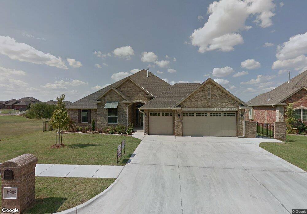
11905 Glenhurst Blvd Oklahoma City, OK 73162
Glenhurst NeighborhoodEstimated Value: $383,000 - $441,000
3
Beds
2
Baths
2,309
Sq Ft
$176/Sq Ft
Est. Value
About This Home
This home is located at 11905 Glenhurst Blvd, Oklahoma City, OK 73162 and is currently estimated at $406,231, approximately $175 per square foot. 11905 Glenhurst Blvd is a home with nearby schools including Dennis Elementary School, Hefner Middle School, and Putnam City North High School.
Ownership History
Date
Name
Owned For
Owner Type
Purchase Details
Closed on
Aug 31, 2017
Sold by
Martin Keith E and Martin Esther J
Bought by
Martin Timothy Dean
Current Estimated Value
Purchase Details
Closed on
Feb 20, 2015
Sold by
Jw Mashburn Development Inc
Bought by
Martin Keith E and Martin Esther J
Purchase Details
Closed on
Feb 11, 2014
Sold by
First American Title & Trust Co
Bought by
J W Mashburn Development Inc
Create a Home Valuation Report for This Property
The Home Valuation Report is an in-depth analysis detailing your home's value as well as a comparison with similar homes in the area
Home Values in the Area
Average Home Value in this Area
Purchase History
| Date | Buyer | Sale Price | Title Company |
|---|---|---|---|
| Martin Timothy Dean | -- | O S Title | |
| Martin Keith E | -- | None Available | |
| J W Mashburn Development Inc | $64,500 | First American Title & Trust |
Source: Public Records
Tax History Compared to Growth
Tax History
| Year | Tax Paid | Tax Assessment Tax Assessment Total Assessment is a certain percentage of the fair market value that is determined by local assessors to be the total taxable value of land and additions on the property. | Land | Improvement |
|---|---|---|---|---|
| 2024 | $4,413 | $38,317 | $6,227 | $32,090 |
| 2023 | $4,413 | $37,201 | $6,135 | $31,066 |
| 2022 | $4,334 | $36,117 | $6,340 | $29,777 |
| 2021 | $4,164 | $35,066 | $6,868 | $28,198 |
| 2020 | $4,021 | $34,045 | $7,095 | $26,950 |
| 2019 | $4,171 | $35,802 | $6,997 | $28,805 |
| 2018 | $4,052 | $34,760 | $0 | $0 |
| 2017 | $4,117 | $35,235 | $6,876 | $28,359 |
| 2016 | $3,986 | $34,210 | $7,095 | $27,115 |
| 2015 | $141 | $1,162 | $1,162 | $0 |
| 2014 | $80 | $685 | $685 | $0 |
Source: Public Records
Map
Nearby Homes
- 5408 NW 119th Terrace
- 5509 NW 120th St
- 11917 Dornick Cir
- 5204 NW 118th Cir
- 5601 NW 116th St
- 5509 NW 121st St
- 11824 Bellhurst Ave
- 5613 NW 115th St
- 11717 Bellhurst Ave
- 12300 Maiden Ln
- 12300 St Lukes Ln
- 4704 Hemlock Ln
- 4702 Hemlock Ln
- 12308 Val Verde Dr
- 11413 Spring Creek Rd
- 12220 Banyan Ln
- 4713 Cypress Ct
- 6112 Rambridge Dr
- 6116 Winfield Dr
- 6108 Plum Thicket Rd
- 11901 Glenhurst Blvd
- 11909 Glenhurst Blvd
- 11900 Glenhurst Blvd
- 11913 Glenhurst Blvd
- 5416 NW 119th Terrace
- 11812 Glenhurst Blvd
- 11809 Glenhurst Blvd
- 11917 Glenhurst Blvd
- 5412 NW 119th Terrace
- 11808 Glenhurst Blvd
- 11904 Sawgrass Rd
- 11908 Sawgrass Rd
- 5416 NW 118th Cir
- 11900 Sawgrass Rd
- 11912 Sawgrass Rd
- 11921 Glenhurst Blvd
- 11804 Glenhurst Blvd
- 11916 Sawgrass Rd
- 11812 Sawgrass Rd
- 11801 Glenhurst Blvd