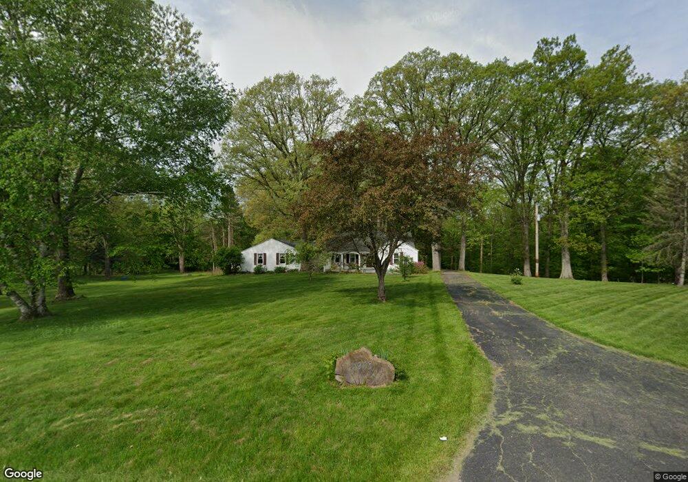
11905 Kenyon Rd Mount Vernon, OH 43050
Estimated Value: $307,000 - $371,000
3
Beds
1
Bath
1,871
Sq Ft
$178/Sq Ft
Est. Value
About This Home
This home is located at 11905 Kenyon Rd, Mount Vernon, OH 43050 and is currently estimated at $333,700, approximately $178 per square foot. 11905 Kenyon Rd is a home located in Knox County with nearby schools including Mount Vernon High School, St. Vincent de Paul School, and Christian Star Academy.
Ownership History
Date
Name
Owned For
Owner Type
Purchase Details
Closed on
Mar 4, 2010
Sold by
Joris Rene K and Bac Home Loans Servicing L P
Bought by
Federal Home Loan Mortgage Corporation
Current Estimated Value
Purchase Details
Closed on
May 1, 2009
Sold by
Joris Alisson L
Bought by
Joris Rene K
Purchase Details
Closed on
Sep 16, 1998
Sold by
Hall Peter Jonathan and Hall Ann
Bought by
Joris Rene K and Joris Alisson L
Purchase Details
Closed on
Aug 17, 1995
Sold by
White Woodrow J and White Dorothy
Bought by
Hall Peter Jonathan and Hall Ann
Purchase Details
Closed on
Sep 15, 1987
Sold by
King Kenneth R and King Linn M
Bought by
White Woodrow J and White Dorothy
Create a Home Valuation Report for This Property
The Home Valuation Report is an in-depth analysis detailing your home's value as well as a comparison with similar homes in the area
Home Values in the Area
Average Home Value in this Area
Purchase History
| Date | Buyer | Sale Price | Title Company |
|---|---|---|---|
| Federal Home Loan Mortgage Corporation | $80,000 | None Available | |
| Joris Rene K | -- | None Available | |
| Joris Rene K | $89,900 | -- | |
| Hall Peter Jonathan | $79,900 | -- | |
| White Woodrow J | $58,500 | -- |
Source: Public Records
Tax History Compared to Growth
Tax History
| Year | Tax Paid | Tax Assessment Tax Assessment Total Assessment is a certain percentage of the fair market value that is determined by local assessors to be the total taxable value of land and additions on the property. | Land | Improvement |
|---|---|---|---|---|
| 2024 | $2,415 | $66,540 | $20,320 | $46,220 |
| 2023 | $2,415 | $66,540 | $20,320 | $46,220 |
| 2022 | $1,716 | $45,890 | $14,020 | $31,870 |
| 2021 | $1,716 | $45,890 | $14,020 | $31,870 |
| 2020 | $2,066 | $45,890 | $14,020 | $31,870 |
| 2019 | $1,950 | $40,140 | $13,360 | $26,780 |
| 2018 | $1,950 | $40,140 | $13,360 | $26,780 |
| 2017 | $1,918 | $40,140 | $13,360 | $26,780 |
| 2016 | $1,788 | $37,170 | $12,370 | $24,800 |
| 2015 | $1,795 | $37,170 | $12,370 | $24,800 |
| 2014 | $1,803 | $37,170 | $12,370 | $24,800 |
| 2013 | $1,748 | $34,940 | $11,620 | $23,320 |
Source: Public Records
Map
Nearby Homes
- 11791 McManis Rd
- 12627 Upper Gilchrist Rd
- 104 Colonial Woods Dr Unit 4
- 17421 Coshocton Rd
- 117 Colonial Woods Dr
- 188 Plymouth Rd
- 0 Venture Dr Unit 20240369
- 13618 Gilchrist Rd
- 20561 Canada Rd
- 84 Woodlake Trail
- 42 Wildwood Ln
- 0 Wildwood Ln
- 20090 New Gambier Rd
- 17375 Gambier Rd
- 405 1/2 Gaskin Ave
- 55 Wildwood Ln
- 60 Wildwood Ln
- 17980 Gambier Rd
- 213 Kokosing Dr
- 2 Coventry Ct W
- 11845 Kenyon Rd
- 11910 Kenyon Rd
- 11925 Kenyon Rd
- 11928 Kenyon Rd
- 11890 Kenyon Rd
- 11957 Kenyon Rd
- 11950 Kenyon Rd
- 11968 Kenyon Rd
- 11988 Kenyon Rd
- 11919 Kenyon Rd
- 11885 Kenyon Rd
- 12040 Kenyon Rd
- 11749 Kenyon Rd
- 11719 Kenyon Rd
- 12141 Kenyon Rd
- 11700 Kenyon Rd
- 18948 Coshocton Rd
- 18948 Coshocton Ave
- 11887 McManis Rd
- 18720 Coshocton Ave