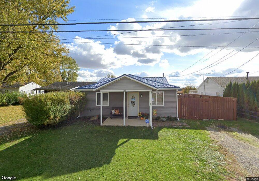
1191 Bennett St Marion, OH 43302
Estimated Value: $114,158 - $157,000
2
Beds
1
Bath
980
Sq Ft
$139/Sq Ft
Est. Value
About This Home
This home is located at 1191 Bennett St, Marion, OH 43302 and is currently estimated at $135,790, approximately $138 per square foot. 1191 Bennett St is a home located in Marion County with nearby schools including James A. Garfield Elementary School, Ulysses S. Grant Middle School, and Harding High School.
Ownership History
Date
Name
Owned For
Owner Type
Purchase Details
Closed on
Mar 26, 2020
Sold by
Siebenaler Joseph
Bought by
Severt Vickie
Current Estimated Value
Purchase Details
Closed on
Apr 5, 2017
Sold by
Burton Thomas G
Bought by
Siebenaler Joseph and Severt Vickie
Purchase Details
Closed on
Mar 3, 2006
Sold by
Mcpeak Billie Jo and Mcpeak Marshall
Bought by
Jividen Lonnie T
Home Financials for this Owner
Home Financials are based on the most recent Mortgage that was taken out on this home.
Original Mortgage
$18,000
Interest Rate
6.2%
Mortgage Type
FHA
Purchase Details
Closed on
Feb 22, 2000
Bought by
Burton Thomas G
Create a Home Valuation Report for This Property
The Home Valuation Report is an in-depth analysis detailing your home's value as well as a comparison with similar homes in the area
Home Values in the Area
Average Home Value in this Area
Purchase History
| Date | Buyer | Sale Price | Title Company |
|---|---|---|---|
| Severt Vickie | -- | None Available | |
| Siebenaler Joseph | $25,000 | None Available | |
| Jividen Lonnie T | $16,500 | Chicago Title | |
| Burton Thomas G | -- | -- |
Source: Public Records
Mortgage History
| Date | Status | Borrower | Loan Amount |
|---|---|---|---|
| Previous Owner | Jividen Lonnie T | $18,000 |
Source: Public Records
Tax History
| Year | Tax Paid | Tax Assessment Tax Assessment Total Assessment is a certain percentage of the fair market value that is determined by local assessors to be the total taxable value of land and additions on the property. | Land | Improvement |
|---|---|---|---|---|
| 2025 | $909 | $28,300 | $2,490 | $25,810 |
| 2024 | $909 | $24,250 | $2,470 | $21,780 |
| 2023 | $909 | $24,250 | $2,470 | $21,780 |
| 2022 | $843 | $24,250 | $2,470 | $21,780 |
| 2021 | $730 | $18,910 | $2,150 | $16,760 |
| 2020 | $731 | $18,910 | $2,150 | $16,760 |
| 2019 | $730 | $18,910 | $2,150 | $16,760 |
| 2018 | $500 | $12,940 | $2,150 | $10,790 |
| 2017 | $667 | $12,940 | $2,150 | $10,790 |
| 2016 | $517 | $12,940 | $2,150 | $10,790 |
| 2015 | $510 | $12,490 | $1,910 | $10,580 |
| 2014 | $751 | $12,490 | $1,910 | $10,580 |
| 2012 | $493 | $11,980 | $2,020 | $9,960 |
Source: Public Records
Map
Nearby Homes
- 1185 Bennett St
- 1197 Bennett St
- 1179 Bennett St
- 1173 Bennett St
- 1165 Bennett St
- 1161 Bennett St
- 1153 Bennett St
- 1147 Bennett St
- 1141 Bennett St
- 1172 Glenwood Dr
- 259 Brentwood Dr
- 1164 Glenwood Dr
- 251 Brentwood Dr
- 265 Brentwood Dr
- 273 Brentwood Dr
- 1156 Glenwood Dr
- 279 Brentwood Dr
- 1130 Bennett St
- 295 Brentwood Dr
- 1148 Glenwood Dr
Your Personal Tour Guide
Ask me questions while you tour the home.