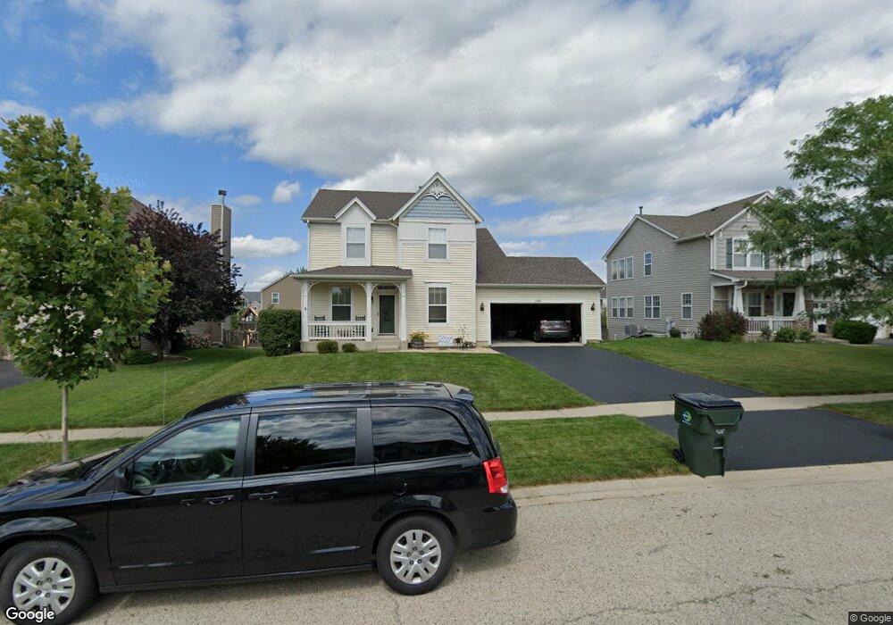
1191 Devon Dr Antioch, IL 60002
Estimated Value: $370,000 - $389,000
3
Beds
3
Baths
2,144
Sq Ft
$178/Sq Ft
Est. Value
About This Home
This home is located at 1191 Devon Dr, Antioch, IL 60002 and is currently estimated at $382,162, approximately $178 per square foot. 1191 Devon Dr is a home located in Lake County with nearby schools including Antioch Community High School.
Ownership History
Date
Name
Owned For
Owner Type
Purchase Details
Closed on
Mar 30, 2004
Sold by
Neumann Homes Inc
Bought by
Johnson Leonard M and Johnson Heather A
Current Estimated Value
Home Financials for this Owner
Home Financials are based on the most recent Mortgage that was taken out on this home.
Original Mortgage
$234,860
Outstanding Balance
$109,133
Interest Rate
5.48%
Mortgage Type
FHA
Estimated Equity
$273,029
Create a Home Valuation Report for This Property
The Home Valuation Report is an in-depth analysis detailing your home's value as well as a comparison with similar homes in the area
Home Values in the Area
Average Home Value in this Area
Purchase History
| Date | Buyer | Sale Price | Title Company |
|---|---|---|---|
| Johnson Leonard M | $242,500 | Chicago Title Insurance Comp |
Source: Public Records
Mortgage History
| Date | Status | Borrower | Loan Amount |
|---|---|---|---|
| Open | Johnson Leonard M | $234,860 |
Source: Public Records
Tax History
| Year | Tax Paid | Tax Assessment Tax Assessment Total Assessment is a certain percentage of the fair market value that is determined by local assessors to be the total taxable value of land and additions on the property. | Land | Improvement |
|---|---|---|---|---|
| 2024 | $11,265 | $102,815 | $7,723 | $95,092 |
| 2023 | $10,576 | $92,062 | $6,915 | $85,147 |
| 2022 | $10,576 | $82,382 | $9,328 | $73,054 |
| 2021 | $10,000 | $76,870 | $8,704 | $68,166 |
| 2020 | $9,836 | $74,748 | $8,464 | $66,284 |
| 2019 | $9,942 | $71,481 | $8,094 | $63,387 |
| 2018 | $8,774 | $63,039 | $9,073 | $53,966 |
| 2017 | $8,692 | $60,003 | $8,636 | $51,367 |
| 2016 | $8,489 | $57,906 | $8,334 | $49,572 |
| 2015 | $6,343 | $56,433 | $8,122 | $48,311 |
| 2014 | $5,416 | $52,651 | $9,846 | $42,805 |
| 2012 | $5,921 | $57,019 | $9,846 | $47,173 |
Source: Public Records
Map
Nearby Homes
- 1056 Deertrail Ct
- 1214 Jerome Ct
- 1076 Goldfinch Ln
- 1073 Walker Ct
- 41259 N Deep Lake Rd
- 42909 N Deep Lake Rd
- 1834 Tall Oaks Dr
- 1780 Centennial Dr
- 1873 White Lake Dr
- 865 Sterling Heights Dr
- 1033 White Pine Dr
- 1261 Prairie Ridge Trail
- 1253 Prairie Ridge Trail
- 1288 Prairie Ridge Trail
- 1249 Prairie Ridge Trail
- 1245 Prairie Ridge Trail
- 1870 Sterling Heights Ct
- 41092 N Deep Lake Rd
- 1768 S Port Dr
- 1764 S Port Dr
- 1195 Devon Dr
- 1187 Devon Dr
- 1176 Kimberly Ln
- 1181 Devon Dr
- 1197 Devon Dr
- 1172 Kimberly Ln
- 1168 Kimberly Ln
- 1180 Kimberly Ln
- 1192 Devon Dr
- 1196 Devon Dr
- 1188 Devon Dr
- 1175 Devon Dr
- 1203 Devon Dr
- 1164 Kimberly Ln
- 1204 Devon Dr
- 1182 Devon Dr
- 1184 Kimberly Ln
- 1210 Devon Dr
- 1207 Devon Dr
- 1188 Kimberly Ln
Your Personal Tour Guide
Ask me questions while you tour the home.