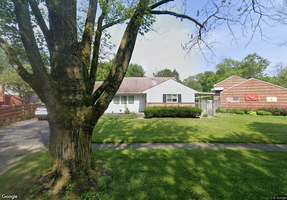
1191 Manfeld Dr Columbus, OH 43227
Shady Lane NeighborhoodEstimated Value: $187,000 - $252,000
3
Beds
2
Baths
1,483
Sq Ft
$147/Sq Ft
Est. Value
About This Home
This home is located at 1191 Manfeld Dr, Columbus, OH 43227 and is currently estimated at $218,366, approximately $147 per square foot. 1191 Manfeld Dr is a home located in Franklin County with nearby schools including Shady Lane Elementary School, Sherwood Middle School, and Walnut Ridge High School.
Ownership History
Date
Name
Owned For
Owner Type
Purchase Details
Closed on
Apr 29, 2005
Sold by
Walton Goldie L
Bought by
Harmon Rodney T
Current Estimated Value
Home Financials for this Owner
Home Financials are based on the most recent Mortgage that was taken out on this home.
Original Mortgage
$103,500
Outstanding Balance
$53,563
Interest Rate
6.13%
Mortgage Type
VA
Estimated Equity
$164,803
Purchase Details
Closed on
Feb 22, 2001
Sold by
Estate Of Albert E Walton
Bought by
Walton Goldie L
Purchase Details
Closed on
Feb 1, 1971
Bought by
Walton Albert E
Create a Home Valuation Report for This Property
The Home Valuation Report is an in-depth analysis detailing your home's value as well as a comparison with similar homes in the area
Home Values in the Area
Average Home Value in this Area
Purchase History
| Date | Buyer | Sale Price | Title Company |
|---|---|---|---|
| Harmon Rodney T | $103,500 | Lawyers Tit | |
| Walton Goldie L | -- | Gahanna Title | |
| Walton Albert E | -- | -- |
Source: Public Records
Mortgage History
| Date | Status | Borrower | Loan Amount |
|---|---|---|---|
| Open | Harmon Rodney T | $103,500 |
Source: Public Records
Tax History
| Year | Tax Paid | Tax Assessment Tax Assessment Total Assessment is a certain percentage of the fair market value that is determined by local assessors to be the total taxable value of land and additions on the property. | Land | Improvement |
|---|---|---|---|---|
| 2025 | $3,003 | $65,530 | $15,720 | $49,810 |
| 2024 | $3,003 | $65,530 | $15,720 | $49,810 |
| 2023 | $2,966 | $65,520 | $15,715 | $49,805 |
| 2022 | $1,724 | $32,450 | $6,200 | $26,250 |
| 2021 | $1,686 | $32,450 | $6,200 | $26,250 |
| 2020 | $1,688 | $32,450 | $6,200 | $26,250 |
| 2019 | $1,578 | $26,010 | $4,940 | $21,070 |
| 2018 | $1,521 | $26,010 | $4,940 | $21,070 |
| 2017 | $1,577 | $26,010 | $4,940 | $21,070 |
| 2016 | $1,616 | $24,400 | $5,080 | $19,320 |
| 2015 | $1,467 | $24,400 | $5,080 | $19,320 |
| 2014 | $1,471 | $24,400 | $5,080 | $19,320 |
| 2013 | $854 | $28,700 | $5,985 | $22,715 |
Source: Public Records
Map
Nearby Homes
- 1260 Country Club Rd
- 4991 Justin Rd
- 1310 Manfeld Dr
- 1211 Shady Lane Rd
- 1193 Marble Dr
- 4859 Folger Dr
- 1472 Blaine Dr
- 4819 Calvin Dr
- 1243 Simpson Dr
- 935 Duke Rd
- 1470 Efner Dr
- 931 Antwerp Rd
- 1284 Thurston Dr
- 4530 Amesbury Rd
- 4677 E Livingston Ave
- 1281 Maetzel Dr
- 1085 S Hamilton Rd
- 4467 Grimsby Rd
- 4382 E Fulton St
- 4623 Langley Ave
- 4905 Barbara Ct
- 4892 Teddy Dr
- 4895 Barbara Ct
- 4882 Teddy Dr
- 1194 Country Club Rd
- 4914 Teddy Dr
- 1182 Country Club Rd
- 4914 Barbara Ct
- 1198 Manfeld Dr
- 4891 Barbara Ct
- 1172 Country Club Rd
- 1196 Manfeld Dr
- 1221 Manfeld Dr
- 4881 Teddy Dr
- 4906 Barbara Ct
- 4909 Teddy Dr
- 4900 Barbara Ct
- 1185 Manfeld Dr
- 1218 Country Club Rd
- 4894 Barbara Ct
Your Personal Tour Guide
Ask me questions while you tour the home.