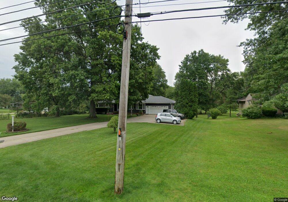
11911 Dunham Rd Northfield, OH 44067
Estimated Value: $301,096 - $335,000
3
Beds
2
Baths
1,806
Sq Ft
$173/Sq Ft
Est. Value
About This Home
This home is located at 11911 Dunham Rd, Northfield, OH 44067 and is currently estimated at $312,274, approximately $172 per square foot. 11911 Dunham Rd is a home located in Summit County with nearby schools including Lee Eaton Elementary School, Nordonia Middle School, and Nordonia High School.
Ownership History
Date
Name
Owned For
Owner Type
Purchase Details
Closed on
Feb 14, 2024
Sold by
Millard William F and Millard Estelle
Bought by
Wem Trust and Millard
Current Estimated Value
Purchase Details
Closed on
Aug 27, 1999
Sold by
Marinelli Marcus Anthony and Marinelli Lisa Ann
Bought by
Millard William F and Millard Estelle
Purchase Details
Closed on
Mar 3, 1999
Sold by
Slencsak Evelyn
Bought by
Marinelli Marcus A and Marinelli Lisa A
Home Financials for this Owner
Home Financials are based on the most recent Mortgage that was taken out on this home.
Original Mortgage
$153,450
Interest Rate
6.25%
Create a Home Valuation Report for This Property
The Home Valuation Report is an in-depth analysis detailing your home's value as well as a comparison with similar homes in the area
Home Values in the Area
Average Home Value in this Area
Purchase History
| Date | Buyer | Sale Price | Title Company |
|---|---|---|---|
| Wem Trust | -- | None Listed On Document | |
| Millard William F | $181,000 | Guardian Title | |
| Marinelli Marcus A | $170,500 | Guardian Title |
Source: Public Records
Mortgage History
| Date | Status | Borrower | Loan Amount |
|---|---|---|---|
| Previous Owner | Marinelli Marcus A | $153,450 |
Source: Public Records
Tax History Compared to Growth
Tax History
| Year | Tax Paid | Tax Assessment Tax Assessment Total Assessment is a certain percentage of the fair market value that is determined by local assessors to be the total taxable value of land and additions on the property. | Land | Improvement |
|---|---|---|---|---|
| 2025 | $3,984 | $89,212 | $23,415 | $65,797 |
| 2024 | $3,984 | $89,212 | $23,415 | $65,797 |
| 2023 | $3,984 | $89,212 | $23,415 | $65,797 |
| 2022 | $3,889 | $72,107 | $17,346 | $54,761 |
| 2021 | $3,810 | $72,107 | $17,346 | $54,761 |
| 2020 | $3,746 | $72,110 | $17,350 | $54,760 |
| 2019 | $3,315 | $59,160 | $16,010 | $43,150 |
| 2018 | $2,914 | $59,160 | $16,010 | $43,150 |
| 2017 | $3,001 | $59,160 | $16,010 | $43,150 |
| 2016 | $3,002 | $59,160 | $16,010 | $43,150 |
| 2015 | $3,001 | $59,160 | $16,010 | $43,150 |
| 2014 | $2,982 | $59,160 | $16,010 | $43,150 |
| 2013 | $3,168 | $62,750 | $16,010 | $46,740 |
Source: Public Records
Map
Nearby Homes
- 944 Heartridge Dr
- 798 Southridge Rd
- 763 Willow Lake Dr
- 17221 Sagamore Rd
- 445 Houghton Rd
- 17001 Alexander Rd
- 8764 Stuart Ln
- 376 Bishop Way
- 18320 Fern Ln
- 8510 Waterside Dr
- 8054 Sandstone Dr
- 247 Lowrie Blvd
- 340 Pineo Ct
- 966 Nesbitt Rd
- 7919 Chaffee Rd
- 395 Spring Pond Rd
- 133 Fell Ave
- 7100 Chestnut Dr
- 50 Kennedy Blvd
- 81 Canter Ln Unit C
- 11895 Dunham Rd
- 11921 Dunham Rd
- 11883 Dunham Rd
- 11937 Dunham Rd
- 11871 Dunham Rd
- 11872 Dunham Rd
- 11953 Dunham Rd
- 11862 Dunham Rd
- 11946 Dunham Rd
- 11847 Dunham Rd
- 11971 Dunham Rd
- 11956 Dunham Rd
- 11890 Marymac Dr
- 11910 Marymac Dr
- 11846 Dunham Rd
- 11924 Marymac Dr
- 11841 Dunham Rd
- 11866 Marymac Dr
- 11940 Marymac Dr
- 11970 Dunham Rd