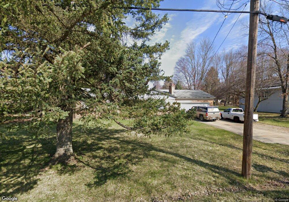
11911 Maxfield Blvd Hartland, MI 48353
Estimated Value: $254,000 - $347,000
3
Beds
2
Baths
1,186
Sq Ft
$253/Sq Ft
Est. Value
About This Home
This home is located at 11911 Maxfield Blvd, Hartland, MI 48353 and is currently estimated at $299,931, approximately $252 per square foot. 11911 Maxfield Blvd is a home located in Livingston County with nearby schools including Hartland High School, Charyl Stockwell Academy, and Our Savior Evangelical Lutheran School.
Ownership History
Date
Name
Owned For
Owner Type
Purchase Details
Closed on
Feb 1, 2000
Sold by
West Gregory L
Bought by
Haves John and Arnold Jennifer
Current Estimated Value
Purchase Details
Closed on
Jan 22, 1996
Sold by
Foreman Esther R
Bought by
Erasmo and Trevino Norma
Home Financials for this Owner
Home Financials are based on the most recent Mortgage that was taken out on this home.
Original Mortgage
$93,600
Interest Rate
7.24%
Mortgage Type
New Conventional
Create a Home Valuation Report for This Property
The Home Valuation Report is an in-depth analysis detailing your home's value as well as a comparison with similar homes in the area
Home Values in the Area
Average Home Value in this Area
Purchase History
| Date | Buyer | Sale Price | Title Company |
|---|---|---|---|
| Haves John | $138,000 | -- | |
| Erasmo | $117,000 | -- |
Source: Public Records
Mortgage History
| Date | Status | Borrower | Loan Amount |
|---|---|---|---|
| Previous Owner | Erasmo | $93,600 |
Source: Public Records
Tax History Compared to Growth
Tax History
| Year | Tax Paid | Tax Assessment Tax Assessment Total Assessment is a certain percentage of the fair market value that is determined by local assessors to be the total taxable value of land and additions on the property. | Land | Improvement |
|---|---|---|---|---|
| 2025 | $1,937 | $136,300 | $0 | $0 |
| 2024 | $838 | $130,100 | $0 | $0 |
| 2023 | $801 | $106,500 | $0 | $0 |
| 2022 | $1,757 | $85,300 | $0 | $0 |
| 2021 | $1,685 | $97,700 | $0 | $0 |
| 2020 | $1,680 | $96,300 | $0 | $0 |
| 2019 | $1,575 | $85,300 | $0 | $0 |
| 2018 | $1,540 | $78,500 | $0 | $0 |
| 2017 | $1,514 | $78,500 | $0 | $0 |
| 2016 | $1,509 | $77,400 | $0 | $0 |
| 2014 | $1,928 | $63,200 | $0 | $0 |
| 2012 | $1,928 | $54,800 | $0 | $0 |
Source: Public Records
Map
Nearby Homes
- 12002 Renfrew Ct
- 11639 Island Ct
- 1560 Odette
- 2.03 Acres Highland Rd
- 1441 Remsing St Unit 4
- 12071 Highland Rd
- 1020 Woods Edge Dr
- 2581 Pepper Ct
- V/L Highland Rd
- 2255 Clark Rd
- 2933 Bullard Rd
- 1163 Long Lake Dr
- 1412 North Ct
- 000 Highland Rd
- V/L Parcel D Old Us-23 Hwy
- V/L Parcels C & D Old Us-23 Hwy
- V/L Parcel C Old Us-23 Hwy
- 10456 Viewtop Ct
- 10484 Northvalley Ct Unit 14
- Chase Plan at Hunters Ridge - Landings 5
- 11937 Maxfield Blvd
- 11893 Maxfield Blvd
- 11862 Clair St
- 11945 Maxfield Blvd
- 11879 Maxfield Blvd
- 11874 Clair St
- 11846 Clair St
- 11900 Maxfield Blvd
- 11896 Clair St
- 11953 Maxfield Blvd
- 11832 Clair St
- 11910 Maxfield Blvd
- 11920 Maxfield Blvd
- 11930 Maxfield Blvd
- 1760 Doris Jean St
- 11904 Clair St
- 11938 Maxfield Blvd
- 11859 Maxfield Blvd
- 11967 Maxfield Blvd
- 11946 Maxfield Blvd