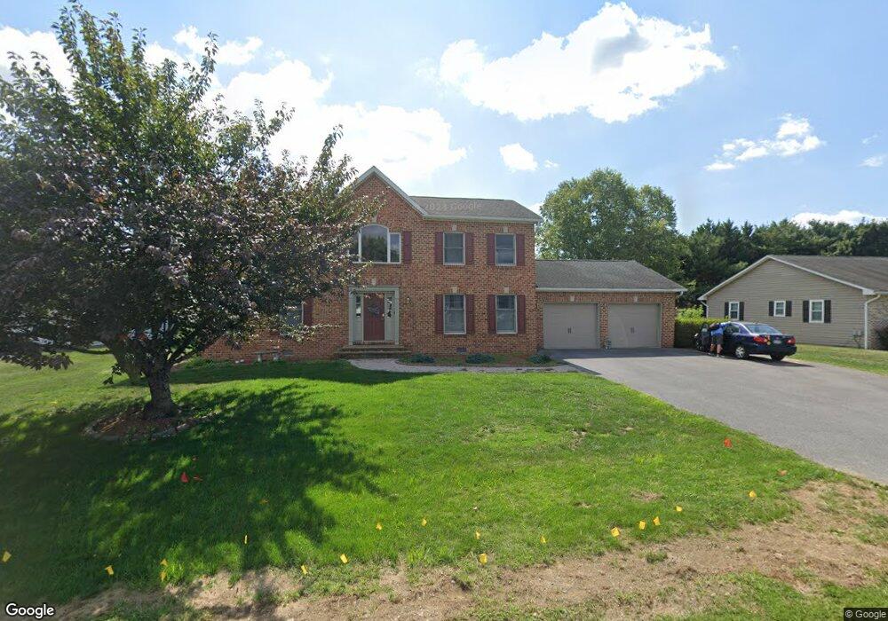
11912 Rinehart Dr Waynesboro, PA 17268
Estimated Value: $145,047 - $448,000
--
Bed
--
Bath
2,576
Sq Ft
$128/Sq Ft
Est. Value
About This Home
This home is located at 11912 Rinehart Dr, Waynesboro, PA 17268 and is currently estimated at $330,512, approximately $128 per square foot. 11912 Rinehart Dr is a home located in Franklin County with nearby schools including Waynesboro Area Senior High School, St. Andrew Catholic School, and Noah's Ark Christian Child Care Center.
Ownership History
Date
Name
Owned For
Owner Type
Purchase Details
Closed on
Aug 12, 2010
Sold by
Sawicki Troy and Sawicki Stacey
Bought by
Sawicki Stacey
Current Estimated Value
Home Financials for this Owner
Home Financials are based on the most recent Mortgage that was taken out on this home.
Original Mortgage
$133,100
Interest Rate
4.51%
Mortgage Type
New Conventional
Create a Home Valuation Report for This Property
The Home Valuation Report is an in-depth analysis detailing your home's value as well as a comparison with similar homes in the area
Home Values in the Area
Average Home Value in this Area
Purchase History
| Date | Buyer | Sale Price | Title Company |
|---|---|---|---|
| Sawicki Stacey | -- | None Available |
Source: Public Records
Mortgage History
| Date | Status | Borrower | Loan Amount |
|---|---|---|---|
| Closed | Sawicki Stacey | $133,100 |
Source: Public Records
Tax History Compared to Growth
Tax History
| Year | Tax Paid | Tax Assessment Tax Assessment Total Assessment is a certain percentage of the fair market value that is determined by local assessors to be the total taxable value of land and additions on the property. | Land | Improvement |
|---|---|---|---|---|
| 2025 | $4,656 | $30,310 | $3,100 | $27,210 |
| 2024 | $4,520 | $30,310 | $3,100 | $27,210 |
| 2023 | $4,386 | $30,310 | $3,100 | $27,210 |
| 2022 | $4,256 | $30,310 | $3,100 | $27,210 |
| 2021 | $4,135 | $30,310 | $3,100 | $27,210 |
| 2020 | $4,071 | $30,310 | $3,100 | $27,210 |
| 2019 | $3,980 | $30,310 | $3,100 | $27,210 |
| 2018 | $3,851 | $30,310 | $3,100 | $27,210 |
| 2017 | $3,768 | $30,310 | $3,100 | $27,210 |
| 2016 | $868 | $30,310 | $3,100 | $27,210 |
| 2015 | $809 | $30,310 | $3,100 | $27,210 |
| 2014 | $809 | $30,310 | $3,100 | $27,210 |
Source: Public Records
Map
Nearby Homes
- 11902 Rinehart Dr
- 9383 Oyer Dr
- 12398 Shelby Ave
- 11439 Viking Ave
- 11412 Viking Ave
- 108 Antietam Dr
- 10851 Sierra Dr
- 10842 Sierra Dr
- 18 Barnett Ave
- 162 Briar Ridge Dr
- 11802 Mystic Rock Ln S
- 11798 Mystic Rock Ln S
- 11849 Mystic Rock Ln S
- 11823 Mystic Rock Ln S
- 11819 Mystic Rock Ln S
- 11797 Mystic Rock Ln S
- 11845 Mystic Rock Ln S
- 11555 Mystic Rock Ln N
- 13082 Welty Rd
- 8859 Picadilly Cir
- 11920 Rinehart Dr
- 11920 Rinehart Dr Unit 37
- 11771 Rinehart Dr
- 11603 Rinehart Dr Unit 43
- 11603 Rinehart Dr
- 11938 Rinehart Dr
- 11878 Rinehart Dr
- 11845 Rinehart Dr
- 11913 Rinehart Dr
- 11901 Rinehart Dr
- 11515 Rinehart Dr
- 11921 Rinehart Dr
- 11889 Rinehart Dr
- 11941 Rinehart Dr
- 11954 Rinehart Dr
- 11427 Rinehart Dr
- 11780 Rinehart Dr
- 11610 Rinehart Dr
- 11957 Rinehart Dr
- 11914 Country Club Rd