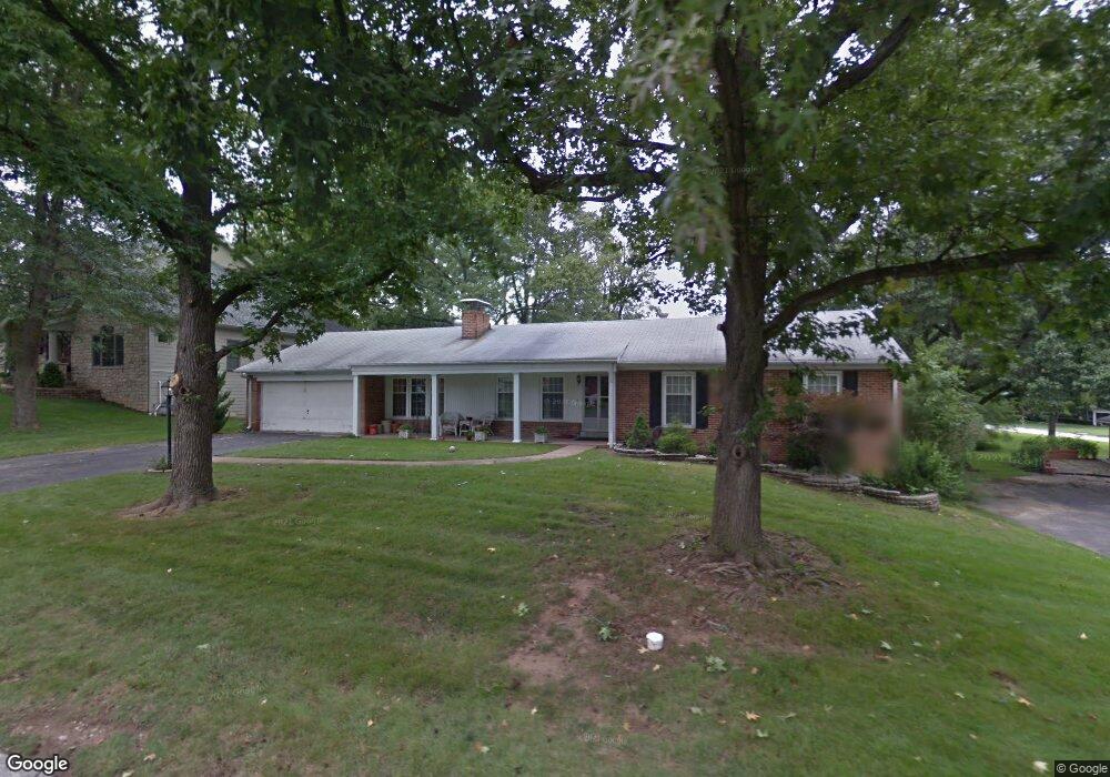
11915 Hargrove Dr Saint Louis, MO 63131
Estimated Value: $498,971 - $636,000
3
Beds
2
Baths
1,719
Sq Ft
$321/Sq Ft
Est. Value
About This Home
This home is located at 11915 Hargrove Dr, Saint Louis, MO 63131 and is currently estimated at $551,243, approximately $320 per square foot. 11915 Hargrove Dr is a home located in St. Louis County with nearby schools including Westchester Elementary School, North Kirkwood Middle School, and Kirkwood Senior High School.
Ownership History
Date
Name
Owned For
Owner Type
Purchase Details
Closed on
Apr 17, 2019
Sold by
Susan M Finley Living Trust
Bought by
Finley Karen I
Current Estimated Value
Purchase Details
Closed on
May 24, 2017
Sold by
Finley Susan M and Finley Karen I
Bought by
Finley Karen I and Susan M Finley Living Trust
Purchase Details
Closed on
Oct 1, 2002
Sold by
Finley Susan M
Bought by
Finley Susan M and Finley Karen I
Create a Home Valuation Report for This Property
The Home Valuation Report is an in-depth analysis detailing your home's value as well as a comparison with similar homes in the area
Home Values in the Area
Average Home Value in this Area
Purchase History
| Date | Buyer | Sale Price | Title Company |
|---|---|---|---|
| Finley Karen I | -- | None Available | |
| Finley Karen I | -- | None Available | |
| Finley Susan M | -- | -- |
Source: Public Records
Tax History Compared to Growth
Tax History
| Year | Tax Paid | Tax Assessment Tax Assessment Total Assessment is a certain percentage of the fair market value that is determined by local assessors to be the total taxable value of land and additions on the property. | Land | Improvement |
|---|---|---|---|---|
| 2025 | $3,816 | $77,140 | $70,320 | $6,820 |
| 2024 | $3,816 | $65,780 | $52,500 | $13,280 |
| 2023 | $3,816 | $65,780 | $52,500 | $13,280 |
| 2022 | $4,011 | $65,500 | $52,500 | $13,000 |
| 2021 | $3,968 | $65,500 | $52,500 | $13,000 |
| 2020 | $3,648 | $57,860 | $48,450 | $9,410 |
| 2019 | $3,653 | $57,860 | $48,450 | $9,410 |
| 2018 | $3,993 | $56,790 | $27,230 | $29,560 |
| 2017 | $4,004 | $56,790 | $27,230 | $29,560 |
| 2016 | $3,696 | $53,070 | $23,430 | $29,640 |
| 2015 | $3,700 | $53,070 | $23,430 | $29,640 |
| 2014 | $3,385 | $47,420 | $10,600 | $36,820 |
Source: Public Records
Map
Nearby Homes
- 1126 Bopp Rd
- 8 Briarbrook Trail
- 1345 Woodgate Dr
- 723 Oak Valley Dr
- 1728 Folkstone Dr
- 1090 Kinstern Dr
- 811 Cherry St
- 1029 Kinstern Dr
- 1741 Pine Hill Dr
- 11909 Lillian Ave
- 11913 Lillian Ave
- 12006 Montour Dr
- 11358 Manchester Rd
- 1001 Dovergate Dr
- 918 N Ballas Rd
- 12439 Springdale Ln Unit TBB
- 12224 TBB Roger Ln
- The Hawthorne Plan at Ballas Ridge
- The Roclare II Plan at Ballas Ridge
- The Westchester IV Plan at Ballas Ridge
- 11923 Hargrove Dr
- 11944 Hargrove Dr
- 1415 Kendon Dr
- 11908 Kendon Dr
- 11931 Hargrove Dr
- 11920 Hargrove Dr
- 11912 Hargrove Dr
- 1327 Kendon Dr
- 11916 Kendon Dr
- 11928 Hargrove Dr
- 11939 Hargrove Dr
- 1408 Kendon Dr
- 1416 Kendon Dr
- 1400 Kendon Dr
- 1424 Kendon Dr
- 11924 Kendon Dr
- 1432 Kendon Dr
- 1319 Kendon Dr
- 11907 Kendon Dr
- 1318 Kendon Dr
