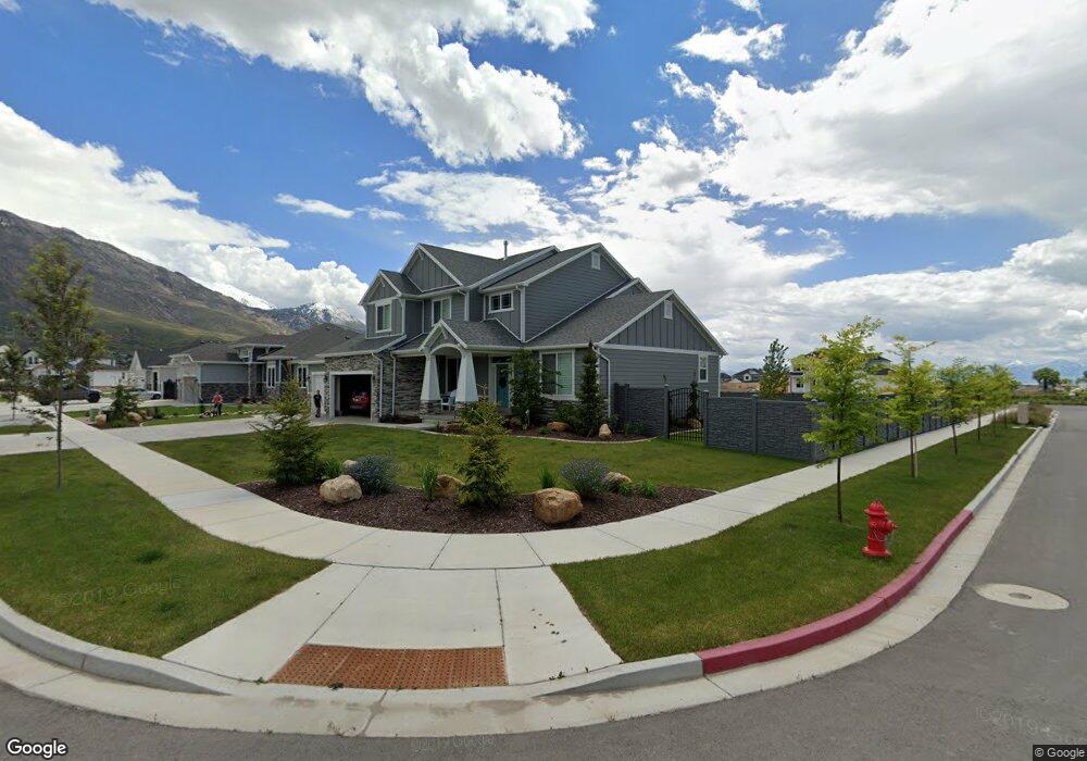
1192 E Candy Ln Unit 10 American Fork, UT 84003
Estimated Value: $1,224,932 - $1,642,000
6
Beds
4
Baths
4,322
Sq Ft
$322/Sq Ft
Est. Value
About This Home
This home is located at 1192 E Candy Ln Unit 10, American Fork, UT 84003 and is currently estimated at $1,392,311, approximately $322 per square foot. 1192 E Candy Ln Unit 10 is a home located in Utah County with nearby schools including Deerfield Elementary School, Mountain Ridge Junior High School, and American Fork High School.
Ownership History
Date
Name
Owned For
Owner Type
Purchase Details
Closed on
Mar 13, 2018
Sold by
Cadence Homes Building Corp
Bought by
Brockbank Stephen and Brockbank Brooke
Current Estimated Value
Home Financials for this Owner
Home Financials are based on the most recent Mortgage that was taken out on this home.
Original Mortgage
$226,800
Outstanding Balance
$131,167
Interest Rate
4.22%
Mortgage Type
New Conventional
Estimated Equity
$1,261,144
Create a Home Valuation Report for This Property
The Home Valuation Report is an in-depth analysis detailing your home's value as well as a comparison with similar homes in the area
Home Values in the Area
Average Home Value in this Area
Purchase History
| Date | Buyer | Sale Price | Title Company |
|---|---|---|---|
| Brockbank Stephen | -- | Artisan Title |
Source: Public Records
Mortgage History
| Date | Status | Borrower | Loan Amount |
|---|---|---|---|
| Open | Brockbank Stephen | $226,800 |
Source: Public Records
Tax History
| Year | Tax Paid | Tax Assessment Tax Assessment Total Assessment is a certain percentage of the fair market value that is determined by local assessors to be the total taxable value of land and additions on the property. | Land | Improvement |
|---|---|---|---|---|
| 2025 | $4,451 | $545,270 | -- | -- |
| 2024 | $4,190 | $494,560 | $0 | $0 |
| 2023 | $4,190 | $493,625 | $0 | $0 |
| 2022 | $4,026 | $468,050 | $0 | $0 |
| 2021 | $3,299 | $599,000 | $240,800 | $358,200 |
| 2020 | $3,150 | $554,700 | $223,000 | $331,700 |
| 2019 | $2,882 | $524,900 | $215,000 | $309,900 |
| 2018 | $2,376 | $227,590 | $0 | $0 |
Source: Public Records
Map
Nearby Homes
- 1125 N 1270 E
- 1058 N 930 E Unit 64
- 1077 N 950 E
- 1089 N 950 E
- 1045 N 930 E Unit 58
- 9587 N 4500 W
- 1121 E 580 N
- 9617 N 4500 W
- 4675 W Ferguson Way
- 9752 N Dorchester Dr
- 4552 W Windsor Cir
- 9506 N 4000 W
- 4531 W Cambridge Dr
- 462 N 950 E Unit 5
- 681 W 2760 N
- 912 E Ellens St Unit 1
- 837 E 475 N
- 4979 W Willowbank Dr
- 9481 N 3830 W
- 3810 W Valley View Dr
- 1206 E Candy Ln
- 1199 E 1030 N Unit 11
- 1184 E Candy Ln Unit 63
- 1211 E 1030 N
- 1193 E Candy Ln Unit 1
- 1222 E Candy Ln
- 1223 E 1030 N
- 1183 E 1030 N Unit 46
- 1207 E Candy Ln
- 1235 E 1030 N
- 1172 E Candy Ln
- 1172 E Candy Ln Unit 64
- 1187 E Candy Ln Unit 69
- 1221 E Candy Ln Unit 3
- 1236 E Candy Ln
- 1194 E 1030 N
- 1165 E 1030 N Unit 47
- 1214 E 1030 N
- 1249 E 1030 N
- 1175 E Candy Ln Unit 68
Your Personal Tour Guide
Ask me questions while you tour the home.