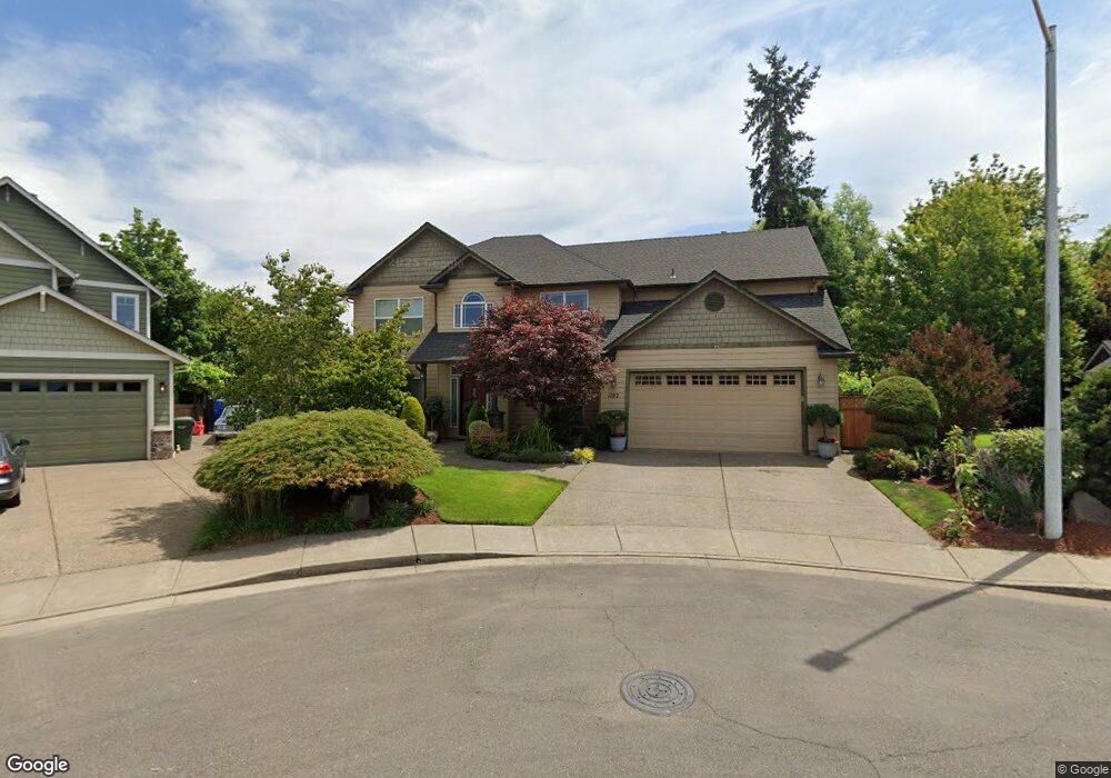
1192 Lent Ct NE Keizer, OR 97303
Estimated Value: $567,000 - $598,000
4
Beds
3
Baths
2,564
Sq Ft
$230/Sq Ft
Est. Value
About This Home
This home is located at 1192 Lent Ct NE, Keizer, OR 97303 and is currently estimated at $588,555, approximately $229 per square foot. 1192 Lent Ct NE is a home located in Marion County with nearby schools including Forest Ridge Elementary School, Whiteaker Middle School, and McNary High School.
Ownership History
Date
Name
Owned For
Owner Type
Purchase Details
Closed on
Nov 15, 2005
Sold by
Randy Fultz Construction Llc
Bought by
Delrosario Guzman Alfonso Q and Delrosario Guzman Maria
Current Estimated Value
Home Financials for this Owner
Home Financials are based on the most recent Mortgage that was taken out on this home.
Original Mortgage
$135,000
Interest Rate
5.9%
Mortgage Type
Fannie Mae Freddie Mac
Purchase Details
Closed on
Mar 10, 2005
Sold by
Lent Rodney E and Lent Loretta R
Bought by
Randy Fultz Construction Llc
Create a Home Valuation Report for This Property
The Home Valuation Report is an in-depth analysis detailing your home's value as well as a comparison with similar homes in the area
Home Values in the Area
Average Home Value in this Area
Purchase History
| Date | Buyer | Sale Price | Title Company |
|---|---|---|---|
| Delrosario Guzman Alfonso Q | $240,000 | First American | |
| Randy Fultz Construction Llc | $60,000 | First American |
Source: Public Records
Mortgage History
| Date | Status | Borrower | Loan Amount |
|---|---|---|---|
| Closed | Delrosario Guzman Alfonso Q | $135,000 |
Source: Public Records
Tax History Compared to Growth
Tax History
| Year | Tax Paid | Tax Assessment Tax Assessment Total Assessment is a certain percentage of the fair market value that is determined by local assessors to be the total taxable value of land and additions on the property. | Land | Improvement |
|---|---|---|---|---|
| 2025 | $6,138 | $363,180 | -- | -- |
| 2024 | $6,138 | $352,610 | -- | -- |
| 2023 | $5,846 | $342,340 | $0 | $0 |
| 2022 | $5,500 | $332,370 | $0 | $0 |
| 2021 | $5,431 | $322,690 | $0 | $0 |
| 2020 | $5,096 | $313,300 | $0 | $0 |
| 2019 | $5,120 | $304,180 | $0 | $0 |
| 2018 | $5,191 | $0 | $0 | $0 |
| 2017 | $4,677 | $0 | $0 | $0 |
| 2016 | $4,487 | $0 | $0 | $0 |
| 2015 | $4,423 | $0 | $0 | $0 |
| 2014 | $4,251 | $0 | $0 | $0 |
Source: Public Records
Map
Nearby Homes
- 7945 June Reid Place NE
- 0 Wheatland (Parcel 063w23ac00800) Dr
- 7846 Matt Place NE
- 959 Stonebridge Ave NE
- 1545 Dale Ave NE
- 1545 Dale Ave
- 8295 Wheatland Rd N
- Lot #2 Oppek St NE
- Lot 6 Oppek St NE
- Lot 5 Oppek St NE
- 7541 Lennox Ln NE
- 754 Pinehurst Ave NE
- 7531 Lennox Ln NE
- 7532 Lennox Ln NE
- 7524 Shadowwood St NE
- 1281 Prairie Grass Ave NE
- 1228 Bent Grass Ct NE
- 1158 Meadowridge St NE
- 248 Hazelbrook Dr N
- 674 Shannon Ct NE
- 1183 Lent Ct NE
- 7937 Mykala St NE
- 1182 Lent Ct NE
- 7947 Mykala St NE
- 7927 Mykala St NE
- 1163 Lent Ct NE
- 1184 Brunner Ct NE
- 7957 Mykala St NE
- 1143 Lent Ct NE
- 1162 Lent Ct NE
- 7917 Mykala St NE
- 1174 Brunner Ct NE
- 1142 Lent Ct NE
- 7909 Timothy Ln NE
- 1194 Brunner Ct NE
- 1123 Lent Ct NE
- 1185 Maddy Ave NE
- 1175 Maddy Ave NE Unit 2) Av
- 1175 Maddy Ave NE
- 1175 Maddy Ave NE