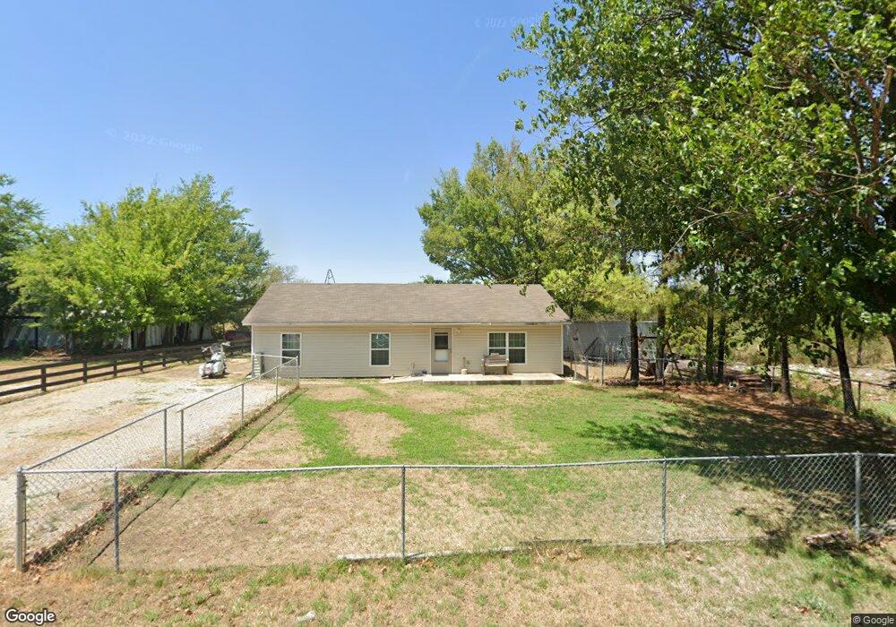
11920 N 193rd East Ave Collinsville, OK 74021
Estimated Value: $212,000 - $233,000
3
Beds
2
Baths
1,288
Sq Ft
$173/Sq Ft
Est. Value
About This Home
This home is located at 11920 N 193rd East Ave, Collinsville, OK 74021 and is currently estimated at $222,561, approximately $172 per square foot. 11920 N 193rd East Ave is a home located in Rogers County with nearby schools including Northeast Elementary School, Owasso 6th Grade Center, and Owasso 8th Grade Center.
Ownership History
Date
Name
Owned For
Owner Type
Purchase Details
Closed on
Aug 15, 2023
Sold by
Borg David and Borg Nina
Bought by
Inglish Timothy G and Inglish Shari E
Current Estimated Value
Home Financials for this Owner
Home Financials are based on the most recent Mortgage that was taken out on this home.
Original Mortgage
$168,547
Outstanding Balance
$161,963
Interest Rate
4%
Mortgage Type
VA
Estimated Equity
$60,598
Purchase Details
Closed on
Feb 4, 2010
Sold by
Lang Denise Darkne
Bought by
Borg David and Borg Nima
Home Financials for this Owner
Home Financials are based on the most recent Mortgage that was taken out on this home.
Original Mortgage
$85,900
Interest Rate
4.97%
Mortgage Type
New Conventional
Purchase Details
Closed on
Oct 22, 2004
Sold by
Lawrence Staci
Purchase Details
Closed on
Jan 3, 1999
Sold by
Bolles Mark
Purchase Details
Closed on
Jun 1, 1995
Sold by
Horn Hugh Dean
Create a Home Valuation Report for This Property
The Home Valuation Report is an in-depth analysis detailing your home's value as well as a comparison with similar homes in the area
Home Values in the Area
Average Home Value in this Area
Purchase History
| Date | Buyer | Sale Price | Title Company |
|---|---|---|---|
| Inglish Timothy G | $165,000 | Community Title Services | |
| Borg David | $84,000 | Multiple | |
| -- | $30,000 | -- | |
| -- | -- | -- | |
| -- | -- | -- |
Source: Public Records
Mortgage History
| Date | Status | Borrower | Loan Amount |
|---|---|---|---|
| Open | Inglish Timothy G | $168,547 | |
| Previous Owner | Borg David | $85,900 |
Source: Public Records
Tax History Compared to Growth
Tax History
| Year | Tax Paid | Tax Assessment Tax Assessment Total Assessment is a certain percentage of the fair market value that is determined by local assessors to be the total taxable value of land and additions on the property. | Land | Improvement |
|---|---|---|---|---|
| 2025 | $1,323 | $13,092 | $3,407 | $9,685 |
| 2024 | $1,478 | $14,266 | $3,905 | $10,361 |
| 2023 | $1,478 | $10,846 | $2,200 | $8,646 |
| 2022 | $1,267 | $11,292 | $2,200 | $9,092 |
| 2021 | $1,219 | $10,980 | $2,200 | $8,780 |
| 2020 | $1,198 | $10,812 | $2,200 | $8,612 |
| 2019 | $1,166 | $10,505 | $2,200 | $8,305 |
| 2018 | $1,072 | $9,985 | $1,650 | $8,335 |
| 2017 | $1,073 | $9,906 | $1,650 | $8,256 |
| 2016 | $1,045 | $9,638 | $1,650 | $7,988 |
| 2015 | $1,100 | $10,001 | $2,189 | $7,812 |
| 2014 | $1,048 | $9,524 | $2,119 | $7,405 |
Source: Public Records
Map
Nearby Homes
- 12047 N 193rd East Ave
- 12225 N 194th East Ave
- 19914 E 126th St N
- 11610 N 190th East Ave
- 4608 E 472 Rd
- 12875 N 193rd East Ave
- 0 Hobbs Creek Dr Unit 2541616
- 12192 N 179th East Ave
- 4728 E Hwy 20
- 11381 N 209th E
- 13247 Hobbs Creek Dr
- 17542 E 112th St N
- 5163 E Hickory Hollow Dr
- 5135 E Hickory Bluff Dr
- 20624 S Brentwood Ave
- 5 Hobbs Creek Trail
- 20823 S Concord Ave
- 20603 S Concord Ave
- 16893 E 116th St N
- 0 E 106th St N Unit 2543814
- 11811 N 193rd East Ave
- 11814 N 193rd East Ave
- 11923 N 193rd Ave E
- 11907 N 193rd E Ave
- 11907 N 193rd Ave E
- 11810 N 193rd East Ave
- 11815 N 193rd East Ave
- 11808 N 193rd East Ave
- 11970 N 194th Ave E
- 11980 N 194th Ave E
- 11970 N 194th East Ave
- 11807 N 193rd East Ave
- 11898 N 194th East Ave
- 11850 N 194th East Ave
- 11800 N 193rd Ave E
- 19485 E 120th St N
- 12012 N 193rd East Ave
- 12012 N 193rd Ave E
- 12027 N 193rd East Ave
- 11909 N 194th East Ave