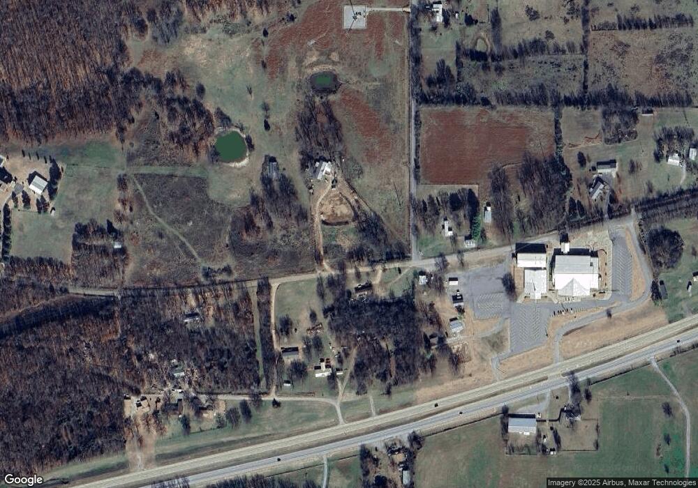
11920 W 835 Rd Tahlequah, OK 74464
Estimated Value: $197,752 - $298,000
3
Beds
2
Baths
1,774
Sq Ft
$153/Sq Ft
Est. Value
About This Home
This home is located at 11920 W 835 Rd, Tahlequah, OK 74464 and is currently estimated at $270,688, approximately $152 per square foot. 11920 W 835 Rd is a home located in Cherokee County.
Ownership History
Date
Name
Owned For
Owner Type
Purchase Details
Closed on
Jul 9, 2015
Sold by
Ford Billy L and Ford Tammy S
Bought by
Ford Billy L and Ford Tammy S
Current Estimated Value
Purchase Details
Closed on
Dec 7, 2005
Sold by
Stanley Mildred
Bought by
Ford Billy L and Ford Tammy S
Home Financials for this Owner
Home Financials are based on the most recent Mortgage that was taken out on this home.
Original Mortgage
$31,343
Interest Rate
6.12%
Mortgage Type
FHA
Purchase Details
Closed on
Mar 23, 2004
Sold by
Walter J W Stanley
Bought by
Mildred Stanley
Create a Home Valuation Report for This Property
The Home Valuation Report is an in-depth analysis detailing your home's value as well as a comparison with similar homes in the area
Home Values in the Area
Average Home Value in this Area
Purchase History
| Date | Buyer | Sale Price | Title Company |
|---|---|---|---|
| Ford Billy L | $198,000 | None Available | |
| Ford Billy L | $150,000 | None Available | |
| Mildred Stanley | -- | -- |
Source: Public Records
Mortgage History
| Date | Status | Borrower | Loan Amount |
|---|---|---|---|
| Previous Owner | Ford Billy L | $31,343 |
Source: Public Records
Tax History Compared to Growth
Tax History
| Year | Tax Paid | Tax Assessment Tax Assessment Total Assessment is a certain percentage of the fair market value that is determined by local assessors to be the total taxable value of land and additions on the property. | Land | Improvement |
|---|---|---|---|---|
| 2024 | $949 | $11,930 | $630 | $11,300 |
| 2023 | $949 | $11,930 | $630 | $11,300 |
| 2022 | $967 | $11,930 | $630 | $11,300 |
| 2021 | $972 | $11,930 | $630 | $11,300 |
| 2020 | $1,023 | $12,281 | $630 | $11,651 |
| 2019 | $1,126 | $13,606 | $1,808 | $11,798 |
| 2018 | $1,140 | $13,606 | $1,808 | $11,798 |
| 2017 | $1,153 | $13,606 | $1,808 | $11,798 |
| 2016 | $1,200 | $14,197 | $1,808 | $12,389 |
| 2015 | $1,035 | $12,746 | $1,808 | $10,938 |
| 2014 | $1,035 | $12,421 | $1,808 | $10,613 |
Source: Public Records
Map
Nearby Homes
- 12219 U S 62
- 0 Hwy 62 Hwy Unit 2532141
- 0 Hwy 62 Hwy Unit 2532145
- 0 Hwy 62 Hwy Unit 2532149
- 0 Hwy 62 Hwy Unit 2532139
- 0 Hwy 62 Hwy Unit 2517481
- 24481 S Manard Rd
- 0 805 Rd
- 11396 W Joyce Ln
- 152 Reid Rd
- 175 Reid Rd
- 1904 N County Line Rd E
- 119 N 6 Mile Ln
- 22695 N 6 Mile Rd
- 14650 W 835 Rd
- 1838 E Hwy 62
- 13380 W Clyde Maher Rd
- 27254 S 490 Rd
- 14784 W 806 Rd
- 11769 W 838 Rd
- 11973 W 835 Rd
- 11973 W 835 Rd
- 12030 W 835 Rd
- 12034 Highway 62
- 12083 W 835 Rd
- 11898 W 838 Rd
- 11825 W 838 Rd
- 11984 Highway 62
- 12046 Highway 62
- 0 Hwy 62 Hwy S Unit 1606956
- 25410 S 450 Rd
- 12079 Highway 62
- 12188 W 835 Rd
- 12217 Highway 62
- 25354 S 450 Rd
- 25390 S 450 Rd
- 12219 Highway 62
- 12219 Highway 62
- 12208 W 835 Rd
- 25380 S 450 Rd
