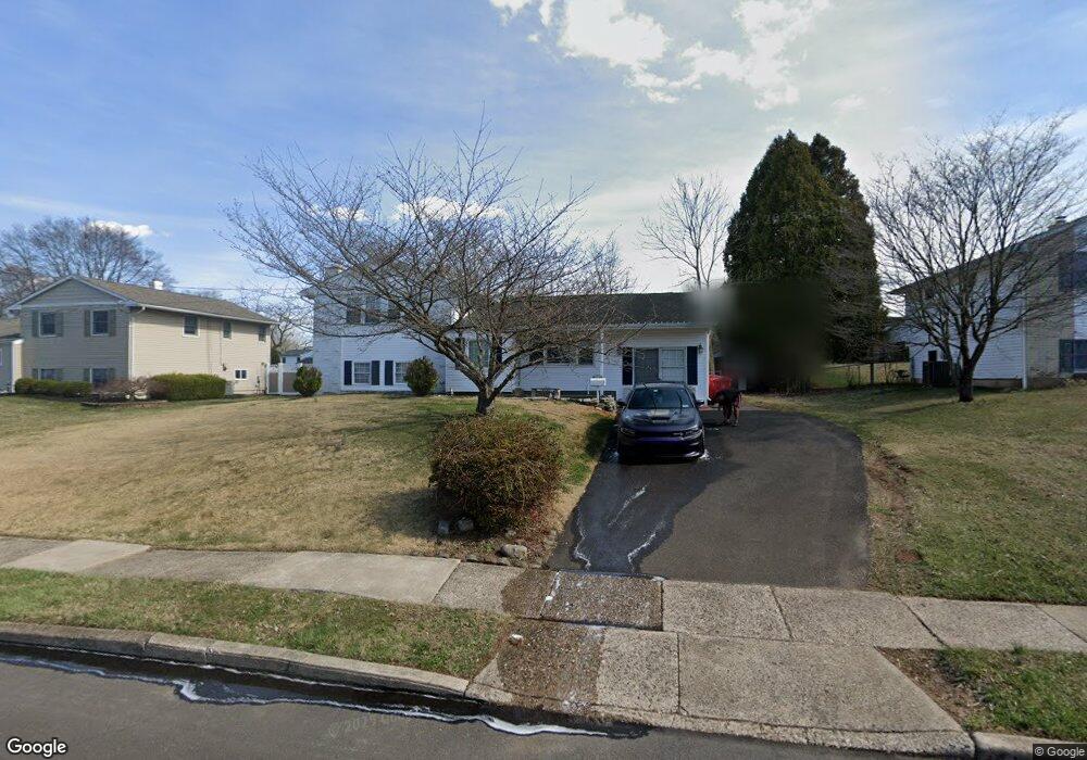
1193 Darrah Rd Warminster, PA 18974
Estimated Value: $450,000 - $456,154
3
Beds
2
Baths
1,112
Sq Ft
$407/Sq Ft
Est. Value
About This Home
This home is located at 1193 Darrah Rd, Warminster, PA 18974 and is currently estimated at $453,039, approximately $407 per square foot. 1193 Darrah Rd is a home located in Bucks County with nearby schools including Willow Dale El School, Log College Middle School, and William Tennent High School.
Ownership History
Date
Name
Owned For
Owner Type
Purchase Details
Closed on
Aug 19, 1996
Sold by
Greenberg Thomas F and Werner Denise J
Bought by
Murphy Peter and Murphy Laura A
Current Estimated Value
Home Financials for this Owner
Home Financials are based on the most recent Mortgage that was taken out on this home.
Original Mortgage
$79,300
Outstanding Balance
$6,375
Interest Rate
8.4%
Estimated Equity
$446,664
Purchase Details
Closed on
Sep 15, 1989
Bought by
Greenberg Thomas F
Create a Home Valuation Report for This Property
The Home Valuation Report is an in-depth analysis detailing your home's value as well as a comparison with similar homes in the area
Home Values in the Area
Average Home Value in this Area
Purchase History
| Date | Buyer | Sale Price | Title Company |
|---|---|---|---|
| Murphy Peter | $139,300 | -- | |
| Greenberg Thomas F | $139,000 | -- |
Source: Public Records
Mortgage History
| Date | Status | Borrower | Loan Amount |
|---|---|---|---|
| Open | Murphy Peter | $79,300 |
Source: Public Records
Tax History Compared to Growth
Tax History
| Year | Tax Paid | Tax Assessment Tax Assessment Total Assessment is a certain percentage of the fair market value that is determined by local assessors to be the total taxable value of land and additions on the property. | Land | Improvement |
|---|---|---|---|---|
| 2025 | $4,728 | $22,400 | $4,880 | $17,520 |
| 2024 | $4,728 | $22,400 | $4,880 | $17,520 |
| 2023 | $4,582 | $22,400 | $4,880 | $17,520 |
| 2022 | $4,484 | $22,400 | $4,880 | $17,520 |
| 2021 | $4,380 | $22,400 | $4,880 | $17,520 |
| 2020 | $4,318 | $22,400 | $4,880 | $17,520 |
| 2019 | $4,089 | $22,400 | $4,880 | $17,520 |
| 2018 | $3,991 | $22,400 | $4,880 | $17,520 |
| 2017 | $3,874 | $22,400 | $4,880 | $17,520 |
| 2016 | $3,874 | $22,400 | $4,880 | $17,520 |
| 2015 | $3,824 | $22,400 | $4,880 | $17,520 |
| 2014 | $3,824 | $22,400 | $4,880 | $17,520 |
Source: Public Records
Map
Nearby Homes
- 1067 Log College Dr
- 1117 Lynch Cir
- 1127 Oak Leaf Ln
- 1130 W Bristol Rd
- 0 W Bristol Rd
- 949 Marshall Dr
- 919 Lavera Rd
- Kingswood Plan at Breton Hill
- Mayweather Plan at Breton Hill
- Cloverfield Plan at Breton Hill
- Raintree Plan at Breton Hill
- Rollins Plan at Breton Hill
- 1402 Valley View
- 1024 Gates Place
- 942 Stein Ct
- 938 Jamison St
- 5302 Knox Ct Unit 5302
- 1203 Knox Ct Unit 1203
- 868 Aster Rd
- 735 Saint Davids Ave
- 1185 Darrah Rd
- 1201 Darrah Rd
- 1177 Darrah Rd
- 1198 Nassau Rd
- 1190 Nassau Rd
- 1209 Darrah Rd
- 1192 Darrah Rd
- 1206 Nassau Rd
- 1200 Darrah Rd
- 1182 Nassau Rd
- 1169 Darrah Rd
- 1208 Darrah Rd
- 1222 Nassau Rd
- 1176 Darrah Rd
- 1174 Nassau Rd
- 1217 Darrah Rd
- 1168 Darrah Rd
- 1166 Nassau Rd
- 1161 Darrah Rd
- 1151 Log College Dr