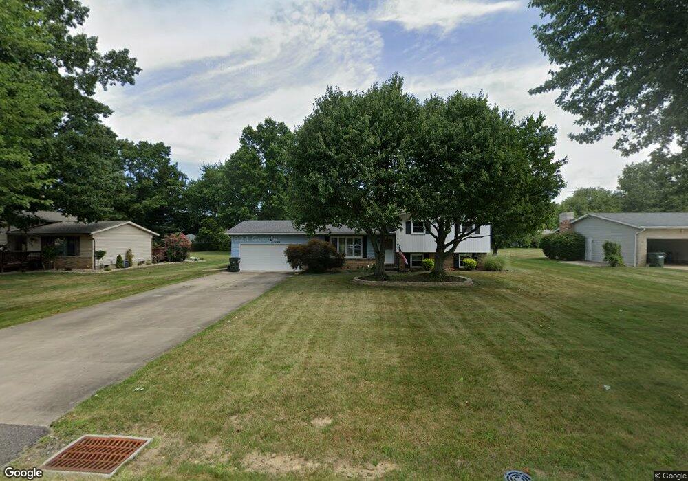
1193 Desert St NE Uniontown, OH 44685
Estimated Value: $247,005 - $272,000
3
Beds
2
Baths
1,092
Sq Ft
$239/Sq Ft
Est. Value
About This Home
This home is located at 1193 Desert St NE, Uniontown, OH 44685 and is currently estimated at $261,001, approximately $239 per square foot. 1193 Desert St NE is a home located in Stark County with nearby schools including Lake Middle/High School and Lake Center Christian School.
Ownership History
Date
Name
Owned For
Owner Type
Purchase Details
Closed on
Aug 15, 1997
Sold by
Wright Florence B
Bought by
Mcdonald Ralph S and Mcdonald Cheryl
Current Estimated Value
Home Financials for this Owner
Home Financials are based on the most recent Mortgage that was taken out on this home.
Original Mortgage
$68,000
Outstanding Balance
$10,345
Interest Rate
7.71%
Mortgage Type
New Conventional
Estimated Equity
$250,656
Purchase Details
Closed on
Nov 26, 1991
Create a Home Valuation Report for This Property
The Home Valuation Report is an in-depth analysis detailing your home's value as well as a comparison with similar homes in the area
Home Values in the Area
Average Home Value in this Area
Purchase History
| Date | Buyer | Sale Price | Title Company |
|---|---|---|---|
| Mcdonald Ralph S | $88,500 | -- | |
| -- | $85,000 | -- |
Source: Public Records
Mortgage History
| Date | Status | Borrower | Loan Amount |
|---|---|---|---|
| Open | Mcdonald Ralph S | $68,000 |
Source: Public Records
Tax History Compared to Growth
Tax History
| Year | Tax Paid | Tax Assessment Tax Assessment Total Assessment is a certain percentage of the fair market value that is determined by local assessors to be the total taxable value of land and additions on the property. | Land | Improvement |
|---|---|---|---|---|
| 2025 | -- | $73,890 | $21,840 | $52,050 |
| 2024 | -- | $73,890 | $21,840 | $52,050 |
| 2023 | $2,873 | $61,570 | $13,620 | $47,950 |
| 2022 | $2,882 | $61,570 | $13,620 | $47,950 |
| 2021 | $2,915 | $61,570 | $13,620 | $47,950 |
| 2020 | $2,848 | $53,940 | $11,730 | $42,210 |
| 2019 | $2,822 | $53,940 | $11,730 | $42,210 |
| 2018 | $2,823 | $53,940 | $11,730 | $42,210 |
| 2017 | $2,548 | $45,220 | $11,760 | $33,460 |
| 2016 | $2,552 | $45,220 | $11,760 | $33,460 |
| 2015 | $2,550 | $45,220 | $11,760 | $33,460 |
| 2014 | $199 | $40,570 | $10,540 | $30,030 |
| 2013 | $1,100 | $40,570 | $10,540 | $30,030 |
Source: Public Records
Map
Nearby Homes
- 1037 Canyon St NE
- 11121 Geib Ave NE
- 747 Grandview Cir
- 2084 Hazel St NE
- 786 Fair Vista Cir SW
- 778 Fair Vista Cir SW
- 425 Tonawanda Trail SW
- 531 Gentlebrook Blvd SW
- 550 Woodlands Glen Ave
- 525 Gentlebrook Blvd SW
- 11900 Geib Ave NE
- 510 Meadow Cir SW Unit 11
- 1180 Tessa Trail Unit 1180
- 1975 Eloise Cir NE
- 12055 King Church Ave NW
- 225 Seneca Trail SW
- 1771 Midway St NW
- Unit 9 Meadow Trail SW Unit 9
- 12201 King Church Ave NW
- 9790 Smithdale Ave NE
- 1209 Desert St NE
- 1173 Desert St NE
- 1155 Desert St NE
- 1231 Desert St NE
- 1190 Canyon St NE
- 1210 Canyon St NE
- 1170 Canyon St NE
- 1192 Desert St NE
- 1172 Desert St NE
- 1208 Desert St NE
- 1152 Canyon St NE
- 1133 Desert St NE
- 1232 Canyon St NE
- 1154 Desert St NE
- 1253 Desert St NE
- 1232 Desert St NE
- 1134 Canyon St NE
- 1266 Canyon St NE
- 1134 Desert St NE
- 1260 Desert St NE