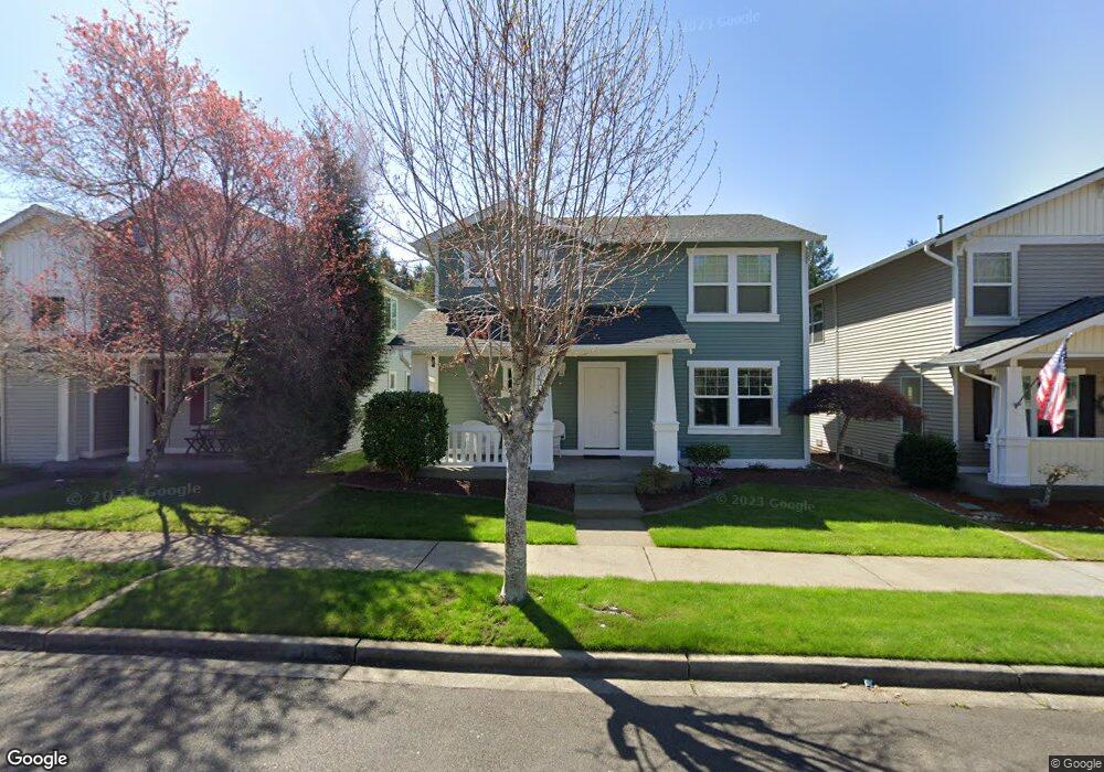
1193 Hudson St Dupont, WA 98327
Estimated Value: $556,777 - $590,000
3
Beds
3
Baths
2,084
Sq Ft
$274/Sq Ft
Est. Value
About This Home
This home is located at 1193 Hudson St, Dupont, WA 98327 and is currently estimated at $571,694, approximately $274 per square foot. 1193 Hudson St is a home located in Pierce County with nearby schools including Chloe Clark Elementary School, Saltars Point Elementary School, and Pioneer Middle School.
Ownership History
Date
Name
Owned For
Owner Type
Purchase Details
Closed on
Feb 24, 2004
Sold by
The Quadrant Corp
Bought by
Robinson Timothy J and Robinson Marion
Current Estimated Value
Home Financials for this Owner
Home Financials are based on the most recent Mortgage that was taken out on this home.
Original Mortgage
$222,101
Outstanding Balance
$103,437
Interest Rate
5.62%
Mortgage Type
VA
Estimated Equity
$468,257
Create a Home Valuation Report for This Property
The Home Valuation Report is an in-depth analysis detailing your home's value as well as a comparison with similar homes in the area
Home Values in the Area
Average Home Value in this Area
Purchase History
| Date | Buyer | Sale Price | Title Company |
|---|---|---|---|
| Robinson Timothy J | -- | Chicago Title |
Source: Public Records
Mortgage History
| Date | Status | Borrower | Loan Amount |
|---|---|---|---|
| Open | Robinson Timothy J | $222,101 |
Source: Public Records
Tax History Compared to Growth
Tax History
| Year | Tax Paid | Tax Assessment Tax Assessment Total Assessment is a certain percentage of the fair market value that is determined by local assessors to be the total taxable value of land and additions on the property. | Land | Improvement |
|---|---|---|---|---|
| 2025 | $3,783 | $526,200 | $204,200 | $322,000 |
| 2024 | $3,783 | $501,400 | $196,700 | $304,700 |
| 2023 | $3,783 | $470,000 | $181,800 | $288,200 |
| 2022 | $3,774 | $478,700 | $181,800 | $296,900 |
| 2021 | $3,610 | $358,500 | $115,500 | $243,000 |
| 2019 | $3,234 | $327,500 | $96,200 | $231,300 |
| 2018 | $3,451 | $316,300 | $96,200 | $220,100 |
| 2017 | $3,100 | $295,600 | $80,900 | $214,700 |
| 2016 | $2,962 | $268,100 | $68,200 | $199,900 |
| 2014 | $2,505 | $263,100 | $68,200 | $194,900 |
| 2013 | $2,505 | $240,700 | $70,000 | $170,700 |
Source: Public Records
Map
Nearby Homes
- 1187 Griggs St Unit 1187
- 1151 Griggs St
- 2696 Erwin Ave Unit 2696
- 1263 Hudson St
- 1267 Hudson St
- 1331 Rowan Ct Unit 1331
- 1337 Hudson St
- 1373 Hudson St Unit 1373
- 2198 Palisade Blvd Unit C2
- 2147 Hammond Ave Unit B10
- 2176 Palisade Blvd Unit F-3
- 2237 Tolmie St
- 2104 Palisade Blvd Unit B-7
- 2160 Anderson Ave
- 2176 McDonald Ave
- 604 Dupont Ave
- 1449 Bobs Hollow Ln
- 1607 Kincaid St Unit E-8
- 1625 Palisade Blvd
- 1613 Palisade Blvd
- 1189 Hudson St
- 1197 Hudson St
- 1185 Hudson St
- 1190 Griggs St
- 1190 Griggs Stdr
- 1186 Griggs St
- 2694 Hamilton Ave Unit 3
- 2694 Hamilton Ave Unit 2694
- 1194 Griggs St
- 1181 Hudson St
- 2670 Hamilton Ave Unit 2670
- 1182 Griggs St
- 2654 Hamilton Ave Unit 2654
- 1184 Hudson St
- 2642 Hamilton Ave Unit 2642
- 1180 Hudson St
- 2682 Hamilton Ave Unit 2682
- 1188 Hudson St
- 2862 Hamilton Ave
- 1177 Hudson St