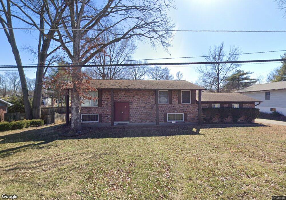
11930 Devonshire Ave Saint Louis, MO 63131
Estimated Value: $515,000 - $656,000
3
Beds
4
Baths
2,278
Sq Ft
$249/Sq Ft
Est. Value
About This Home
This home is located at 11930 Devonshire Ave, Saint Louis, MO 63131 and is currently estimated at $567,851, approximately $249 per square foot. 11930 Devonshire Ave is a home located in St. Louis County with nearby schools including Westchester Elementary School, North Kirkwood Middle School, and Kirkwood Senior High School.
Ownership History
Date
Name
Owned For
Owner Type
Purchase Details
Closed on
Jul 14, 2021
Sold by
Seymour Thomas Fletcher and Seymour Kellie Anita
Bought by
Pentrex Development Corporation
Current Estimated Value
Purchase Details
Closed on
Mar 6, 2001
Sold by
Nave Ronald T
Bought by
Seymour Thomas Fletcher and Seymour Kellie Anita
Purchase Details
Closed on
Mar 25, 1999
Sold by
Bedford Kellie A
Bought by
Nave Ronald T
Purchase Details
Closed on
Apr 9, 1998
Sold by
Nave Ronald T
Bought by
Bedford Kellie A
Purchase Details
Closed on
Jan 26, 1998
Sold by
Nave Ronald T and Nave Frances A
Bought by
Nave Ronald T
Home Financials for this Owner
Home Financials are based on the most recent Mortgage that was taken out on this home.
Original Mortgage
$132,000
Interest Rate
9.12%
Create a Home Valuation Report for This Property
The Home Valuation Report is an in-depth analysis detailing your home's value as well as a comparison with similar homes in the area
Home Values in the Area
Average Home Value in this Area
Purchase History
| Date | Buyer | Sale Price | Title Company |
|---|---|---|---|
| Pentrex Development Corporation | $390,000 | Investors Title Co Clayton | |
| Seymour Thomas Fletcher | $144,577 | -- | |
| Seymour Thomas Fletcher | $144,577 | -- | |
| Nave Ronald T | -- | -- | |
| Bedford Kellie A | -- | -- | |
| Nave Ronald T | -- | -- |
Source: Public Records
Mortgage History
| Date | Status | Borrower | Loan Amount |
|---|---|---|---|
| Previous Owner | Nave Ronald T | $132,000 |
Source: Public Records
Tax History
| Year | Tax Paid | Tax Assessment Tax Assessment Total Assessment is a certain percentage of the fair market value that is determined by local assessors to be the total taxable value of land and additions on the property. | Land | Improvement |
|---|---|---|---|---|
| 2025 | $4,713 | $88,120 | $57,300 | $30,820 |
| 2024 | $4,713 | $81,360 | $42,980 | $38,380 |
| 2023 | $4,713 | $81,360 | $42,980 | $38,380 |
| 2022 | $4,455 | $72,790 | $42,980 | $29,810 |
| 2021 | $4,407 | $72,790 | $42,980 | $29,810 |
| 2020 | $3,907 | $62,000 | $42,830 | $19,170 |
| 2019 | $3,912 | $62,000 | $42,830 | $19,170 |
| 2018 | $3,767 | $53,550 | $26,660 | $26,890 |
| 2017 | $3,777 | $53,550 | $26,660 | $26,890 |
| 2016 | $2,835 | $40,610 | $19,040 | $21,570 |
| 2015 | $2,838 | $40,610 | $19,040 | $21,570 |
| 2014 | $2,551 | $35,630 | $9,960 | $25,670 |
Source: Public Records
Map
Nearby Homes
- 11909 Lillian Ave
- 1126 Bopp Rd
- 12224 TBB Roger Ln
- 1319 Kendon Dr
- 1056 Cedargate Dr
- 954 Rochdale Dr
- 1144 Missouri Ave
- 11344 Manchester Rd
- 1312 W Essex Ave
- 1940 Meadowtree Ln Unit 1
- 1940 Meadowtree Ln Unit 2
- 1534 Woodgate Dr
- 2000 Meadowtree Ln Unit 7
- 2005 Woodland Knoll
- 2025 Woodland Knoll
- 1612 Dougherty Ferry Rd
- 2033 Woodland Knoll
- 516 Kirkshire Dr
- 452 Iris Ln
- 966 N Geyer Rd
- 11940 Devonshire Ave
- 11924 Devonshire Ave
- 11935 Amherst Dr
- 11931 Amherst Dr
- 11942 Devonshire Ave
- 11939 Amherst Dr
- 11923 Devonshire Ave
- 11929 Devonshire Ave
- 11919 Devonshire Ave
- 11931 Devonshire Ave
- 11925 Devonshire Ave
- 995 Tallie Dr
- 11943 Amherst Dr
- 11927 Amherst Dr
- 11933 Devonshire Ave
- 1003 Tallie Dr
- 11936 Amherst Dr
- 11940 Amherst Dr
- 11910 Manhattan Ave
- 11912 Manhattan Uc Ave
Your Personal Tour Guide
Ask me questions while you tour the home.