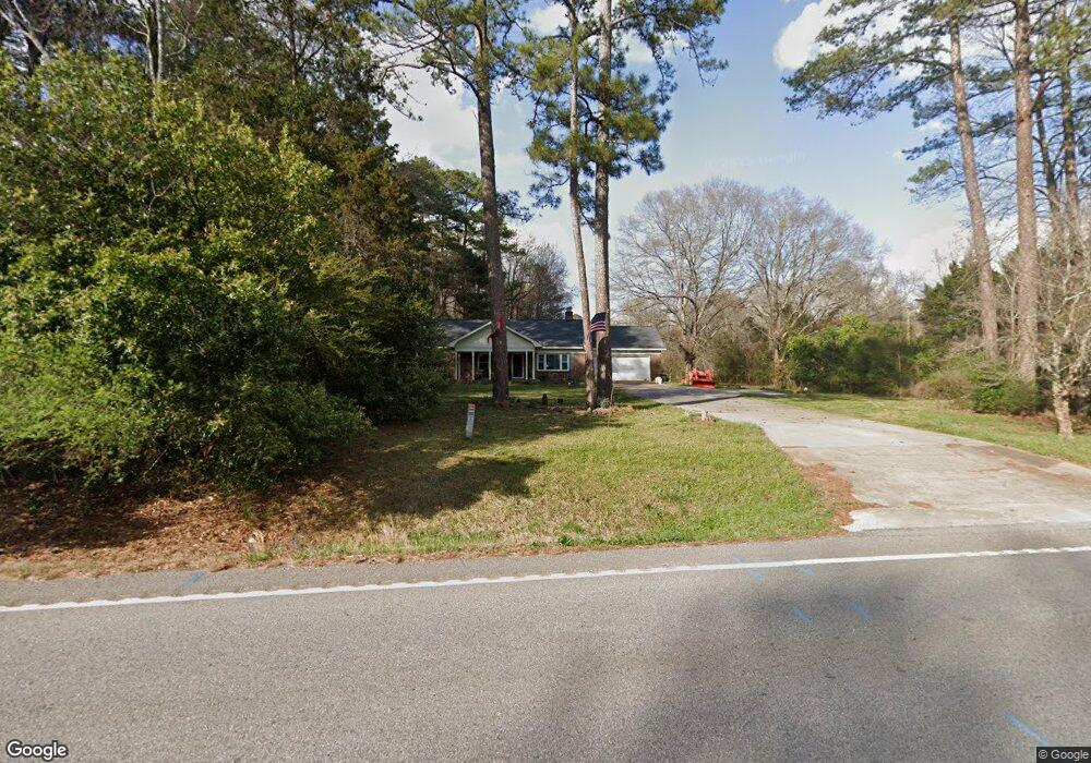
11937 Highway 278 Covington, GA 30014
Estimated Value: $311,916 - $341,000
--
Bed
2
Baths
1,641
Sq Ft
$195/Sq Ft
Est. Value
About This Home
This home is located at 11937 Highway 278, Covington, GA 30014 and is currently estimated at $320,729, approximately $195 per square foot. 11937 Highway 278 is a home located in Newton County with nearby schools including Flint Hill Elementary School, Cousins Middle School, and Eastside High School.
Ownership History
Date
Name
Owned For
Owner Type
Purchase Details
Closed on
Mar 20, 2020
Sold by
Smith Luke D
Bought by
Smith Luke D and Smith Jennifer L
Current Estimated Value
Home Financials for this Owner
Home Financials are based on the most recent Mortgage that was taken out on this home.
Original Mortgage
$196,377
Outstanding Balance
$172,829
Interest Rate
3.4%
Mortgage Type
FHA
Estimated Equity
$147,900
Purchase Details
Closed on
Sep 21, 2009
Sold by
Federal Home Loan Mortgage Corporation
Bought by
Jones Robert P
Home Financials for this Owner
Home Financials are based on the most recent Mortgage that was taken out on this home.
Original Mortgage
$58,913
Interest Rate
5.11%
Mortgage Type
FHA
Purchase Details
Closed on
Oct 7, 2008
Sold by
Countrywide Home Loan Inc
Bought by
Federal Home Loan Mortgage Corporation
Create a Home Valuation Report for This Property
The Home Valuation Report is an in-depth analysis detailing your home's value as well as a comparison with similar homes in the area
Home Values in the Area
Average Home Value in this Area
Purchase History
| Date | Buyer | Sale Price | Title Company |
|---|---|---|---|
| Smith Luke D | -- | -- | |
| Smith Luke D | $200,000 | -- | |
| Jones Robert P | -- | -- | |
| Federal Home Loan Mortgage Corporation | -- | -- | |
| Countrywide Home Loan Inc | $115,000 | -- |
Source: Public Records
Mortgage History
| Date | Status | Borrower | Loan Amount |
|---|---|---|---|
| Open | Smith Luke D | $196,377 | |
| Closed | Smith Luke D | $196,377 | |
| Previous Owner | Jones Robert P | $58,913 |
Source: Public Records
Tax History Compared to Growth
Tax History
| Year | Tax Paid | Tax Assessment Tax Assessment Total Assessment is a certain percentage of the fair market value that is determined by local assessors to be the total taxable value of land and additions on the property. | Land | Improvement |
|---|---|---|---|---|
| 2025 | $3,330 | $133,840 | $16,520 | $117,320 |
| 2024 | $2,938 | $116,000 | $8,680 | $107,320 |
| 2023 | $2,927 | $107,880 | $8,680 | $99,200 |
| 2022 | $2,319 | $85,480 | $8,680 | $76,800 |
| 2021 | $2,255 | $74,360 | $8,680 | $65,680 |
| 2020 | $1,992 | $63,200 | $9,600 | $53,600 |
| 2019 | $1,429 | $45,800 | $9,600 | $36,200 |
| 2018 | $1,381 | $44,120 | $9,600 | $34,520 |
| 2017 | $1,277 | $41,080 | $9,600 | $31,480 |
| 2016 | $1,084 | $35,480 | $9,600 | $25,880 |
| 2015 | $1,091 | $35,680 | $9,600 | $26,080 |
| 2014 | $1,089 | $35,680 | $0 | $0 |
Source: Public Records
Map
Nearby Homes
- 245 Tamea Trail
- 45 Bridgemill Dr
- 66 Dogwood Ln
- 65 Dogwood Ln
- 295 Eastwood Forest
- 55 Tall Oak Trail
- 58 Deerfield Rd
- 155 Tall Oak Trail
- 90 Eastwood Cir
- 595 Ridgeway Rd
- 180 River Meadow Ln
- 210 River Meadow Ln
- 230 River Meadow Ln
- 220 River Meadow Ln
- 269 Georgia 11
- 115 Alcovy Cir
- 147 Cobb Rd
- 160 Vinnys Way Unit 1
- 160 Vinny's Way
- 0 Highway 11 S Unit 10573906
- 11937 Highway 278
- 11937 U S 278
- 11957 Highway 278
- 11915 Highway 278
- 20 Melody Dr
- 50 Melody Ridge
- 40 Melody Ridge
- 30 Melody Ridge
- 20 Melody Ridge
- 60 Melody Ridge
- 15 Melody Dr
- 10 Melody Ridge
- 11883 Highway 278
- 55 Melody Ridge
- 25 Melody Dr
- 45 Melody Ridge
- 35 Melody Ridge
- 11836 Highway 278
- 35 Melody Dr
- 195 Tamea Trail