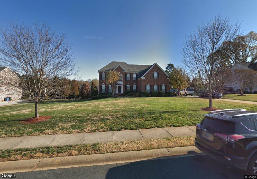
11939 Canter Dr Mint Hill, NC 28227
Estimated Value: $693,000 - $774,356
4
Beds
3
Baths
3,960
Sq Ft
$187/Sq Ft
Est. Value
About This Home
This home is located at 11939 Canter Dr, Mint Hill, NC 28227 and is currently estimated at $742,089, approximately $187 per square foot. 11939 Canter Dr is a home located in Mecklenburg County with nearby schools including Bain Elementary, Mint Hill Middle School, and Independence High.
Ownership History
Date
Name
Owned For
Owner Type
Purchase Details
Closed on
Jan 3, 2006
Sold by
Nvr Inc
Bought by
Burgess Travis and Burgess Tonya
Current Estimated Value
Home Financials for this Owner
Home Financials are based on the most recent Mortgage that was taken out on this home.
Original Mortgage
$330,736
Outstanding Balance
$177,325
Interest Rate
5.5%
Mortgage Type
Fannie Mae Freddie Mac
Estimated Equity
$564,764
Create a Home Valuation Report for This Property
The Home Valuation Report is an in-depth analysis detailing your home's value as well as a comparison with similar homes in the area
Home Values in the Area
Average Home Value in this Area
Purchase History
| Date | Buyer | Sale Price | Title Company |
|---|---|---|---|
| Burgess Travis | $413,500 | None Available |
Source: Public Records
Mortgage History
| Date | Status | Borrower | Loan Amount |
|---|---|---|---|
| Open | Burgess Travis | $330,736 |
Source: Public Records
Tax History Compared to Growth
Tax History
| Year | Tax Paid | Tax Assessment Tax Assessment Total Assessment is a certain percentage of the fair market value that is determined by local assessors to be the total taxable value of land and additions on the property. | Land | Improvement |
|---|---|---|---|---|
| 2025 | $4,800 | $670,900 | $110,000 | $560,900 |
| 2024 | $4,800 | $670,900 | $110,000 | $560,900 |
| 2023 | $4,728 | $670,900 | $110,000 | $560,900 |
| 2022 | $3,575 | $405,500 | $70,000 | $335,500 |
| 2021 | $3,575 | $405,500 | $70,000 | $335,500 |
| 2020 | $3,575 | $405,500 | $70,000 | $335,500 |
| 2019 | $3,569 | $405,500 | $70,000 | $335,500 |
| 2018 | $3,868 | $351,300 | $49,900 | $301,400 |
| 2017 | $3,838 | $351,300 | $49,900 | $301,400 |
| 2016 | $3,678 | $336,900 | $49,900 | $287,000 |
| 2015 | $3,675 | $336,900 | $49,900 | $287,000 |
| 2014 | $3,853 | $353,500 | $66,500 | $287,000 |
Source: Public Records
Map
Nearby Homes
- 11903 Canter Dr
- 11935 Jumper Dr
- 12135 Jumper Dr
- 12145 Jumper Dr
- 18217 Middle Springs Ln
- 7425 Purple Martin Way
- 7425 Purple Martin Way Unit 46
- 18209 Middle Springs Ln
- 7415 Purple Martin Way
- 7415 Purple Martin Way Unit 48
- 7411 Purple Martin Way
- 7411 Purple Martin Way Unit 49
- 17049 Malone Ln
- Newell Plan at Whitley Preserve - Enclave Collection
- Lemley Plan at Whitley Preserve - Park Collection
- Wyngate Plan at Whitley Preserve - Park Collection
- 12025 Mariner Dr
- Trailwind Plan at Whitley Preserve - Enclave Collection
- Goldrush Plan at Whitley Preserve - Park Collection
- Teasdale Plan at Whitley Preserve - Park Collection
- 11929 Canter Dr
- 11949 Canter Dr
- 12010 Jumper Dr
- 12000 Jumper Dr
- 11919 Canter Dr
- 11938 Canter Dr
- 11959 Canter Dr
- 12020 Jumper Dr
- 11948 Canter Dr
- 11928 Canter Dr
- 11940 Jumper Dr
- 11958 Canter Dr
- 11909 Canter Dr
- 11918 Canter Dr
- 12003 Canter Dr
- 1 Jumper Dr
- 12030 Jumper Dr
- 10948 Canter Dr
- 11930 Jumper Dr
- 11945 Jumper Dr