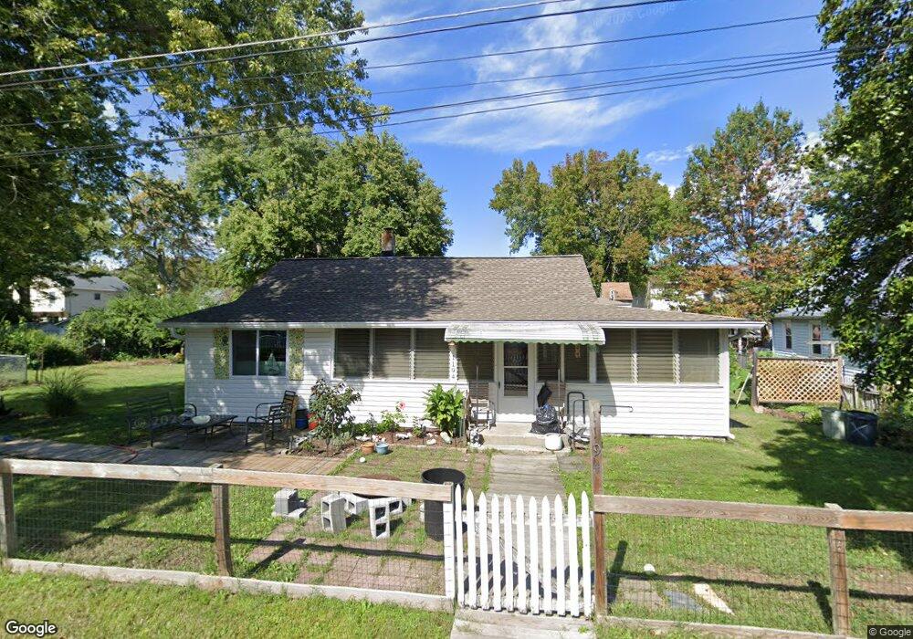
1194 Maple Ave Shady Side, MD 20764
Estimated Value: $361,643 - $422,000
Studio
1
Bath
1,687
Sq Ft
$234/Sq Ft
Est. Value
About This Home
This home is located at 1194 Maple Ave, Shady Side, MD 20764 and is currently estimated at $394,661, approximately $233 per square foot. 1194 Maple Ave is a home located in Anne Arundel County with nearby schools including Shady Side Elementary School, Southern Middle School, and Southern High School.
Ownership History
Date
Name
Owned For
Owner Type
Purchase Details
Closed on
Apr 20, 2005
Sold by
Mchenry Mary D
Bought by
Stende Cheryl L
Current Estimated Value
Home Financials for this Owner
Home Financials are based on the most recent Mortgage that was taken out on this home.
Original Mortgage
$176,250
Outstanding Balance
$90,480
Interest Rate
5.7%
Mortgage Type
Purchase Money Mortgage
Estimated Equity
$304,182
Purchase Details
Closed on
Aug 30, 1989
Sold by
Stowe Robert S
Bought by
Mchenry Mary D
Home Financials for this Owner
Home Financials are based on the most recent Mortgage that was taken out on this home.
Original Mortgage
$84,000
Interest Rate
10.21%
Create a Home Valuation Report for This Property
The Home Valuation Report is an in-depth analysis detailing your home's value as well as a comparison with similar homes in the area
Home Values in the Area
Average Home Value in this Area
Purchase History
| Date | Buyer | Sale Price | Title Company |
|---|---|---|---|
| Stende Cheryl L | $235,000 | -- | |
| Mchenry Mary D | $105,000 | -- |
Source: Public Records
Mortgage History
| Date | Status | Borrower | Loan Amount |
|---|---|---|---|
| Open | Stende Cheryl L | $176,250 | |
| Previous Owner | Mchenry Mary D | $84,000 |
Source: Public Records
Tax History
| Year | Tax Paid | Tax Assessment Tax Assessment Total Assessment is a certain percentage of the fair market value that is determined by local assessors to be the total taxable value of land and additions on the property. | Land | Improvement |
|---|---|---|---|---|
| 2025 | $3,119 | $259,700 | -- | -- |
| 2024 | $3,119 | $248,000 | $0 | $0 |
| 2023 | $2,007 | $236,300 | $143,100 | $93,200 |
| 2022 | $2,841 | $233,433 | $0 | $0 |
| 2020 | $2,717 | $227,700 | $143,100 | $84,600 |
| 2019 | $2,715 | $218,667 | $0 | $0 |
| 2018 | $2,126 | $209,633 | $0 | $0 |
| 2017 | $2,541 | $200,600 | $0 | $0 |
| 2016 | -- | $194,800 | $0 | $0 |
| 2015 | -- | $189,000 | $0 | $0 |
| 2014 | -- | $183,200 | $0 | $0 |
Source: Public Records
Map
Nearby Homes
- 1199 Oak Ave
- 5191 Spring Ave
- 1461 Cedarhurst Rd
- 0 Haile Pkwy Unit MDAA2127474
- 1445 & 1447 Haile Pkwy
- 1436 Haile Pkwy
- 5235 Al Jones Dr
- 5250 Al Jones Dr
- 1650 Cedar Ln
- 1428 Haile Pkwy
- 1408 & 1410 Haile Pkwy
- 0 Shady Side Rd Unit MDAA2113156
- 0 Shady Side Rd Unit MDAA2113166
- 4949 Idlewilde Rd
- 1711 Columbia Beach Rd
- 5314 Al Jones Dr
- 1451 Shady Rest Rd
- 1419 Shady Rest Rd
- 5218 Nick Rd
- 1330 Jordan Dr
- 1192 Maple Ave
- 1188 Maple Ave
- 1199 Bayview Ave
- 1191 Maple Ave
- 1193 Maple Ave
- 1189 Maple Ave
- 1203 Bayview Ave
- 1195 Bayview Ave
- 1203 Bay View Ave
- 1196 Maple Ave
- 1195 Maple Ave
- 1184 Maple Ave
- 1205 Bayview Ave
- 1193 Bay View Ave
- 1185 Maple Ave
- 1197 Maple Ave
- 1198 Maple Ave
- 1178 Cedar Ave
- 1207 Bayview Ave
- 1207 Bay View Ave
Your Personal Tour Guide
Ask me questions while you tour the home.