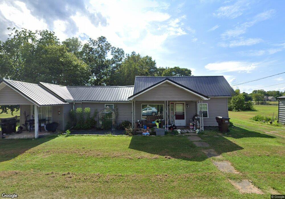
11941 State Route 335 Lucasville, OH 45648
Estimated Value: $126,000 - $274,000
4
Beds
2
Baths
1,724
Sq Ft
$102/Sq Ft
Est. Value
About This Home
This home is located at 11941 State Route 335, Lucasville, OH 45648 and is currently estimated at $175,666, approximately $101 per square foot. 11941 State Route 335 is a home located in Scioto County with nearby schools including Minford Primary Elementary School, Minford Middle School, and Minford High School.
Ownership History
Date
Name
Owned For
Owner Type
Purchase Details
Closed on
May 15, 2007
Sold by
Buckner Lester
Bought by
Twinam James E and Evans Heather M
Current Estimated Value
Purchase Details
Closed on
Jan 11, 2007
Sold by
Buckner Lester
Bought by
Buckner Lester
Purchase Details
Closed on
Jan 15, 2004
Bought by
Buckner Lester
Purchase Details
Closed on
Jul 21, 2003
Sold by
Akers Frank P + Patricia
Bought by
Beneficial Ohio Inc
Purchase Details
Closed on
Sep 10, 1999
Sold by
Elliott Julie M
Bought by
Akers Frank P + Patricia
Create a Home Valuation Report for This Property
The Home Valuation Report is an in-depth analysis detailing your home's value as well as a comparison with similar homes in the area
Home Values in the Area
Average Home Value in this Area
Purchase History
| Date | Buyer | Sale Price | Title Company |
|---|---|---|---|
| Twinam James E | -- | -- | |
| Buckner Lester | -- | -- | |
| Buckner Lester | $20,000 | -- | |
| Beneficial Ohio Inc | -- | -- | |
| Akers Frank P + Patricia | $55,000 | -- |
Source: Public Records
Tax History Compared to Growth
Tax History
| Year | Tax Paid | Tax Assessment Tax Assessment Total Assessment is a certain percentage of the fair market value that is determined by local assessors to be the total taxable value of land and additions on the property. | Land | Improvement |
|---|---|---|---|---|
| 2024 | $1,229 | $29,890 | $7,440 | $22,450 |
| 2023 | $1,229 | $29,890 | $7,440 | $22,450 |
| 2022 | $1,220 | $29,890 | $7,440 | $22,450 |
| 2021 | $1,013 | $24,700 | $6,400 | $18,300 |
| 2020 | $1,013 | $24,700 | $6,400 | $18,300 |
| 2019 | $995 | $22,760 | $5,820 | $16,940 |
| 2018 | $940 | $22,760 | $5,820 | $16,940 |
| 2017 | $939 | $22,760 | $5,820 | $16,940 |
| 2016 | $908 | $21,740 | $5,480 | $16,260 |
| 2015 | $908 | $21,740 | $5,480 | $16,260 |
| 2013 | $806 | $21,740 | $5,480 | $16,260 |
Source: Public Records
Map
Nearby Homes
- 373 Piketon Rd
- 447 Bull Run Rd
- 6485 Millers Run Back Run Rd
- 0-5A Rice Rd
- 0-5B Rice Rd
- 0-5 Rice Rd
- 0-2C Rice Rd
- 0-2B Rice Rd
- 0-2A Rice Rd
- 311 Diane St
- 640 Rases Mountain Dr
- 21 Salem Rd
- 1614 White Gravel Dewey Rd
- 4149 Piketon Rd
- 436 High St
- 1285 Nelson Rd
- 215 Ohio 335
- 8499 Ohio 139
- 7948 State Route 139
- 2261 Glades Rd
- 11941 Ohio 335
- 26 Greenwood Dr
- 90 Greenwood Dr
- 66 Greenwood Dr
- 9 Greenwood Dr
- 329 Greenwood Dr
- 41 Greenwood
- 41 Greenwood Dr
- 106 Greenwood Dr
- 456 Greenwood Dr
- 73 Greenwood Dr
- 12050 State Route 335
- 431 Greenwood Dr
- 431 Greenwood Dr
- 450 Greenwood Dr
- 11820 State Route 335
- 164 Greenwood Dr
- 151 Greenwood Dr
- 387 Greenwood Dr
- 406 Greenwood Dr