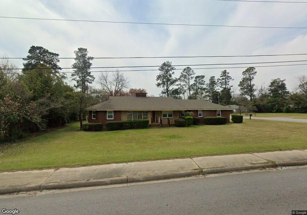
1195 Chestnut St Orangeburg, SC 29115
Estimated Value: $178,000 - $204,000
2
Beds
2
Baths
2,307
Sq Ft
$83/Sq Ft
Est. Value
About This Home
This home is located at 1195 Chestnut St, Orangeburg, SC 29115 and is currently estimated at $191,825, approximately $83 per square foot. 1195 Chestnut St is a home located in Orangeburg County with nearby schools including Brookdale Elementary School, Brookdale Elementary, and Robert E. Howard Middle School.
Ownership History
Date
Name
Owned For
Owner Type
Purchase Details
Closed on
Dec 15, 2021
Sold by
Mcneil Carolyn H and Wiles Rebecca M
Bought by
Anderson Spencer Reid
Current Estimated Value
Purchase Details
Closed on
Apr 14, 2015
Sold by
Estate Of Margaret H Wiles and Mcneill Carolynh
Bought by
Wiles Lewis Aaron and Mcneill Carolyn H
Purchase Details
Closed on
Jun 29, 2006
Sold by
Wiles Lewis A and Wiles Margaret H
Bought by
Wiles Lewis A and Wiles Margaret H
Purchase Details
Closed on
Aug 18, 2003
Sold by
Wiles Lewis Arthur and Wiles Margaret H
Bought by
Jeffcoat Timmothy D and Jeffcoat Jeania M
Create a Home Valuation Report for This Property
The Home Valuation Report is an in-depth analysis detailing your home's value as well as a comparison with similar homes in the area
Home Values in the Area
Average Home Value in this Area
Purchase History
| Date | Buyer | Sale Price | Title Company |
|---|---|---|---|
| Anderson Spencer Reid | $145,000 | None Available | |
| Poole Ripon Carter | -- | None Available | |
| Wiles Lewis Aaron | -- | -- | |
| Wiles Lewis A | -- | None Available | |
| Jeffcoat Timmothy D | $140,000 | -- |
Source: Public Records
Tax History Compared to Growth
Tax History
| Year | Tax Paid | Tax Assessment Tax Assessment Total Assessment is a certain percentage of the fair market value that is determined by local assessors to be the total taxable value of land and additions on the property. | Land | Improvement |
|---|---|---|---|---|
| 2024 | $4,405 | $8,762 | $1,202 | $7,560 |
| 2023 | $4,372 | $8,575 | $1,153 | $7,422 |
| 2022 | $3,177 | $8,575 | $1,153 | $7,422 |
| 2021 | $3,177 | $6,517 | $1,153 | $5,364 |
| 2020 | $2,969 | $6,517 | $0 | $0 |
| 2019 | $3,158 | $7,117 | $0 | $0 |
| 2018 | $3,020 | $6,379 | $0 | $0 |
| 2017 | $2,956 | $6,379 | $0 | $0 |
| 2016 | $3,514 | $7,585 | $0 | $0 |
| 2015 | $304 | $7,585 | $0 | $0 |
| 2014 | $304 | $7,585 | $1,153 | $6,432 |
| 2013 | -- | $0 | $0 | $0 |
Source: Public Records
Map
Nearby Homes
- 1188 Gloria St
- 1238 Dantzler St
- 1135 Gloria St
- 1069 Chestnut St
- 1231 Eutaw St
- 1697 Enderly St
- 1174 Ellis Ave
- 1103 Ellis Ave
- 1085 Ellis Ave
- 1235 Sawyer St
- 1254 Sawyer St
- 0 Decatur St NE
- 1118 Decatur St NE
- 112 Praline Ct
- 1895 Columbia Rd
- 194 Orangepark Dr
- 3604 Columbia Rd
- 1236 College Ave
- 1757 Saint Matthews Rd
- 119 Wellsgrove Ln
- 1360 Dantzler St
- 1181 Chestnut St
- 1175 Chestnut St
- 1342 Dantzler St
- 1231 Chestnut St
- 1218 Chestnut St
- 1357 Dantzler St
- 1184 Gloria St
- 1206 Chestnut St
- 1167 Chestnut St
- 0 Chestnut St
- 1186 Gloria St
- 1186 Gloria St
- 1174 Gloria St
- 1243 Chestnut St
- 1325 Dantzler St
- 1198 Chestnut St
- 1168 Gloria St
- 1155 Chestnut St
- 1231 Delmas St