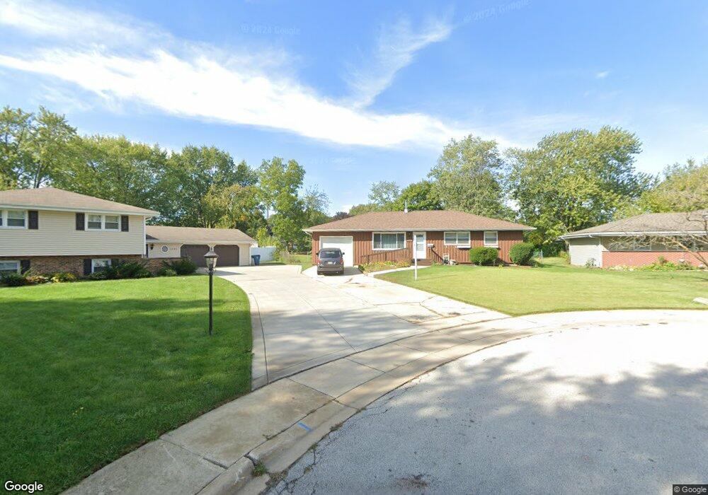
1195 Comet Dr Aurora, IL 60505
Indian Creek NeighborhoodEstimated Value: $251,000 - $365,000
3
Beds
2
Baths
1,160
Sq Ft
$272/Sq Ft
Est. Value
About This Home
This home is located at 1195 Comet Dr, Aurora, IL 60505 and is currently estimated at $315,759, approximately $272 per square foot. 1195 Comet Dr is a home located in Kane County with nearby schools including Mabel O Donnell Elementary School, Simmons Middle School, and East Aurora High School.
Ownership History
Date
Name
Owned For
Owner Type
Purchase Details
Closed on
Aug 30, 2013
Sold by
King Jimmie and King Stephanie
Bought by
King Jimmie and King Stephanie
Current Estimated Value
Purchase Details
Closed on
Jan 31, 2007
Sold by
King Jimmie and King Laura J
Bought by
King Jimmie
Home Financials for this Owner
Home Financials are based on the most recent Mortgage that was taken out on this home.
Original Mortgage
$177,600
Interest Rate
6.21%
Mortgage Type
New Conventional
Create a Home Valuation Report for This Property
The Home Valuation Report is an in-depth analysis detailing your home's value as well as a comparison with similar homes in the area
Home Values in the Area
Average Home Value in this Area
Purchase History
| Date | Buyer | Sale Price | Title Company |
|---|---|---|---|
| King Jimmie | -- | National Title Solutions Inc | |
| King Jimmie | -- | Chicago Title Insurance Co |
Source: Public Records
Mortgage History
| Date | Status | Borrower | Loan Amount |
|---|---|---|---|
| Closed | King Jimmie | $177,600 |
Source: Public Records
Tax History
| Year | Tax Paid | Tax Assessment Tax Assessment Total Assessment is a certain percentage of the fair market value that is determined by local assessors to be the total taxable value of land and additions on the property. | Land | Improvement |
|---|---|---|---|---|
| 2024 | $5,157 | $83,224 | $14,669 | $68,555 |
| 2023 | $4,959 | $74,361 | $13,107 | $61,254 |
| 2022 | $4,699 | $67,848 | $11,959 | $55,889 |
| 2021 | $4,615 | $63,167 | $11,134 | $52,033 |
| 2020 | $4,381 | $58,673 | $10,342 | $48,331 |
| 2019 | $4,262 | $54,362 | $9,582 | $44,780 |
| 2018 | $4,346 | $53,733 | $8,863 | $44,870 |
| 2017 | $4,444 | $51,320 | $8,166 | $43,154 |
| 2016 | $4,694 | $50,610 | $8,858 | $41,752 |
| 2015 | -- | $44,315 | $7,617 | $36,698 |
| 2014 | -- | $41,483 | $7,326 | $34,157 |
| 2013 | -- | $40,891 | $7,221 | $33,670 |
Source: Public Records
Map
Nearby Homes
- 1578 Colleen Ln
- Lot 1 Reckinger Rd
- 1050 N Farnsworth Ave Unit 111
- 1110 N Farnsworth Ave Unit 213
- 1110 N Farnsworth Ave Unit 211
- 1160 N Ohio St Unit 62
- 1060 N Farnsworth Ave Unit 1105
- 0000 N Farnsworth Ave
- 1750 N Marywood Ave Unit 305
- 1750 N Marywood Ave Unit 315
- 907 Harley Ct
- 1826 N Farnsworth Ave
- 1923 Schomer Ct
- 953 Sheffer Rd
- 1671 Sheffer Rd
- 1870 Tall Oaks Dr Unit 2104
- 1771 Briarheath Dr
- 1009 Assell Ave
- 1220 Mitchell Rd
- 304 Hankes Ave
Your Personal Tour Guide
Ask me questions while you tour the home.