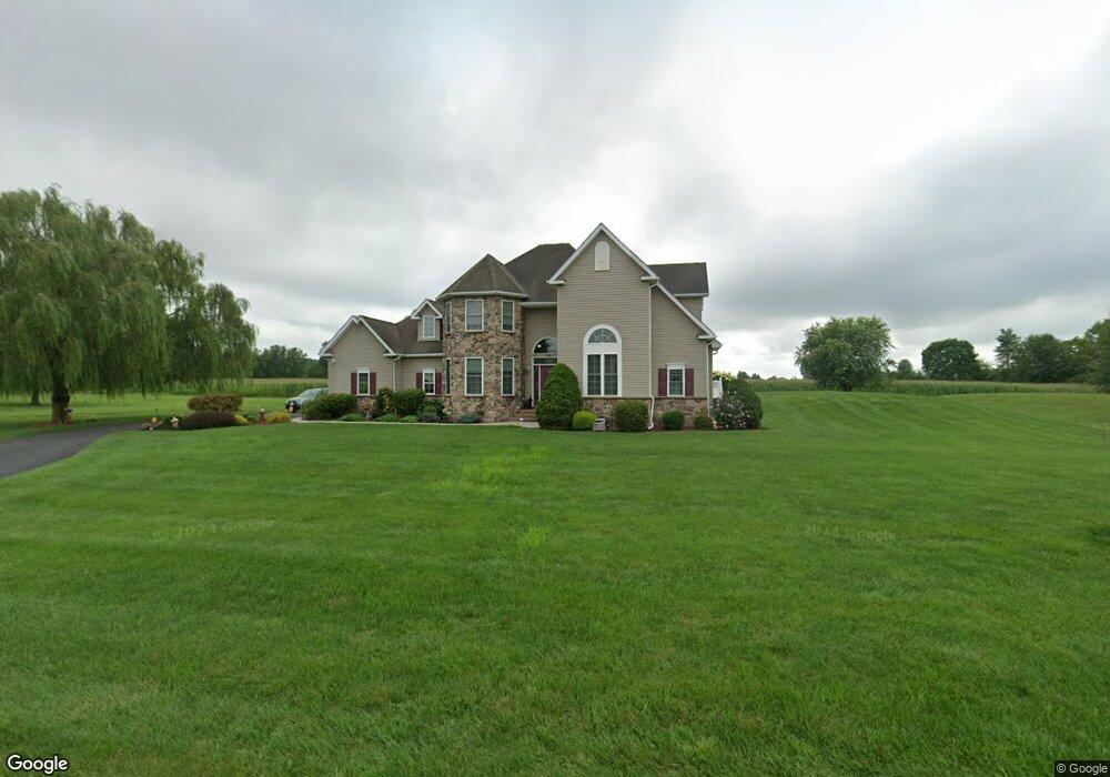
1195 Fish And Game Rd Unit 21 Littlestown, PA 17340
Estimated Value: $506,575 - $629,000
3
Beds
3
Baths
2,615
Sq Ft
$216/Sq Ft
Est. Value
About This Home
This home is located at 1195 Fish And Game Rd Unit 21, Littlestown, PA 17340 and is currently estimated at $564,644, approximately $215 per square foot. 1195 Fish And Game Rd Unit 21 is a home located in Adams County with nearby schools including Rolling Acres El School, Maple Avenue Middle School, and Littlestown Senior High School.
Ownership History
Date
Name
Owned For
Owner Type
Purchase Details
Closed on
Sep 4, 2005
Sold by
Artisans Design Build Inc
Bought by
Osborne Thomas E and Osborne Sherry S
Current Estimated Value
Home Financials for this Owner
Home Financials are based on the most recent Mortgage that was taken out on this home.
Original Mortgage
$190,000
Interest Rate
6.39%
Mortgage Type
New Conventional
Create a Home Valuation Report for This Property
The Home Valuation Report is an in-depth analysis detailing your home's value as well as a comparison with similar homes in the area
Home Values in the Area
Average Home Value in this Area
Purchase History
| Date | Buyer | Sale Price | Title Company |
|---|---|---|---|
| Osborne Thomas E | $406,000 | -- |
Source: Public Records
Mortgage History
| Date | Status | Borrower | Loan Amount |
|---|---|---|---|
| Previous Owner | Osborne Thomas E | $190,000 |
Source: Public Records
Tax History Compared to Growth
Tax History
| Year | Tax Paid | Tax Assessment Tax Assessment Total Assessment is a certain percentage of the fair market value that is determined by local assessors to be the total taxable value of land and additions on the property. | Land | Improvement |
|---|---|---|---|---|
| 2025 | $6,258 | $330,600 | $53,300 | $277,300 |
| 2024 | $6,015 | $330,600 | $53,300 | $277,300 |
| 2023 | $5,863 | $330,600 | $53,300 | $277,300 |
| 2022 | $5,821 | $330,600 | $53,300 | $277,300 |
| 2021 | $5,614 | $330,600 | $53,300 | $277,300 |
| 2020 | $5,532 | $330,600 | $53,300 | $277,300 |
| 2019 | $5,414 | $330,600 | $53,300 | $277,300 |
| 2018 | $5,253 | $330,600 | $53,300 | $277,300 |
| 2017 | $5,088 | $330,600 | $53,300 | $277,300 |
| 2016 | -- | $330,600 | $53,300 | $277,300 |
| 2015 | -- | $330,600 | $53,300 | $277,300 |
| 2014 | -- | $330,600 | $53,300 | $277,300 |
Source: Public Records
Map
Nearby Homes
- 0 Hershey Rd Unit PALA2058618
- 0 Conestoga Blvd Unit PALA2080682
- 37 Amanda Dr Unit 14
- 2238 Harney Rd Unit 3
- 975 Hoffman Home Rd Unit 6
- 1024 Frederick Pike Unit 6
- 161 Stoners Cir
- 58 Windsor Ct
- 20c Locust Dr
- 0 Locust Dr Unit PAAD2015910
- 22 Rita Marie Ave
- 440 N Queen St
- 140 Apple Grove Ln Unit 425
- 15 Yorktowne Ct Unit 97
- 464 Locust Ln
- 117 Charles St
- 115 Charles St
- 162 Newark St
- 22 Cemetery St
- 241 M St
- 1183 Fish And Game Rd Unit 20
- 1235 Fish And Game Rd Unit 22
- 1190 Fish And Game Rd
- 1170 Fish And Game Rd Unit 1
- 1220 Fish And Game Rd
- 1150 Fish And Game Rd
- 1250 Fish And Game Rd
- 1124 Fish And Game Rd
- 1264 Fish And Game Rd
- 1274 Fish And Game Rd
- 1100 Fish And Game Rd
- 79 Quail Ct Unit 12
- 458 Mud College Rd
- 65 Quail Ct Unit 11
- 65 Quail Ct
- 47 Quail Ct Unit 10
- 47 Quail Ct
- 11 Quail Ct
- 93 Quail Ct Unit 13
- 31 Quail Ct Unit 9