Estimated Value: $313,000 - $446,096
3
Beds
3
Baths
2,152
Sq Ft
$183/Sq Ft
Est. Value
About This Home
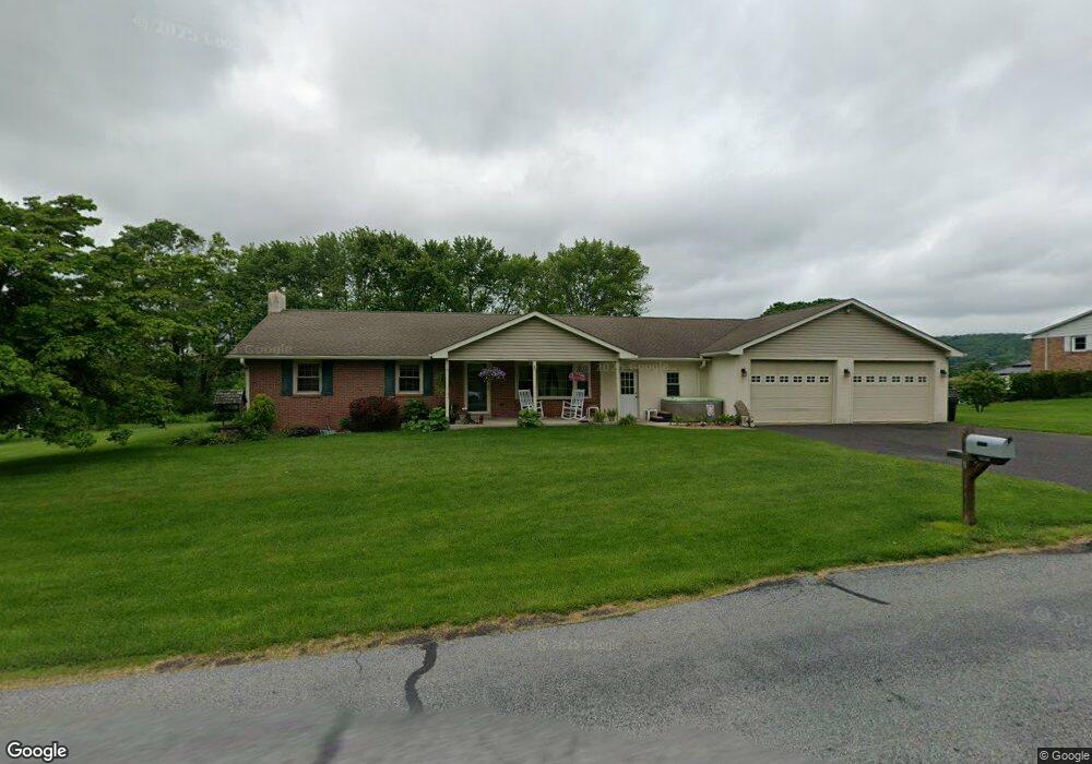
This home is located at 1195 Station Rd, Palm, PA 18070 and is currently estimated at $393,024, approximately $182 per square foot. 1195 Station Rd is a home located in Montgomery County with nearby schools including Upper Perkiomen 4th & 5th Grade Center, Upper Perkiomen Middle School, and Upper Perkiomen High School.
Ownership History
Date
Name
Owned For
Owner Type
Purchase Details
Closed on
Dec 23, 2004
Sold by
Christman Timothy P and Christman Leanne W
Bought by
Jenkins Robert and Jenkins Beth
Current Estimated Value
Home Financials for this Owner
Home Financials are based on the most recent Mortgage that was taken out on this home.
Original Mortgage
$112,000
Outstanding Balance
$56,388
Interest Rate
5.81%
Estimated Equity
$336,636
Purchase Details
Closed on
May 30, 1996
Sold by
Tomlinson Allen K and Stoneback Jeannette E
Bought by
Christman Timothy P and Christman Leanne W
Create a Home Valuation Report for This Property
The Home Valuation Report is an in-depth analysis detailing your home's value as well as a comparison with similar homes in the area
Home Values in the Area
Average Home Value in this Area
Purchase History
| Date | Buyer | Sale Price | Title Company |
|---|---|---|---|
| Jenkins Robert | $140,000 | -- | |
| Christman Timothy P | $118,000 | -- |
Source: Public Records
Mortgage History
| Date | Status | Borrower | Loan Amount |
|---|---|---|---|
| Open | Jenkins Robert | $112,000 |
Source: Public Records
Tax History Compared to Growth
Tax History
| Year | Tax Paid | Tax Assessment Tax Assessment Total Assessment is a certain percentage of the fair market value that is determined by local assessors to be the total taxable value of land and additions on the property. | Land | Improvement |
|---|---|---|---|---|
| 2025 | $4,921 | $146,810 | -- | -- |
| 2024 | $4,921 | $146,810 | -- | -- |
| 2023 | $4,688 | $146,810 | $0 | $0 |
| 2022 | $4,624 | $146,810 | $0 | $0 |
| 2021 | $4,507 | $146,810 | $0 | $0 |
| 2020 | $4,482 | $146,810 | $0 | $0 |
| 2019 | $4,381 | $146,810 | $0 | $0 |
| 2018 | $4,381 | $146,810 | $0 | $0 |
| 2017 | $4,248 | $146,810 | $0 | $0 |
| 2016 | $4,191 | $146,810 | $0 | $0 |
| 2015 | $3,955 | $146,810 | $0 | $0 |
| 2014 | $3,955 | $146,810 | $0 | $0 |
Source: Public Records
Map
Nearby Homes
- 770 Gravel Pike
- 7921 Corning Rd
- 1962 Tollgate Rd
- 0 Chestnut St
- 62 Ashford Ln
- 1137 Church Rd
- 328 Ashford Ln
- 117 Concord Dr
- 317 Ashford Ln
- 548 Blaker Dr
- 434 Jefferson St
- 2563 Wasser Rd
- 333 Blaker Dr
- 317 State St
- 2100 Fox Hollow Ln
- 2071 Baus Rd
- 4675 E Mill Hill Rd
- 202 Dotts St
- 1418-1/5 W 4th St
- 2128 Danville Dr
- 1189 Station Rd
- 1201 Station Rd
- 1204 Station Rd
- 1198 Station Rd
- 1192 Station Rd
- 1185 Station Rd
- 1206 Station Rd
- 1207 Station Rd
- 1184 Station Rd
- 1181 Station Rd
- 1212 Station Rd
- 1180 Station Rd
- 1173 Station Rd
- 1176 Station Rd
- 1176 Station Rd
- 1169 Station Rd
- 0 Station Rd Unit 6657589
- 1168 Station Rd
- 1161 Station Rd
- 1158 Station Rd