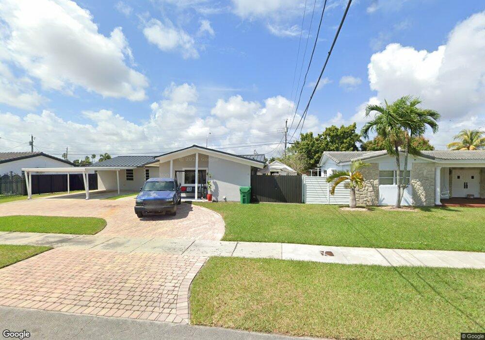
11955 Bird Dr Miami, FL 33175
Southern Estates NeighborhoodEstimated Value: $861,000 - $2,103,000
5
Beds
3
Baths
3,166
Sq Ft
$382/Sq Ft
Est. Value
About This Home
This home is located at 11955 Bird Dr, Miami, FL 33175 and is currently estimated at $1,209,590, approximately $382 per square foot. 11955 Bird Dr is a home located in Miami-Dade County with nearby schools including Village Green Elementary School, W. R. Thomas Middle School, and Southwest Miami Senior High School.
Ownership History
Date
Name
Owned For
Owner Type
Purchase Details
Closed on
Apr 8, 2025
Sold by
Cornelie 62 Inc
Bought by
11955 Cornelie Llc
Current Estimated Value
Purchase Details
Closed on
Aug 17, 2023
Sold by
Llano Rosendo V
Bought by
Cornelie 62 Inc
Purchase Details
Closed on
Mar 22, 2018
Sold by
Llano Rosendo V and Llano Rosendo V
Bought by
Llano Rosendo V and Llano Rosendo V
Create a Home Valuation Report for This Property
The Home Valuation Report is an in-depth analysis detailing your home's value as well as a comparison with similar homes in the area
Home Values in the Area
Average Home Value in this Area
Purchase History
| Date | Buyer | Sale Price | Title Company |
|---|---|---|---|
| 11955 Cornelie Llc | -- | None Listed On Document | |
| Cornelie 62 Inc | -- | None Listed On Document | |
| Cornelie 62 Inc | -- | None Listed On Document | |
| Llano Rosendo V | -- | Attorney |
Source: Public Records
Tax History
| Year | Tax Paid | Tax Assessment Tax Assessment Total Assessment is a certain percentage of the fair market value that is determined by local assessors to be the total taxable value of land and additions on the property. | Land | Improvement |
|---|---|---|---|---|
| 2025 | $13,210 | $749,681 | $370,419 | $379,262 |
| 2024 | $10,868 | $735,264 | $352,780 | $382,484 |
| 2023 | $10,868 | $573,886 | $0 | $0 |
| 2022 | $10,101 | $521,715 | $0 | $0 |
| 2021 | $8,890 | $474,287 | $194,029 | $280,258 |
| 2020 | $8,545 | $453,376 | $185,210 | $268,166 |
| 2019 | $8,161 | $430,468 | $174,626 | $255,842 |
| 2018 | $7,987 | $432,543 | $174,626 | $257,917 |
| 2017 | $7,628 | $406,229 | $0 | $0 |
| 2016 | $7,347 | $382,561 | $0 | $0 |
| 2015 | $6,941 | $353,535 | $0 | $0 |
| 2014 | -- | $336,192 | $0 | $0 |
Source: Public Records
Map
Nearby Homes
- 3860 SW 121st Ave
- 11950 SW 43rd St
- 12225 SW 42nd St
- 12320 SW 39th St
- 11800 SW 35th St
- 3640 SW 122nd Place
- 12175 SW 45th St
- 3611 SW 117th Ave Unit 10207
- 3581 SW 117th Ave Unit 5409
- 3581 SW 117th Ave Unit 5207
- 3601 SW 117th Ave Unit 9301
- 11450 SW 40th St
- 12270 SW 45th St
- 3610 SW 114th Ave Unit 4104
- 3825 SW 125th Ave
- 3815 SW 125th Ave
- 12401 SW 45th St
- 11417 SW 35th Ln
- 11835 SW 47th St
- 11535 SW 32nd Ln
- 11965 Bird Dr
- 3980 SW 119th Ct
- 11960 SW 41st Dr
- 11945 Bird Dr Unit W
- 11945 Bird Dr
- 11945 Bird Dr Unit EFF
- 11975 Bird Dr
- 4109 SW 119th Ct
- 11970 SW 41st Dr
- 11938 SW 41st Dr
- 11935 Bird Dr
- 11985 Bird Dr
- 11940 SW 39th Terrace
- 11980 SW 41st Dr
- 11951 SW 40th St
- 11929 SW 39th Terrace
- 11995 Bird Dr
- 12000 Bird Dr
- 11925 Bird Dr
Your Personal Tour Guide
Ask me questions while you tour the home.