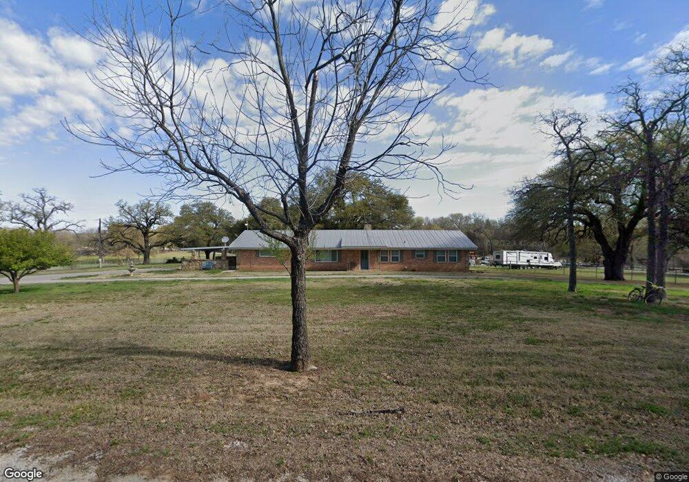
1196 Greenwood Rd Decatur, TX 76234
Estimated Value: $386,983 - $738,000
--
Bed
2
Baths
2,640
Sq Ft
$206/Sq Ft
Est. Value
About This Home
This home is located at 1196 Greenwood Rd, Decatur, TX 76234 and is currently estimated at $544,496, approximately $206 per square foot. 1196 Greenwood Rd is a home located in Wise County with nearby schools including Decatur High School.
Ownership History
Date
Name
Owned For
Owner Type
Purchase Details
Closed on
Feb 24, 2017
Sold by
Mcferrin Harold Gene and Mcferrin Peggy Joyce
Bought by
Mcferrin Harold G and Mcferrin Peggy H
Current Estimated Value
Home Financials for this Owner
Home Financials are based on the most recent Mortgage that was taken out on this home.
Original Mortgage
$125,000
Outstanding Balance
$103,425
Interest Rate
4.09%
Mortgage Type
Credit Line Revolving
Estimated Equity
$441,071
Purchase Details
Closed on
Aug 25, 1998
Bought by
Coker John W and Coker Loretta J
Purchase Details
Closed on
Nov 26, 1986
Bought by
Coker John W and Coker Loretta J
Purchase Details
Closed on
Jan 1, 1901
Bought by
Coker John W and Coker Loretta J
Create a Home Valuation Report for This Property
The Home Valuation Report is an in-depth analysis detailing your home's value as well as a comparison with similar homes in the area
Home Values in the Area
Average Home Value in this Area
Purchase History
| Date | Buyer | Sale Price | Title Company |
|---|---|---|---|
| Mcferrin Harold G | -- | None Available | |
| Coker John W | -- | -- | |
| Coker John W | -- | -- | |
| Coker John W | -- | -- |
Source: Public Records
Mortgage History
| Date | Status | Borrower | Loan Amount |
|---|---|---|---|
| Open | Mcferrin Harold G | $125,000 |
Source: Public Records
Tax History Compared to Growth
Tax History
| Year | Tax Paid | Tax Assessment Tax Assessment Total Assessment is a certain percentage of the fair market value that is determined by local assessors to be the total taxable value of land and additions on the property. | Land | Improvement |
|---|---|---|---|---|
| 2025 | $1,358 | $272,656 | -- | -- |
| 2024 | $1,358 | $247,869 | $0 | $0 |
| 2023 | $2,722 | $225,335 | $0 | $0 |
| 2022 | $3,143 | $204,850 | $0 | $0 |
| 2021 | $2,985 | $218,730 | $17,700 | $201,030 |
| 2020 | $2,731 | $169,300 | $15,310 | $153,990 |
| 2019 | $2,856 | $166,210 | $15,310 | $150,900 |
| 2018 | $2,783 | $156,780 | $13,030 | $143,750 |
| 2017 | $2,581 | $145,390 | $11,030 | $134,360 |
| 2016 | $2,536 | $143,710 | $9,350 | $134,360 |
| 2015 | -- | $133,710 | $8,510 | $125,200 |
| 2014 | -- | $134,710 | $8,020 | $126,690 |
Source: Public Records
Map
Nearby Homes
- Lot 12 Cedar Springs Estates
- 362 Decatur Cemetery Rd
- 114 Cemetery Rd
- 853 County Road 2215
- 3092 N Trinity St
- 124 Blackstar Ln
- 116 Blackstar Ln
- 132 Blackstar Ln
- 159 Blackstar Ln
- 2811 N Trinity St
- TBD E Hwy 380 Hwy
- 130 Nicholas Way
- 175 Quail Ridge Ct
- 165 Quail Ridge Ct
- 2270 County Road 2360
- 1952 Old Decatur Rd
- 918 Old Decatur Rd
- 307 E Vernon St
- 114 Sondra Lin Blvd
- 903 N Miller St
- 571 County Road 2228
- 343 County Road 2228
- 343 County Road 2228
- 167 Private Road 2232
- Lot 5 County Road 2229
- Lot 1 County Road 2229
- Lot 3 County Road 2229
- Lot 4 County Road 2229
- Lot 2 County Road 2229
- Lot 6 County Road 2229
- 25 ac County Road 2229
- 10 ac County Road 2229
- 316 County Road 2228
- 300 County Road 2228
- 111 County Road 2229
- 2430 N Fm 51
- 301 County Road 2228
- 1055 Greenwood Rd
- 1055 Greenwood Rd
- 10 Acres County Road 2229