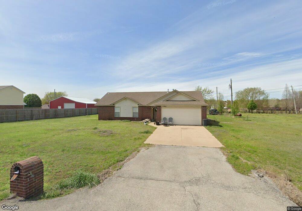
11962 Valley Ave Collinsville, OK 74021
Estimated Value: $219,325 - $265,000
3
Beds
2
Baths
1,235
Sq Ft
$199/Sq Ft
Est. Value
About This Home
This home is located at 11962 Valley Ave, Collinsville, OK 74021 and is currently estimated at $245,331, approximately $198 per square foot. 11962 Valley Ave is a home located in Rogers County with nearby schools including Northeast Elementary School, Owasso 6th Grade Center, and Owasso 8th Grade Center.
Ownership History
Date
Name
Owned For
Owner Type
Purchase Details
Closed on
May 3, 2009
Sold by
Mcdannald Justin M and Mcdannald Becky J
Bought by
Benshoof Tyler J
Current Estimated Value
Home Financials for this Owner
Home Financials are based on the most recent Mortgage that was taken out on this home.
Original Mortgage
$101,000
Interest Rate
5.02%
Mortgage Type
FHA
Purchase Details
Closed on
Oct 20, 2004
Sold by
Homes By Betty Inc
Purchase Details
Closed on
May 26, 2004
Sold by
Cherub Investments Inc
Create a Home Valuation Report for This Property
The Home Valuation Report is an in-depth analysis detailing your home's value as well as a comparison with similar homes in the area
Home Values in the Area
Average Home Value in this Area
Purchase History
| Date | Buyer | Sale Price | Title Company |
|---|---|---|---|
| Benshoof Tyler J | $120,000 | Clarmore Abstract | |
| -- | $103,000 | -- | |
| -- | $18,000 | -- |
Source: Public Records
Mortgage History
| Date | Status | Borrower | Loan Amount |
|---|---|---|---|
| Previous Owner | Benshoof Tyler J | $101,000 |
Source: Public Records
Tax History Compared to Growth
Tax History
| Year | Tax Paid | Tax Assessment Tax Assessment Total Assessment is a certain percentage of the fair market value that is determined by local assessors to be the total taxable value of land and additions on the property. | Land | Improvement |
|---|---|---|---|---|
| 2025 | $2,021 | $18,619 | $3,790 | $14,829 |
| 2024 | $1,957 | $17,732 | $3,609 | $14,123 |
| 2023 | $1,957 | $16,889 | $3,300 | $13,589 |
| 2022 | $1,806 | $16,084 | $3,299 | $12,785 |
| 2021 | $1,701 | $15,323 | $3,300 | $12,023 |
| 2020 | $1,617 | $15,119 | $3,300 | $11,819 |
| 2019 | $1,541 | $13,894 | $2,750 | $11,144 |
| 2018 | $1,529 | $14,244 | $2,750 | $11,494 |
| 2017 | $1,531 | $14,131 | $2,750 | $11,381 |
| 2016 | $1,495 | $13,790 | $2,750 | $11,040 |
| 2015 | $1,479 | $13,445 | $2,750 | $10,695 |
| 2014 | $1,489 | $13,543 | $2,750 | $10,793 |
Source: Public Records
Map
Nearby Homes
- 11610 N 190th East Ave
- 12047 N 193rd East Ave
- 12225 N 194th East Ave
- 0 Hobbs Creek Dr Unit 2541616
- 12875 N 193rd East Ave
- 17542 E 112th St N
- 4608 E 472 Rd
- 12885 N 193rd East Ave
- 13247 Hobbs Creek Dr
- 16893 E 116th St N
- 11417 N 168th East Ave
- 16550 E 120th St N
- 0 E 106th St N Unit 2543814
- 0 E 106th St N Unit 2546711
- 4728 E Hwy 20
- 11381 N 209th E
- 5 Hobbs Creek Trail
- 12537 N 165th East Ave
- 11890 S 4050 Rd
- 5163 E Hickory Hollow Dr
- 11942 Valley Ave
- 11982 Valley Ave
- 11995 Gunsmoke Dr
- 11995 Gun Smoke Dr
- 11922 Valley Ave
- 11975 Gunsmoke Dr
- 11990 Gunsmoke Dr
- 11903 Fieldstone Dr
- 18862 Savage Ct
- 11975 Gun Smoke Dr
- 11882 Valley Ave
- 18952 Savage Ct
- 11990 Gun Smoke Dr
- 11883 Fieldstone Dr
- 11955 Gunsmoke Dr
- 18832 Savage Ct
- 12003 Fieldstone Dr
- 11955 Gun Smoke Dr