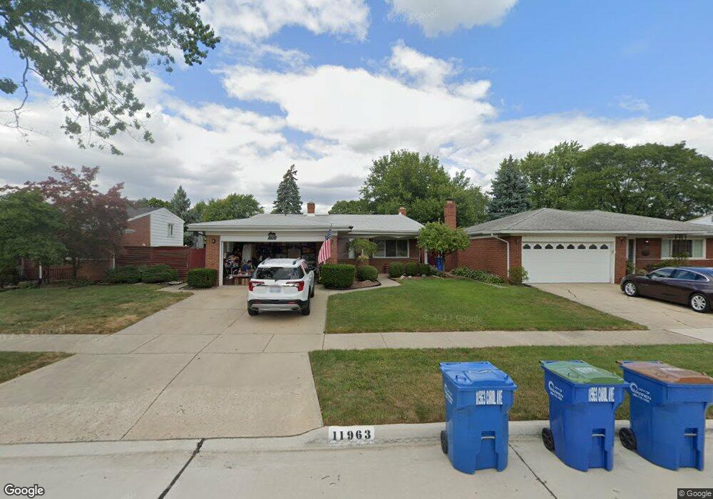
11963 Carol Ave Warren, MI 48093
Northeast Warren NeighborhoodEstimated Value: $273,554 - $290,000
3
Beds
2
Baths
1,887
Sq Ft
$148/Sq Ft
Est. Value
About This Home
This home is located at 11963 Carol Ave, Warren, MI 48093 and is currently estimated at $279,389, approximately $148 per square foot. 11963 Carol Ave is a home located in Macomb County with nearby schools including Warren Woods Tower High School and Frontier International Academy Elementary.
Ownership History
Date
Name
Owned For
Owner Type
Purchase Details
Closed on
Apr 12, 2006
Sold by
Scurto Susan and Scurto Susan L
Bought by
Scurto Vincent
Current Estimated Value
Home Financials for this Owner
Home Financials are based on the most recent Mortgage that was taken out on this home.
Original Mortgage
$148,450
Interest Rate
6.48%
Mortgage Type
FHA
Purchase Details
Closed on
May 15, 2003
Sold by
Scurto Carl
Bought by
Scurto Vincent and Scurto Susan
Create a Home Valuation Report for This Property
The Home Valuation Report is an in-depth analysis detailing your home's value as well as a comparison with similar homes in the area
Home Values in the Area
Average Home Value in this Area
Purchase History
| Date | Buyer | Sale Price | Title Company |
|---|---|---|---|
| Scurto Vincent | -- | None Available | |
| Scurto Vincent | $150,000 | -- |
Source: Public Records
Mortgage History
| Date | Status | Borrower | Loan Amount |
|---|---|---|---|
| Closed | Scurto Vincent | $148,450 |
Source: Public Records
Tax History Compared to Growth
Tax History
| Year | Tax Paid | Tax Assessment Tax Assessment Total Assessment is a certain percentage of the fair market value that is determined by local assessors to be the total taxable value of land and additions on the property. | Land | Improvement |
|---|---|---|---|---|
| 2025 | $3,091 | $128,420 | $0 | $0 |
| 2024 | $3,004 | $124,450 | $0 | $0 |
| 2023 | $2,838 | $116,960 | $0 | $0 |
| 2022 | $2,782 | $101,740 | $0 | $0 |
| 2021 | $2,730 | $93,560 | $0 | $0 |
| 2020 | $2,617 | $88,810 | $0 | $0 |
| 2019 | $2,500 | $81,960 | $0 | $0 |
| 2018 | $0 | $69,870 | $0 | $0 |
| 2017 | $2,388 | $69,630 | $9,820 | $59,810 |
| 2016 | $2,370 | $69,630 | $0 | $0 |
| 2015 | -- | $57,430 | $0 | $0 |
| 2012 | -- | $47,340 | $0 | $0 |
Source: Public Records
Map
Nearby Homes
- 27260 Norma Dr
- 27480 Shackett Ave
- 27074 Bonnie Dr
- 27529 Roan Dr
- 27278 Shackett Ave
- 11960 E Fort Lauderdale St
- 12291 E 11 Mile Rd
- 27300 Santa Ana Dr
- 26608 Marilyn Ave
- 11455 E 11 Mile Rd
- 12855 Ray Dr
- 26443 Marilyn Ave
- 12876 Martin Rd
- 12237 Champaign Ave
- 27125 Gilbert Dr
- 28203 Newport Dr
- 27345 Broadmoor Dr
- 26515 Newport Ave
- 11620 Herbert Ave
- 13342 De Mott Dr
- 12007 Carol Ave
- 11951 Carol Ave
- 12019 Carol Ave
- 11939 Carol Ave
- 11966 Susan Ave
- 11954 Susan Ave
- 12008 Susan Ave
- 11942 Susan Ave
- 27463 Bonnie Dr
- 12033 Carol Ave
- 11927 Carol Ave
- 12016 Carol Ave
- 12022 Susan Ave
- 11930 Susan Ave
- 27451 Bonnie Dr
- 11915 Carol Ave
- 12047 Carol Ave
- 12030 Carol Ave
- 27486 Norma Dr
- 11918 Susan Ave