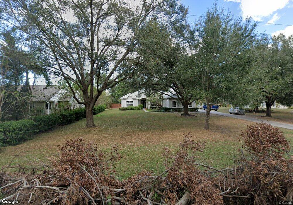
11964 71st St E Parrish, FL 34219
Estimated Value: $499,000 - $570,754
3
Beds
3
Baths
2,367
Sq Ft
$224/Sq Ft
Est. Value
About This Home
This home is located at 11964 71st St E, Parrish, FL 34219 and is currently estimated at $531,189, approximately $224 per square foot. 11964 71st St E is a home located in Manatee County with nearby schools including Barbara A. Harvey Elementary School, Buffalo Creek Middle School, and Parrish Community High School.
Ownership History
Date
Name
Owned For
Owner Type
Purchase Details
Closed on
Jun 8, 2015
Sold by
Trompke Jeffrey R and Trompke Lee H
Bought by
Bosso Todd E and Boso Michelle R
Current Estimated Value
Home Financials for this Owner
Home Financials are based on the most recent Mortgage that was taken out on this home.
Original Mortgage
$289,656
Outstanding Balance
$229,425
Interest Rate
4.4%
Mortgage Type
FHA
Estimated Equity
$301,764
Purchase Details
Closed on
Mar 16, 2001
Sold by
Whidden Joel Don and Whidden Bonny Lee
Bought by
Trompke Jeffrey R and Trompke Lee H
Create a Home Valuation Report for This Property
The Home Valuation Report is an in-depth analysis detailing your home's value as well as a comparison with similar homes in the area
Home Values in the Area
Average Home Value in this Area
Purchase History
| Date | Buyer | Sale Price | Title Company |
|---|---|---|---|
| Bosso Todd E | $295,000 | Barnes Walker Title Inc | |
| Trompke Jeffrey R | $30,000 | -- |
Source: Public Records
Mortgage History
| Date | Status | Borrower | Loan Amount |
|---|---|---|---|
| Open | Bosso Todd E | $289,656 |
Source: Public Records
Tax History
| Year | Tax Paid | Tax Assessment Tax Assessment Total Assessment is a certain percentage of the fair market value that is determined by local assessors to be the total taxable value of land and additions on the property. | Land | Improvement |
|---|---|---|---|---|
| 2025 | $3,916 | $319,252 | -- | -- |
| 2023 | $3,916 | $301,218 | $0 | $0 |
| 2022 | $3,808 | $292,445 | $0 | $0 |
| 2021 | $3,656 | $283,927 | $0 | $0 |
| 2020 | $3,712 | $280,007 | $0 | $0 |
| 2019 | $3,654 | $273,712 | $0 | $0 |
| 2018 | $3,619 | $268,608 | $0 | $0 |
| 2017 | $3,355 | $263,083 | $0 | $0 |
| 2016 | $3,349 | $257,672 | $0 | $0 |
Source: Public Records
Map
Nearby Homes
- 7121 122nd Ave E
- 12300 Parrish Cemetary Rd
- 6927 Indus Valley Cir
- 7107 Indus Valley Cir
- 11809 Catawba Cove
- 12346 U S 301
- 12345 Parrish Cemetary Rd
- 6209 116th Ave E
- 6306 115th Ave E
- 11452 64th St E
- 11880 Us Highway 301 N
- 12310 Oak Hill Way
- 6203 115th Ave E
- 1628 Rio Vista Terrace
- 1517 Rio Vista Terrace
- 12342 Oak Hill Way
- 8514 Arrow Creek Dr
- 12369 Oak Hill Way
- 12350 Oak Hill Way
- 8518 Arrow Creek Dr
- 12008 71st St E
- 11954 71st St E
- 11944 71st St E
- 12012 71st St E
- 11955 71st St E
- 11941 73rd St E
- 12007 73rd St E
- 11937 73rd St E
- 11924 71st St E
- 11945 71st St E
- 12011 73rd St E
- 11933 73rd St E
- 6925 120th Ave E
- 6920 120th Ave E
- 11925 71st St E
- 11842 71st St E
- 11929 73rd St E
- 6919 120th Ave E
- 12020 71st St E
- 11845 71st St E
Your Personal Tour Guide
Ask me questions while you tour the home.