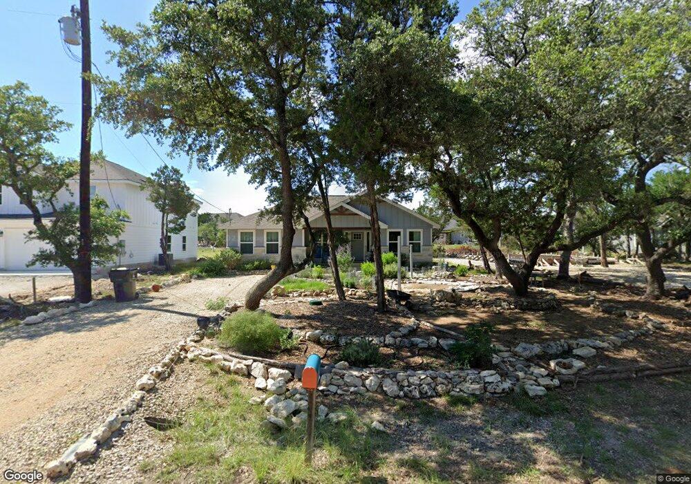
1197 Bob White Dr Spring Branch, TX 78070
Hill Country NeighborhoodEstimated Value: $266,492 - $344,000
--
Bed
--
Bath
1,368
Sq Ft
$228/Sq Ft
Est. Value
About This Home
This home is located at 1197 Bob White Dr, Spring Branch, TX 78070 and is currently estimated at $311,373, approximately $227 per square foot. 1197 Bob White Dr is a home with nearby schools including Rebecca Creek Elementary School, Mt Valley Middle School, and Canyon Lake High School.
Ownership History
Date
Name
Owned For
Owner Type
Purchase Details
Closed on
Feb 22, 2019
Sold by
Darla Jo Properties Llc
Bought by
Macentee Karen M
Current Estimated Value
Home Financials for this Owner
Home Financials are based on the most recent Mortgage that was taken out on this home.
Original Mortgage
$140,400
Outstanding Balance
$123,185
Interest Rate
4.4%
Mortgage Type
Purchase Money Mortgage
Estimated Equity
$188,188
Purchase Details
Closed on
Mar 26, 2018
Sold by
Landsackk Investments Llc
Bought by
Darla Jo Properties Llc
Purchase Details
Closed on
Mar 1, 2018
Sold by
Huffman Robert L
Bought by
Landsckk Investments Llc
Create a Home Valuation Report for This Property
The Home Valuation Report is an in-depth analysis detailing your home's value as well as a comparison with similar homes in the area
Home Values in the Area
Average Home Value in this Area
Purchase History
| Date | Buyer | Sale Price | Title Company |
|---|---|---|---|
| Macentee Karen M | -- | None Available | |
| Darla Jo Properties Llc | -- | Trinity Title Co | |
| Landsckk Investments Llc | -- | None Available |
Source: Public Records
Mortgage History
| Date | Status | Borrower | Loan Amount |
|---|---|---|---|
| Open | Macentee Karen M | $140,400 |
Source: Public Records
Tax History Compared to Growth
Tax History
| Year | Tax Paid | Tax Assessment Tax Assessment Total Assessment is a certain percentage of the fair market value that is determined by local assessors to be the total taxable value of land and additions on the property. | Land | Improvement |
|---|---|---|---|---|
| 2025 | $4,190 | $288,610 | $43,530 | $245,080 |
| 2024 | $4,190 | $281,620 | $39,080 | $242,540 |
| 2023 | $4,190 | $274,650 | $44,950 | $229,700 |
| 2022 | $4,419 | $261,520 | $35,780 | $225,740 |
| 2021 | $3,089 | $173,430 | $12,360 | $161,070 |
| 2020 | $3,573 | $192,840 | $10,500 | $182,340 |
| 2019 | $2,909 | $153,260 | $8,480 | $144,780 |
| 2018 | $94 | $4,990 | $4,990 | $0 |
| 2017 | $90 | $4,770 | $4,770 | $0 |
| 2016 | $73 | $3,900 | $3,900 | $0 |
| 2015 | $73 | $3,900 | $3,900 | $0 |
| 2014 | $73 | $3,900 | $3,900 | $0 |
Source: Public Records
Map
Nearby Homes
- 1229 Bob White Dr
- 1265 Bob White Dr
- 124 Lookout Ct
- 890 Live Oak Dr
- 866 Live Oak Dr
- 644 Cashew
- 1431 Cedar Grove Trail
- 799 Mockingbird Cove
- 771 Mockingbird Cove
- 1556 Rimrock Cove
- 952 Rimrock Cove
- 147 Juniper Cir
- 1230 Echo Meadow Ln
- 1903 Tanglewood Trail
- 1475 Echo Meadow Ln
- 407 Havasu Point
- 1456 Green Meadow Ln
- 496 Havasu Point
- 500 Havasu Point
- 1053 Live Oak Dr
- 1187 Bob White Dr
- 1205 Bob White Dr
- 1217 Bob White Dr
- 962 Rimrock Cove
- 1184 Bob White Dr
- 972 Rimrock Cove
- 1174 Bob White Dr
- 125 Lookout Ct
- 125 Lookout Ct
- 139 Lookout Ct
- 1155 Bob White Dr
- 982 Rimrock Cove
- 1212 Bob White Dr
- 1164 Bob White Dr
- 109 Lookout Ct
- 1272 Bob White Dr
- 992 Rimrock Cove
- 1154 Bob White Dr
- 1147 Cedar Grove Trail
- 1145 Bob White Dr