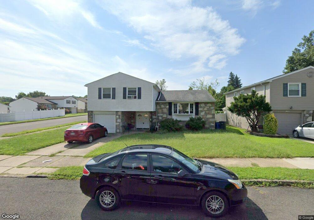
11971 Dumont Rd Philadelphia, PA 19116
Somerton NeighborhoodEstimated Value: $505,674 - $552,000
--
Bed
--
Bath
2,365
Sq Ft
$221/Sq Ft
Est. Value
About This Home
This home is located at 11971 Dumont Rd, Philadelphia, PA 19116 and is currently estimated at $522,919, approximately $221 per square foot. 11971 Dumont Rd is a home located in Philadelphia County with nearby schools including Watson Comly School, CCA Baldi Middle School, and George Washington High School.
Ownership History
Date
Name
Owned For
Owner Type
Purchase Details
Closed on
Mar 30, 2000
Sold by
Levick Rosalyn C
Bought by
Ramos Samuel and Ramos Yolanda
Current Estimated Value
Home Financials for this Owner
Home Financials are based on the most recent Mortgage that was taken out on this home.
Original Mortgage
$119,000
Outstanding Balance
$48,074
Interest Rate
10.75%
Estimated Equity
$474,845
Create a Home Valuation Report for This Property
The Home Valuation Report is an in-depth analysis detailing your home's value as well as a comparison with similar homes in the area
Home Values in the Area
Average Home Value in this Area
Purchase History
| Date | Buyer | Sale Price | Title Company |
|---|---|---|---|
| Ramos Samuel | $140,000 | -- |
Source: Public Records
Mortgage History
| Date | Status | Borrower | Loan Amount |
|---|---|---|---|
| Open | Ramos Samuel | $119,000 |
Source: Public Records
Tax History Compared to Growth
Tax History
| Year | Tax Paid | Tax Assessment Tax Assessment Total Assessment is a certain percentage of the fair market value that is determined by local assessors to be the total taxable value of land and additions on the property. | Land | Improvement |
|---|---|---|---|---|
| 2025 | $5,430 | $466,100 | $93,220 | $372,880 |
| 2024 | $5,430 | $466,100 | $93,220 | $372,880 |
| 2023 | $5,430 | $387,900 | $77,580 | $310,320 |
| 2022 | $4,465 | $387,900 | $77,580 | $310,320 |
| 2021 | $4,465 | $0 | $0 | $0 |
| 2020 | $4,465 | $0 | $0 | $0 |
| 2019 | $4,276 | $0 | $0 | $0 |
| 2018 | $3,914 | $0 | $0 | $0 |
| 2017 | $3,914 | $0 | $0 | $0 |
| 2016 | $3,914 | $0 | $0 | $0 |
| 2015 | $3,747 | $0 | $0 | $0 |
| 2014 | -- | $279,600 | $154,380 | $125,220 |
| 2012 | -- | $39,168 | $6,926 | $32,242 |
Source: Public Records
Map
Nearby Homes
- 11992 Lockart Rd
- 11169 Hendrix St
- 11722 Audubon Ave
- 166 Rennard St
- 290 Byberry Rd Unit 2
- 290 Byberry Rd Unit 18
- 300 Byberry Rd Unit 303
- 11715 Jeanes St
- 370 Selma St
- 3175 Kathy Ln
- 11990 Rennard St
- 120 Woodland Rd
- 11243 Jeanes Place
- 133 Gardner St
- 509 Larkspur St
- 301 Byberry Rd Unit F7
- 301 Byberry Rd Unit H10
- 11022 Ferndale St
- 13360 Susan Terrace
- 301 00 Byberry Rd Unit C7
- 11969 Dumont Rd
- 11996 Lockart Rd
- 11977 Dumont Rd
- 11994 Lockart Rd
- 11966 Dumont Rd
- 11964 Dumont Rd
- 11968 Dumont Rd
- 11999 Lockart Rd
- 11979 Dumont Rd
- 11970 Dumont Rd
- 11962 Dumont Rd
- 11959 Dumont Rd
- 11997 Lockart Rd
- 11960 Dumont Rd
- 277 Hendrix Place
- 11972 Dumont Rd
- 279 Hendrix Place
- 11957 Dumont Rd
- 11981 Dumont Rd
- 11995 Lockart Rd