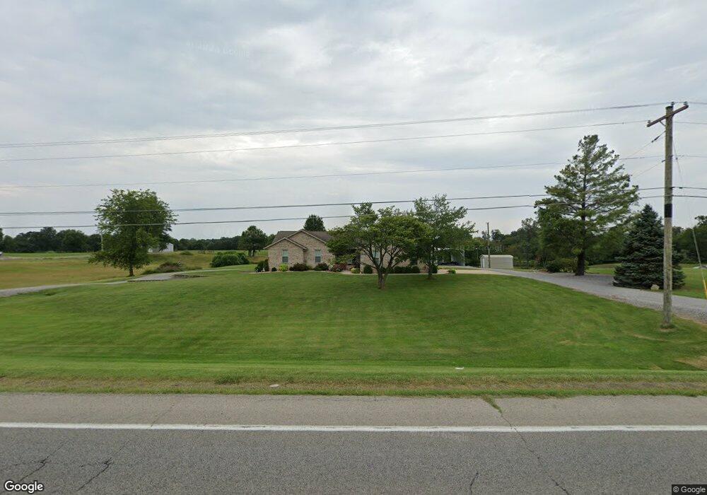
11977 Route 37 Marion, IL 62959
Estimated Value: $68,404 - $130,000
--
Bed
--
Bath
960
Sq Ft
$108/Sq Ft
Est. Value
About This Home
This home is located at 11977 Route 37, Marion, IL 62959 and is currently estimated at $104,101, approximately $108 per square foot. 11977 Route 37 is a home located in Williamson County with nearby schools including Lincoln Elementary School, Marion Junior High School, and Marion High School.
Ownership History
Date
Name
Owned For
Owner Type
Purchase Details
Closed on
Feb 24, 2021
Sold by
Rdj Investment Co Llc
Bought by
Store Master Funding Ii Llc
Current Estimated Value
Purchase Details
Closed on
Feb 21, 2018
Sold by
Fluck John E and Fluck Janice L
Bought by
Flanders Electric Motor Servic
Create a Home Valuation Report for This Property
The Home Valuation Report is an in-depth analysis detailing your home's value as well as a comparison with similar homes in the area
Home Values in the Area
Average Home Value in this Area
Purchase History
| Date | Buyer | Sale Price | Title Company |
|---|---|---|---|
| Store Master Funding Ii Llc | $2,165,000 | Fidelity National Title | |
| Store Master Funding Ii Llc | $2,165,000 | Fidelity National Title | |
| Rdj Investment Co Llc | -- | Fidelity National Title | |
| Flanders Electric Motor Servic | $25,500 | Patchett Hampson And Garrison |
Source: Public Records
Mortgage History
| Date | Status | Borrower | Loan Amount |
|---|---|---|---|
| Closed | Store Master Funding Ii Llc | $0 |
Source: Public Records
Tax History Compared to Growth
Tax History
| Year | Tax Paid | Tax Assessment Tax Assessment Total Assessment is a certain percentage of the fair market value that is determined by local assessors to be the total taxable value of land and additions on the property. | Land | Improvement |
|---|---|---|---|---|
| 2025 | $600 | $8,770 | $8,770 | $0 |
| 2024 | $600 | $8,770 | $8,770 | $0 |
| 2023 | $600 | $7,740 | $7,740 | $0 |
| 2022 | $570 | $8,150 | $8,150 | $0 |
| 2021 | $556 | $7,860 | $7,860 | $0 |
| 2020 | $556 | $7,430 | $7,430 | $0 |
| 2019 | $258 | $3,400 | $3,400 | $0 |
| 2018 | $258 | $3,400 | $3,400 | $0 |
| 2017 | $1,025 | $13,750 | $3,400 | $10,350 |
| 2015 | $993 | $13,020 | $3,220 | $9,800 |
| 2013 | $461 | $13,020 | $3,220 | $9,800 |
| 2012 | $461 | $13,020 | $3,220 | $9,800 |
Source: Public Records
Map
Nearby Homes
- 12171 Blue Sky Dr
- 12195 Blue Sky Dr
- 300 Longstreet Rd
- 1408 W Longstreet Rd
- 107 Scott St
- 109 Brase St
- 11149 Crenshaw Rd
- 11115 Lamaster Rd
- 000 Whitney Ln
- 204 Bracey St
- 1708 N State St
- 415 E Reichert Dr
- 805 New Day Way
- 1515 Brittany Ln
- 1535 Maureen Dr
- 0 W Patrick St Unit RMAEB458387
- 1208 Morgan Ave
- 1505 N Glendale St Unit A/B
- 1106 Horizon Dr
- 1506 Gleneagle Dr
- 11977 Route 37
- 11989 Route 37
- 11881 Route 37
- 12041 Route 37
- 11853 Illinois 37
- 11853 Route 37
- 0000 N Route 37
- 12109 Route 37
- 12301 Reid St
- 12333 Reid St
- 11780 Route 37
- 11743 Route 37
- 12353 Reid St
- 11768 Route 37
- 11732 Illinois 37
- 11732 Route 37
- 12338 Curie Ln
- 12338 Curie Ln
- 12346 Curie Ln
- 1022 N Rt 37 St N