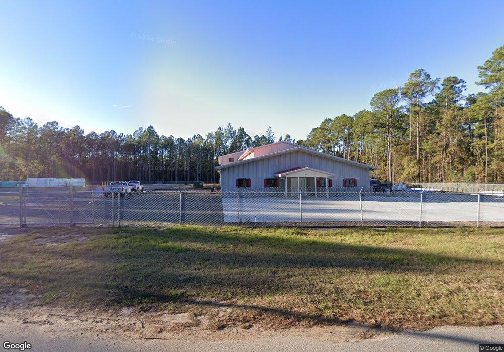
1198 Barfield Rd SW Townsend, GA 31331
Estimated Value: $428,394
--
Bed
--
Bath
12,400
Sq Ft
$35/Sq Ft
Est. Value
About This Home
This home is located at 1198 Barfield Rd SW, Townsend, GA 31331 and is currently estimated at $428,394, approximately $34 per square foot. 1198 Barfield Rd SW is a home located in McIntosh County with nearby schools including Todd Grant Elementary School, McIntosh County Middle School, and McIntosh County Academy.
Ownership History
Date
Name
Owned For
Owner Type
Purchase Details
Closed on
Nov 10, 2023
Sold by
Gentile Don B
Bought by
Jenkins & Jenkins Llc
Current Estimated Value
Purchase Details
Closed on
Jul 6, 2017
Sold by
Crews Jeanette
Bought by
Gentile Don B
Purchase Details
Closed on
Oct 20, 1997
Sold by
Crews Alton
Bought by
Crews David and Crews Jeanne
Purchase Details
Closed on
Jun 6, 1996
Sold by
Jeanette Crews Desig
Bought by
Crews Alton
Purchase Details
Closed on
Jun 7, 1995
Sold by
Tiger Shark Inc
Bought by
Jeanette Crews Desig
Create a Home Valuation Report for This Property
The Home Valuation Report is an in-depth analysis detailing your home's value as well as a comparison with similar homes in the area
Home Values in the Area
Average Home Value in this Area
Purchase History
| Date | Buyer | Sale Price | Title Company |
|---|---|---|---|
| Jenkins & Jenkins Llc | $400,000 | -- | |
| Gentile Don B | $285,000 | -- | |
| Crews Jeanette | -- | -- | |
| Crews David | -- | -- | |
| Crews Alton | $204,000 | -- | |
| Jeanette Crews Desig | $17,500 | -- |
Source: Public Records
Tax History Compared to Growth
Tax History
| Year | Tax Paid | Tax Assessment Tax Assessment Total Assessment is a certain percentage of the fair market value that is determined by local assessors to be the total taxable value of land and additions on the property. | Land | Improvement |
|---|---|---|---|---|
| 2024 | $4,299 | $154,960 | $36,000 | $118,960 |
| 2023 | $2,167 | $77,840 | $16,800 | $61,040 |
| 2022 | $2,275 | $81,720 | $16,000 | $65,720 |
| 2021 | $2,406 | $86,440 | $16,000 | $70,440 |
| 2020 | $3,130 | $111,120 | $16,000 | $95,120 |
| 2019 | $2,706 | $101,840 | $16,000 | $85,840 |
| 2018 | $2,706 | $101,840 | $16,000 | $85,840 |
| 2017 | $3,048 | $101,840 | $16,000 | $85,840 |
| 2016 | $2,706 | $101,840 | $16,000 | $85,840 |
| 2015 | $2,942 | $110,484 | $5,360 | $105,124 |
| 2014 | $3,278 | $122,877 | $17,753 | $105,124 |
Source: Public Records
Map
Nearby Homes
- 3 ACRES Lewis Ln SW
- 1366 Lewis Ln SW
- Lot 35 Lewis Ln
- 0 Briar Patch Lot#27 Place
- 0 Briar Patch Lot 15 Place
- 0 Briar Patch Lot 16 Place
- Lot 27B Eulonia Lake Estates Rd SW
- 1138 Hanover Ln
- 1119 Hanover Ln
- 1181 Charlton Chase NE
- 1340 Pelican Ln SE
- 14261 US Highway 17
- GA HWY 99 I-95
- Lot 30 Freedom Trail SW
- Lot 43 Freedom Trail SW
- 1494 Forest Marsh Loop NE
- 0 Briar Patch Rd SE Unit 1658040
- 0 Briar Patch Rd SE Unit 1658033
- 0 Briar Patch Rd SE Unit 1658042
- 0 Briar Patch Rd SE Unit 1658032
- 1065 Pin Oak Dr SW
- 1137 Barfield Rd SW
- 1319 Barfield Rd SW
- 38 Eulonia Lake Estate
- 0 Eulonia Lake Estates Unit LOT 38 02980702
- 5 Pin Oaks Dr
- 1299 Ga Highway 57
- 1171 Pin Oak Dr SW
- Lot 25 Barfield Cir
- 0 Georgia Highway 57 and Barfield Rd Unit 10198519
- 0 Highway 57 and Barfield Rd
- 1170 Pin Oak Dr SW
- 1187 Lecounte Rd SW
- 1495 Barfield Rd SW
- 40 acres +/- Lecount Rd
- 1111 Lecounte Rd SW
- LOT 27B Eulonia Lake Estate Rd
- 1086 Lecounte Rd SW
- 24 Revolutionary Rd SE
- 15227 Us Highway 17