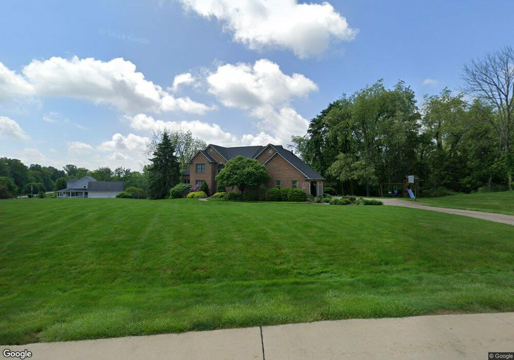
1198 Maple Grove Cir New Franklin, OH 44216
Estimated Value: $438,000 - $687,000
5
Beds
4
Baths
3,322
Sq Ft
$176/Sq Ft
Est. Value
About This Home
This home is located at 1198 Maple Grove Cir, New Franklin, OH 44216 and is currently estimated at $585,481, approximately $176 per square foot. 1198 Maple Grove Cir is a home located in Summit County.
Ownership History
Date
Name
Owned For
Owner Type
Purchase Details
Closed on
Apr 1, 2020
Sold by
Patricia Coler
Bought by
Gutbrod James J and Gutbrod Loren M
Current Estimated Value
Purchase Details
Closed on
Dec 19, 2000
Sold by
Coler Patricia
Bought by
Gutbrod James J and Gutbrod Loren M
Create a Home Valuation Report for This Property
The Home Valuation Report is an in-depth analysis detailing your home's value as well as a comparison with similar homes in the area
Home Values in the Area
Average Home Value in this Area
Purchase History
| Date | Buyer | Sale Price | Title Company |
|---|---|---|---|
| Gutbrod James J | -- | None Listed On Document | |
| Gutbrod James J | $61,250 | Wigley Title Agency Inc |
Source: Public Records
Tax History Compared to Growth
Tax History
| Year | Tax Paid | Tax Assessment Tax Assessment Total Assessment is a certain percentage of the fair market value that is determined by local assessors to be the total taxable value of land and additions on the property. | Land | Improvement |
|---|---|---|---|---|
| 2025 | $8,903 | $178,126 | $31,924 | $146,202 |
| 2024 | $8,903 | $178,126 | $31,924 | $146,202 |
| 2023 | $8,903 | $178,126 | $31,924 | $146,202 |
| 2022 | $8,481 | $132,293 | $23,646 | $108,647 |
| 2021 | $8,511 | $132,293 | $23,646 | $108,647 |
| 2020 | $8,364 | $132,300 | $23,650 | $108,650 |
| 2019 | $11,858 | $168,170 | $23,650 | $144,520 |
| 2018 | $10,230 | $168,170 | $23,650 | $144,520 |
| 2017 | $9,308 | $168,170 | $23,650 | $144,520 |
| 2016 | $9,199 | $138,590 | $23,650 | $114,940 |
| 2015 | $9,308 | $138,590 | $23,650 | $114,940 |
| 2014 | $9,187 | $137,850 | $23,650 | $114,200 |
| 2013 | $9,119 | $137,860 | $23,650 | $114,210 |
Source: Public Records
Map
Nearby Homes
- 6090 Manchester Rd Unit 6096
- 6387 Hampsher Rd
- 781 Leeman Dr
- 715 Highland Park Dr
- 5983 Weaver Rd
- 451 Yager Rd
- 6407 Southview Dr
- 4851 Manchester Rd
- 7060 Manchester Rd
- 0 W Comet Rd Unit 5079117
- 4698 Manchester Rd
- 2200 W Comet Rd
- 8714 Greenmeadow Ave NW
- S/L 14,15 Shakes Hotel Dr
- 4567 Rex Lake Dr
- 2536 Emmons Dr
- 6 Shrakes Hotel Dr
- 7 Shrakes Hotel Dr
- 4 Shrakes Hotel Dr
- 5 Shrakes Hotel Dr
- 6134 Spangler Dr
- 1232 Maple Grove Cir
- 6072 Spangler Dr
- 6182 Spangler Dr
- 6125 Spangler Dr
- 6087 Spangler Dr
- 6055 Spangler Dr
- 1264 Maple Grove Cir
- 6163 Spangler Dr
- 6020 Spangler Dr
- 1283 Maple Grove Cir
- 6025 Spangler Dr
- 1300 Maple Grove Cir
- 6205 Spangler Dr
- 6001 Spangler Dr
- 6234 Spangler Dr
- 1289 Highwood Dr
- 1269 Highwood Dr
- 1297 Highwood Dr
- 6235 Spangler Dr