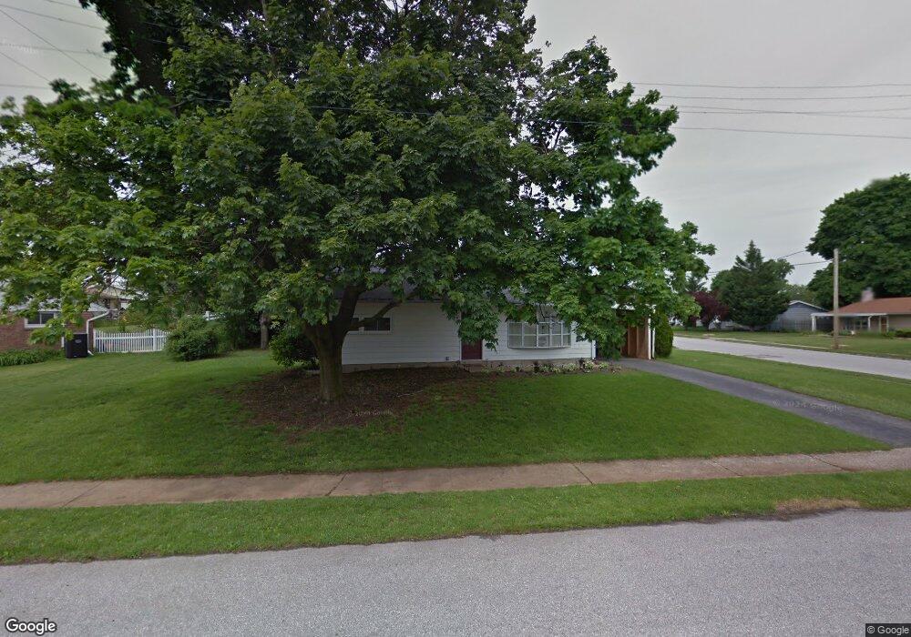
1198 Priority Rd York, PA 17404
Devers NeighborhoodEstimated Value: $165,970 - $174,000
3
Beds
1
Bath
1,005
Sq Ft
$168/Sq Ft
Est. Value
About This Home
This home is located at 1198 Priority Rd, York, PA 17404 and is currently estimated at $168,993, approximately $168 per square foot. 1198 Priority Rd is a home located in York County with nearby schools including Jacob L. Devers School, William Penn Senior High School, and York Academy Regional Charter Lower School.
Ownership History
Date
Name
Owned For
Owner Type
Purchase Details
Closed on
Mar 29, 2011
Sold by
Household Realty Corporation
Bought by
1198 Priority Road Trust
Current Estimated Value
Purchase Details
Closed on
Dec 17, 2010
Sold by
Kinard Shirley E and Paules Tina M
Bought by
Household Realty Corporation
Create a Home Valuation Report for This Property
The Home Valuation Report is an in-depth analysis detailing your home's value as well as a comparison with similar homes in the area
Home Values in the Area
Average Home Value in this Area
Purchase History
| Date | Buyer | Sale Price | Title Company |
|---|---|---|---|
| 1198 Priority Road Trust | $38,850 | None Available | |
| Household Realty Corporation | -- | None Available |
Source: Public Records
Mortgage History
| Date | Status | Borrower | Loan Amount |
|---|---|---|---|
| Previous Owner | Kinard Shirley E | $59,141 |
Source: Public Records
Tax History Compared to Growth
Tax History
| Year | Tax Paid | Tax Assessment Tax Assessment Total Assessment is a certain percentage of the fair market value that is determined by local assessors to be the total taxable value of land and additions on the property. | Land | Improvement |
|---|---|---|---|---|
| 2025 | $3,748 | $59,330 | $20,950 | $38,380 |
| 2024 | $3,683 | $59,330 | $20,950 | $38,380 |
| 2023 | $3,683 | $59,330 | $20,950 | $38,380 |
| 2022 | $3,662 | $59,330 | $20,950 | $38,380 |
| 2021 | $3,561 | $59,330 | $20,950 | $38,380 |
| 2020 | $3,477 | $59,330 | $20,950 | $38,380 |
| 2019 | $3,471 | $59,330 | $20,950 | $38,380 |
| 2018 | $3,471 | $59,330 | $20,950 | $38,380 |
| 2017 | $3,518 | $59,330 | $20,950 | $38,380 |
| 2016 | -- | $59,330 | $20,950 | $38,380 |
| 2015 | $3,478 | $59,330 | $20,950 | $38,380 |
| 2014 | $3,478 | $59,330 | $20,950 | $38,380 |
Source: Public Records
Map
Nearby Homes
- 856 Gunnison Rd
- 1116 Burgard St
- 820 Gunnison Rd
- 857 859 Tioga St
- 1416 Dartmouth Rd
- 806 Pacific Ave
- 1355 Ben Hogan Way
- 1327 Ben Hogan Way
- 745 Oatman St
- 619 Colony Dr Unit 32F
- 1618 Devers Rd Unit 7C
- 1750 Devers Rd Unit 2F
- 383 Maryland Ave
- 827 Roosevelt Ave
- 1360 Breezeview Dr
- 600 N Hartley St Unit 204
- 1185 Greenbriar Rd
- 469 Linden Ave Unit 13
- 436 Linden Ave
- 626 Texas Ave
- 806 Fireside Rd
- 868 Priority Rd
- 1197 Priority Rd
- 1202 Priority Rd
- 810 Fireside Rd
- 864 Gunnison Rd
- 1117 Priority Rd
- 1201 Priority Rd
- 760 Fireside Rd
- 860 Gunnison Rd
- 811 Fireside Rd
- 757 Fireside Rd
- 1206 Priority Rd
- 1112 Priority Rd
- 815 Fireside Rd
- 1205 Priority Rd
- 1306 Dartmouth Rd
- 737 Gunnison Rd
- 818 Fireside Rd
- 753 Fireside Rd