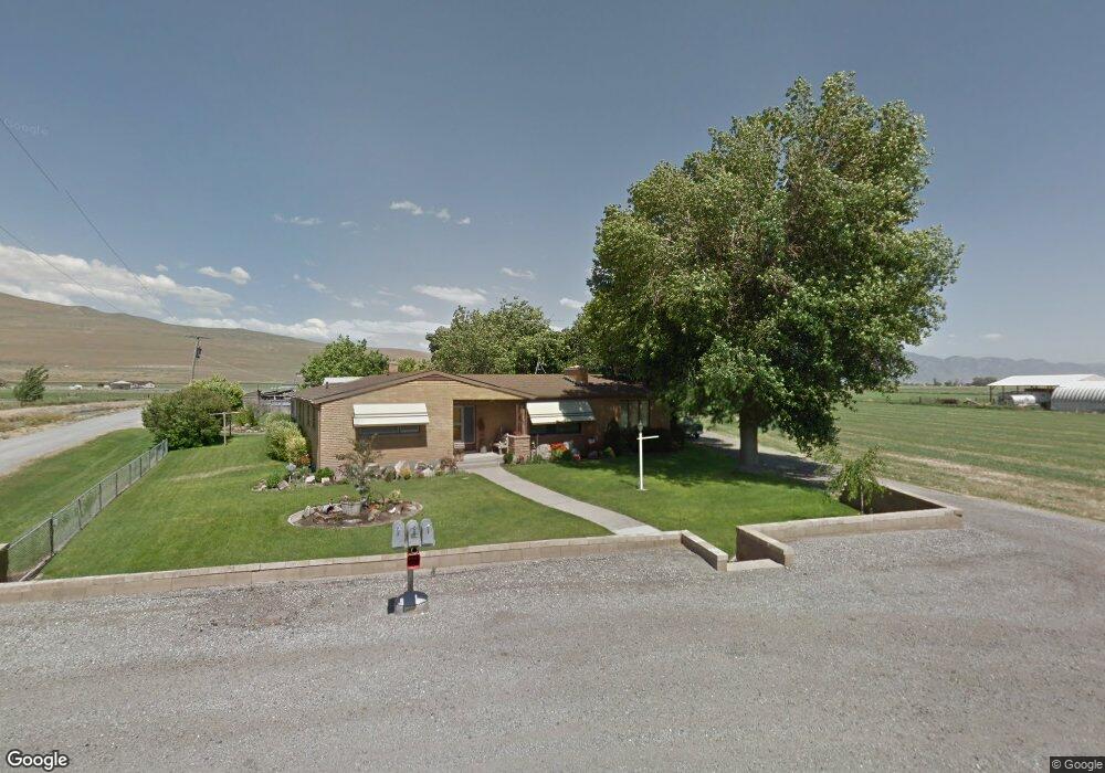
11980 N 10000 W Tremonton, UT 84337
Estimated Value: $269,365 - $324,000
--
Bed
--
Bath
936
Sq Ft
$311/Sq Ft
Est. Value
About This Home
This home is located at 11980 N 10000 W, Tremonton, UT 84337 and is currently estimated at $291,091, approximately $310 per square foot. 11980 N 10000 W is a home located in Box Elder County with nearby schools including Garland School, Alice C. Harris Intermediate School, and Bear River Middle School.
Create a Home Valuation Report for This Property
The Home Valuation Report is an in-depth analysis detailing your home's value as well as a comparison with similar homes in the area
Home Values in the Area
Average Home Value in this Area
Tax History Compared to Growth
Tax History
| Year | Tax Paid | Tax Assessment Tax Assessment Total Assessment is a certain percentage of the fair market value that is determined by local assessors to be the total taxable value of land and additions on the property. | Land | Improvement |
|---|---|---|---|---|
| 2025 | $1,380 | $240,865 | $105,000 | $135,865 |
| 2024 | $1,380 | $238,876 | $105,000 | $133,876 |
| 2023 | $1,389 | $236,066 | $100,000 | $136,066 |
| 2022 | $1,120 | $197,477 | $30,000 | $167,477 |
| 2021 | $921 | $120,826 | $30,000 | $90,826 |
| 2020 | $784 | $120,826 | $30,000 | $90,826 |
| 2019 | $739 | $60,707 | $16,500 | $44,207 |
| 2018 | $609 | $45,692 | $13,750 | $31,942 |
| 2017 | $629 | $83,077 | $13,750 | $58,077 |
| 2016 | $623 | $44,172 | $13,750 | $30,422 |
| 2015 | $577 | $41,406 | $13,750 | $27,656 |
| 2014 | $577 | $40,089 | $13,750 | $26,339 |
| 2013 | -- | $39,677 | $13,338 | $26,339 |
Source: Public Records
Map
Nearby Homes
- 13464 N 10800 W Unit 4
- 10230 W 11200 N
- 12695 N 10800 W
- 13585 N 10000 W
- 10645 N 10800 W Unit 1
- 3566 W 1000 N
- 10205 W 10400 N
- 229 W 1470 S Unit 44
- 10959 N 8300 W
- 10973 N 8300 W Unit 24
- 11157 N 8300 W Unit 10
- 8345 W 11050 N
- 11148 N 8300 W Unit 11
- Xavier Plan at Beckams Edge
- Ravenstone Plan at Beckams Edge
- Stanton Plan at Beckams Edge
- Somerley Plan at Beckams Edge
- Kensington Plan at Beckams Edge
- Northfield Plan at Beckams Edge
- Norfolk Plan at Beckams Edge
- 11980 N 10000 W
- 12024 N 10000 W Unit 1
- 10045 W 12000 N
- 11930 N 10000 W
- 10065 W 12000 N
- 12344 N 10000 W Unit 9
- 12106 N 10000 W Unit 3
- 13450 N 10000 W
- 12068 N 10000 W Unit 2
- 12068 N 10000 W
- 10090 W 12000 N
- 10140 W 12000 N
- 10155 W 12000 N
- 12144 N 10000 W Unit 4
- 11820 N 10000 W
- 12182 N 10000 W
- 12182 N 10000 W Unit 5
- 9765 W Point Lookout Dr Unit 36
- 9765 W Point Lookout Dr Unit 36
- 9765 Point Lookout Dr