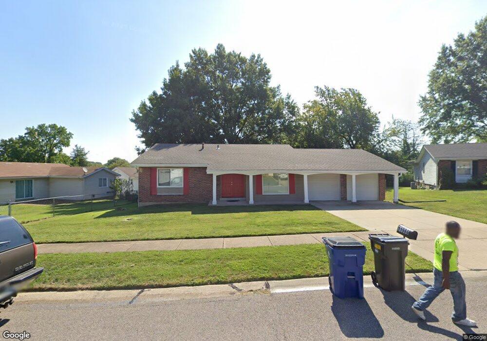
11988 Red Lion Dr Florissant, MO 63033
Estimated Value: $192,372 - $215,000
3
Beds
2
Baths
1,284
Sq Ft
$160/Sq Ft
Est. Value
About This Home
This home is located at 11988 Red Lion Dr, Florissant, MO 63033 and is currently estimated at $204,843, approximately $159 per square foot. 11988 Red Lion Dr is a home located in St. Louis County with nearby schools including Jamestown Elementary School, Central Middle School, and Hazelwood Central High School.
Ownership History
Date
Name
Owned For
Owner Type
Purchase Details
Closed on
Jan 3, 2013
Sold by
Secretary Of Housing & Urban Development
Bought by
Cooper Malray
Current Estimated Value
Purchase Details
Closed on
Sep 19, 2012
Sold by
Pnc Bank National Association
Bought by
Secretary Of Housing & Urban Development
Purchase Details
Closed on
Sep 13, 2012
Sold by
Threats Roshaun A
Bought by
Pnc Bank National Association
Purchase Details
Closed on
Dec 2, 2003
Sold by
Bates Young Vanessa and Young Stanford
Bought by
Threats Roshaun A
Home Financials for this Owner
Home Financials are based on the most recent Mortgage that was taken out on this home.
Original Mortgage
$100,800
Interest Rate
8.87%
Mortgage Type
Purchase Money Mortgage
Create a Home Valuation Report for This Property
The Home Valuation Report is an in-depth analysis detailing your home's value as well as a comparison with similar homes in the area
Home Values in the Area
Average Home Value in this Area
Purchase History
| Date | Buyer | Sale Price | Title Company |
|---|---|---|---|
| Cooper Malray | $32,501 | None Available | |
| Secretary Of Housing & Urban Development | $133,168 | None Available | |
| Pnc Bank National Association | $133,168 | None Available | |
| Threats Roshaun A | $112,000 | -- |
Source: Public Records
Mortgage History
| Date | Status | Borrower | Loan Amount |
|---|---|---|---|
| Previous Owner | Threats Roshaun A | $100,800 | |
| Closed | Threats Roshaun A | $5,600 |
Source: Public Records
Tax History Compared to Growth
Tax History
| Year | Tax Paid | Tax Assessment Tax Assessment Total Assessment is a certain percentage of the fair market value that is determined by local assessors to be the total taxable value of land and additions on the property. | Land | Improvement |
|---|---|---|---|---|
| 2025 | $2,768 | $33,520 | $4,260 | $29,260 |
| 2024 | $2,768 | $30,610 | $2,950 | $27,660 |
| 2023 | $2,758 | $30,610 | $2,950 | $27,660 |
| 2022 | $2,415 | $23,820 | $4,900 | $18,920 |
| 2021 | $2,285 | $23,820 | $4,900 | $18,920 |
| 2020 | $2,179 | $21,150 | $4,260 | $16,890 |
| 2019 | $2,162 | $21,150 | $4,260 | $16,890 |
| 2018 | $2,122 | $19,190 | $1,730 | $17,460 |
| 2017 | $2,120 | $19,190 | $1,730 | $17,460 |
| 2016 | $2,110 | $18,790 | $2,490 | $16,300 |
| 2015 | $2,062 | $18,790 | $2,490 | $16,300 |
| 2014 | $1,914 | $17,350 | $3,210 | $14,140 |
Source: Public Records
Map
Nearby Homes
- 12065 El Camara Dr
- 12095 El Camara Dr
- 11774 El Somo Ct
- 12136 La Padera Ln
- 11951 Jerries Ln
- 6250 Pennyrich Ct
- 6530 Farm Pond Ct
- 11760 Sheffield Dr
- 12320 Missile Ln
- 12292 Jerries Ln
- 5348 Trailoaks Dr
- 5432 Trailbend Dr
- 5372 Trailbend Dr
- 12455 Jerries Ln
- 5239 Trailoaks Dr
- 11757 Vizcuya Ct
- 6480 Hadden Bay Dr
- 11440 Sheffield Dr
- 6320 Hadden Bay Dr
- 2291 Redman Rd
- 11965 Kingshead Dr
- 11975 Kingshead Dr
- 11978 Red Lion Dr
- 11945 Kingshead Dr
- 11989 Red Lion Dr
- 11968 Red Lion Dr
- 12005 Kingshead Dr
- 11935 Kingshead Dr
- 11959 Red Lion Dr
- 11958 Red Lion Dr
- 11980 Kingshead Dr
- 12015 Kingshead Dr
- 11950 Kingshead Dr
- 11960 Kingshead Dr
- 11970 Kingshead Dr
- 11939 Red Lion Dr
- 11930 Kingshead Dr
- 11940 Kingshead Dr
- 12000 Kingshead Dr
- 11948 Red Lion Dr