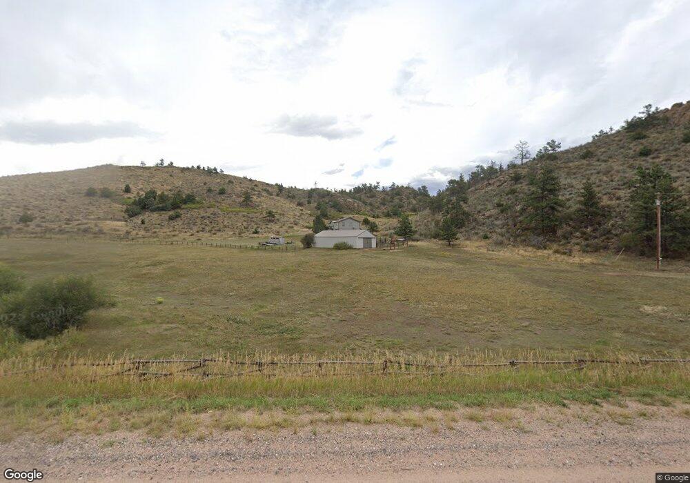
11990 W County Road 74e Livermore, CO 80536
Estimated Value: $488,000 - $624,412
2
Beds
1
Bath
1,893
Sq Ft
$292/Sq Ft
Est. Value
About This Home
This home is located at 11990 W County Road 74e, Livermore, CO 80536 and is currently estimated at $553,471, approximately $292 per square foot. 11990 W County Road 74e is a home located in Larimer County with nearby schools including Livermore Elementary School, Cache La Poudre Middle School, and Poudre High School.
Ownership History
Date
Name
Owned For
Owner Type
Purchase Details
Closed on
May 30, 1987
Sold by
Amy Dale T and Amy Norman E
Bought by
Amy Dale T
Current Estimated Value
Purchase Details
Closed on
Mar 1, 1981
Bought by
Amy Dale T and Amy Norman E
Create a Home Valuation Report for This Property
The Home Valuation Report is an in-depth analysis detailing your home's value as well as a comparison with similar homes in the area
Home Values in the Area
Average Home Value in this Area
Purchase History
| Date | Buyer | Sale Price | Title Company |
|---|---|---|---|
| Amy Dale T | -- | None Available | |
| Amy Dale T | $46,000 | -- |
Source: Public Records
Tax History Compared to Growth
Tax History
| Year | Tax Paid | Tax Assessment Tax Assessment Total Assessment is a certain percentage of the fair market value that is determined by local assessors to be the total taxable value of land and additions on the property. | Land | Improvement |
|---|---|---|---|---|
| 2025 | $3,095 | $35,135 | $12,060 | $23,075 |
| 2024 | $2,948 | $35,135 | $12,060 | $23,075 |
| 2022 | $2,901 | $29,948 | $8,688 | $21,260 |
| 2021 | $2,933 | $30,810 | $8,938 | $21,872 |
| 2020 | $1,794 | $18,683 | $8,151 | $10,532 |
| 2019 | $1,802 | $18,683 | $8,151 | $10,532 |
| 2018 | $1,350 | $15,062 | $8,208 | $6,854 |
| 2017 | $1,345 | $15,062 | $8,208 | $6,854 |
| 2016 | $1,649 | $18,380 | $7,244 | $11,136 |
| 2015 | $1,637 | $18,380 | $7,240 | $11,140 |
| 2014 | $1,303 | $14,530 | $7,640 | $6,890 |
Source: Public Records
Map
Nearby Homes
- 1388 Mount Moriah Rd
- 1388 Mt Moriah Rd
- 23 E Quandary Ct
- 609 Eiger Rd
- 11881 W County Road 74e
- 90 Sunlight Cir
- 91 Eagle Rising Place
- 117 Mount Sherman Ct
- 679 Mount Massive Dr
- 816 Meadow Way
- 487 Laplata Dr
- 556 Bald Mountain Dr
- 4092 Green Mountain Dr
- 1737 Eiger Rd
- 62 White Slide Mountain Ct
- 81 Humboldt Dr
- 569 Gordon Ct
- 490 Gordon Ct
- 615 Guardian Peak Dr
- 166 Red Cloud Peak Ct
- 788 Mount Moriah Rd
- 0 Simoncrest Dr Unit 8000079
- 0 Simoncrest Dr Unit 908245
- 0 Simoncrest Dr Unit 9611154
- 0 Simoncrest Dr Unit 880615
- 302 Simoncrest Dr
- 302 Simoncrest Dr
- 482 Mount Moriah Rd
- 200 Simoncrest Dr
- 12343 W County Road 74e
- 119 Simoncrest Dr
- 1 Eiger Rd
- 100 Mount Moriah Ct
- 50 Banana Belt Ct
- 1 County Road 74e
- 112 Banana Belt Ct
- 545 Mount Moriah Rd
- 339 Mount Simon Dr
- 0 Eiger Rd
- 62 Banana Belt Ct