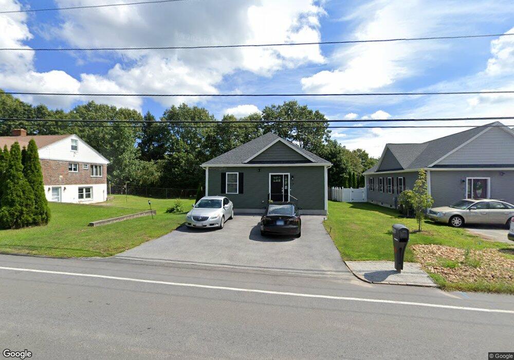
119A Thompson Rd Lot:c Webster, MA 01570
Estimated Value: $421,000 - $481,000
3
Beds
2
Baths
1,323
Sq Ft
$343/Sq Ft
Est. Value
About This Home
This home is located at 119A Thompson Rd Lot:c, Webster, MA 01570 and is currently estimated at $453,635, approximately $342 per square foot. 119A Thompson Rd Lot:c is a home located in Worcester County with nearby schools including Park Avenue Elementary School, Webster Middle School, and Bartlett High School.
Ownership History
Date
Name
Owned For
Owner Type
Purchase Details
Closed on
Jul 17, 2020
Sold by
Perkins David W
Bought by
Gonzalez Raymond W and Barahona Angela M
Current Estimated Value
Home Financials for this Owner
Home Financials are based on the most recent Mortgage that was taken out on this home.
Original Mortgage
$277,400
Outstanding Balance
$245,519
Interest Rate
3%
Mortgage Type
New Conventional
Estimated Equity
$208,116
Create a Home Valuation Report for This Property
The Home Valuation Report is an in-depth analysis detailing your home's value as well as a comparison with similar homes in the area
Home Values in the Area
Average Home Value in this Area
Purchase History
| Date | Buyer | Sale Price | Title Company |
|---|---|---|---|
| Gonzalez Raymond W | $292,000 | None Available |
Source: Public Records
Mortgage History
| Date | Status | Borrower | Loan Amount |
|---|---|---|---|
| Open | Gonzalez Raymond W | $277,400 |
Source: Public Records
Tax History Compared to Growth
Tax History
| Year | Tax Paid | Tax Assessment Tax Assessment Total Assessment is a certain percentage of the fair market value that is determined by local assessors to be the total taxable value of land and additions on the property. | Land | Improvement |
|---|---|---|---|---|
| 2025 | $4,852 | $408,400 | $51,500 | $356,900 |
| 2024 | $4,829 | $396,500 | $49,500 | $347,000 |
| 2023 | $4,355 | $348,400 | $47,100 | $301,300 |
| 2022 | $4,227 | $302,800 | $45,800 | $257,000 |
| 2021 | $3,052 | $202,100 | $45,800 | $156,300 |
| 2020 | $449 | $29,800 | $29,800 | $0 |
| 2019 | $561 | $36,600 | $36,600 | $0 |
| 2018 | $331,619 | $34,900 | $34,900 | $0 |
| 2017 | $517 | $34,200 | $34,200 | $0 |
| 2016 | $518 | $34,200 | $34,200 | $0 |
| 2015 | $492 | $33,500 | $33,500 | $0 |
Source: Public Records
Map
Nearby Homes
- 119A Thompson Rd
- 119B Thompson Rd
- 119 Thompson Rd
- 119B Thompson Rd Lot:b
- 123` Thompson Rd
- 121 Thompson Rd
- 120 Thompson Rd Unit B
- 120 Thompson Rd Unit A
- 117 Thompson Rd
- 123 Thompson Rd
- 116 Thompson Rd Unit 118
- 118 Thompson Rd Unit B
- 118 Thompson Rd Unit A
- 125 Thompson Rd
- 124 Thompson Rd
- 28 Sibley Ave
- 31 Sibley Ave
- 108 Thompson Rd
- 126 Thompson Rd
- 27 Sibley Ave