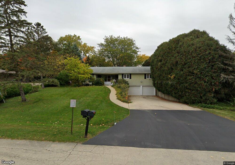
11N288 Romeo Dr Elgin, IL 60124
Far West Elgin NeighborhoodEstimated Value: $363,000 - $505,000
3
Beds
2
Baths
1,839
Sq Ft
$228/Sq Ft
Est. Value
About This Home
This home is located at 11N288 Romeo Dr, Elgin, IL 60124 and is currently estimated at $419,053, approximately $227 per square foot. 11N288 Romeo Dr is a home located in Kane County with nearby schools including Howard B. Thomas Grade School, Prairie Knolls Middle School, and Central Middle School.
Ownership History
Date
Name
Owned For
Owner Type
Purchase Details
Closed on
Aug 1, 2014
Sold by
Ackmann Steven C
Bought by
Ackmann Steven C and Steven C Ackmann Trust
Current Estimated Value
Purchase Details
Closed on
Jun 12, 2014
Sold by
Ackmann Justine M
Bought by
Ackmann Steven C
Purchase Details
Closed on
Jan 10, 2010
Sold by
Ackmann Justine M
Bought by
Ackmann Justine M and Justine M Ackmann Trust
Create a Home Valuation Report for This Property
The Home Valuation Report is an in-depth analysis detailing your home's value as well as a comparison with similar homes in the area
Home Values in the Area
Average Home Value in this Area
Purchase History
| Date | Buyer | Sale Price | Title Company |
|---|---|---|---|
| Ackmann Steven C | -- | None Available | |
| Ackmann Steven C | -- | None Available | |
| Ackmann Justine M | -- | None Available |
Source: Public Records
Tax History Compared to Growth
Tax History
| Year | Tax Paid | Tax Assessment Tax Assessment Total Assessment is a certain percentage of the fair market value that is determined by local assessors to be the total taxable value of land and additions on the property. | Land | Improvement |
|---|---|---|---|---|
| 2024 | $7,281 | $94,754 | $27,638 | $67,116 |
| 2023 | $7,043 | $85,711 | $25,000 | $60,711 |
| 2022 | $6,805 | $80,240 | $23,138 | $57,102 |
| 2021 | $6,530 | $74,892 | $22,353 | $52,539 |
| 2020 | $6,513 | $73,546 | $21,951 | $51,595 |
| 2019 | $6,299 | $70,198 | $21,667 | $48,531 |
| 2018 | $6,431 | $72,061 | $20,664 | $51,397 |
| 2017 | $6,279 | $69,560 | $20,140 | $49,420 |
| 2016 | $6,237 | $63,523 | $19,662 | $43,861 |
| 2015 | -- | $60,370 | $19,662 | $40,708 |
| 2014 | -- | $64,496 | $19,662 | $44,834 |
| 2013 | -- | $66,767 | $19,998 | $46,769 |
Source: Public Records
Map
Nearby Homes
- 278 Winding Hill Dr
- 276 Winding Hill Dr
- 308 Winding Hill Dr
- 316 Burr Oak Dr
- The Ashbury - Sideload Plan at Tall Oaks
- The Erie Sideload Plan at Tall Oaks
- The Westwood Plan at Tall Oaks
- The Braxton Plan at Tall Oaks
- The Ontario Plan at Tall Oaks
- The Craftsman - Sideload Plan at Tall Oaks
- The Williamson - Sideload Plan at Tall Oaks
- The Aspen Plan at Tall Oaks
- The Superior Plan at Tall Oaks
- The Halsted Plan at Tall Oaks
- The Bettendorf Sideload Plan at Tall Oaks
- The Modern Farmhouse - Sideload Plan at Tall Oaks
- 302 Astor Ct
- 311 Snow Drop Ln
- 313 Snow Drop Ln
- 315 Snow Drop Ln
- 11N324 Romeo Dr
- 11N268 Romeo Dr
- 197 Wrenwood Cir
- 199 Wrenwood Cir
- 195 Wrenwood Cir
- 11N269 Romeo Dr
- 201 Wrenwood Cir
- 11N275 Romeo Dr Unit 5
- 11N301 Romeo Dr
- 193 Winding Hill Dr
- 277 Winding Hill Dr
- 275 Winding Hill Dr
- 11N253 Romeo Dr
- 11N246 Romeo Dr
- 39W230 Cliff Dr Unit 5
- 196 Wrenwood Cir
- 39W195 Cliff Dr
- 11N221 Romeo Dr
- 200 Wrenwood Cir