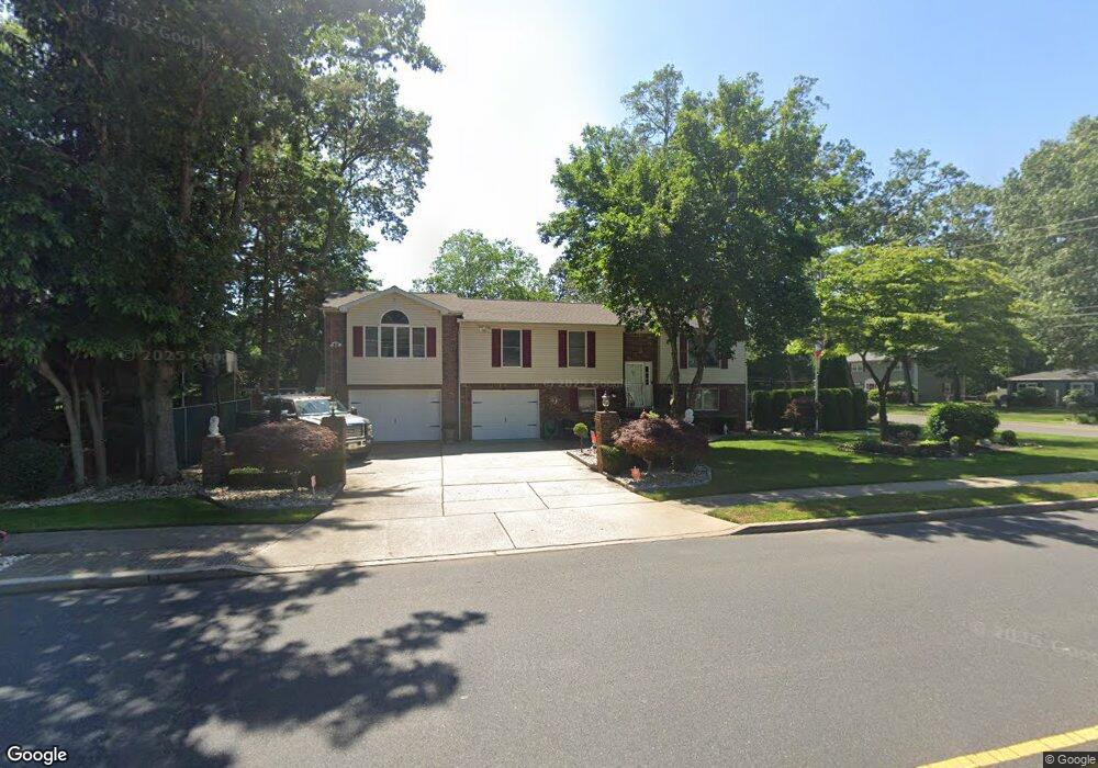
12 10th St Monroe Township, NJ 08831
Estimated Value: $642,536 - $758,000
--
Bed
--
Bath
2,136
Sq Ft
$329/Sq Ft
Est. Value
About This Home
This home is located at 12 10th St, Monroe Township, NJ 08831 and is currently estimated at $702,134, approximately $328 per square foot. 12 10th St is a home located in Middlesex County with nearby schools including Mill Lake Elementary School, Woodland Elementary School, and Monroe Township Middle School.
Ownership History
Date
Name
Owned For
Owner Type
Purchase Details
Closed on
Aug 19, 1998
Sold by
Patron Thomas
Bought by
Buchan William and Buchan Roseann
Current Estimated Value
Purchase Details
Closed on
Sep 19, 1997
Sold by
Arcaro Salvatore
Bought by
Arcaro Patrick and Arcaro Sali Ann
Home Financials for this Owner
Home Financials are based on the most recent Mortgage that was taken out on this home.
Original Mortgage
$138,000
Interest Rate
7.47%
Create a Home Valuation Report for This Property
The Home Valuation Report is an in-depth analysis detailing your home's value as well as a comparison with similar homes in the area
Home Values in the Area
Average Home Value in this Area
Purchase History
| Date | Buyer | Sale Price | Title Company |
|---|---|---|---|
| Buchan William | $119,300 | -- | |
| Arcaro Patrick | $173,500 | -- |
Source: Public Records
Mortgage History
| Date | Status | Borrower | Loan Amount |
|---|---|---|---|
| Previous Owner | Arcaro Patrick | $138,000 |
Source: Public Records
Tax History Compared to Growth
Tax History
| Year | Tax Paid | Tax Assessment Tax Assessment Total Assessment is a certain percentage of the fair market value that is determined by local assessors to be the total taxable value of land and additions on the property. | Land | Improvement |
|---|---|---|---|---|
| 2025 | $9,902 | $354,800 | $173,000 | $181,800 |
| 2024 | $9,558 | $354,800 | $173,000 | $181,800 |
| 2023 | $9,558 | $354,800 | $173,000 | $181,800 |
| 2022 | $9,409 | $354,800 | $173,000 | $181,800 |
| 2021 | $7,014 | $354,800 | $173,000 | $181,800 |
| 2020 | $9,360 | $354,800 | $173,000 | $181,800 |
| 2019 | $9,157 | $354,800 | $173,000 | $181,800 |
| 2018 | $9,086 | $354,800 | $173,000 | $181,800 |
| 2017 | $8,909 | $354,800 | $173,000 | $181,800 |
| 2016 | $8,778 | $354,800 | $173,000 | $181,800 |
| 2015 | $8,529 | $354,800 | $173,000 | $181,800 |
| 2014 | $8,182 | $354,800 | $173,000 | $181,800 |
Source: Public Records
Map
Nearby Homes
- 32 Avenue F
- 20 Daniel Rd
- 21 Rieder Rd
- 411 Manalapan Rd
- 13 Ellingham Ave
- 12 Ellingham Ave
- 24 Pennington Ave
- 38 Avenue I
- 8 Main St
- 0-0 Sommerdale St
- 1007 Meadow Ct
- 11 Avenue B
- 40 Avenue I
- 139 Village Dr W
- 7 Avenue B
- 20-B N Shore Blvd
- 16 Sheryl Ct Unit 88-016
- 26 N Shore Blvd
- 1109 Stoneridge Cir
- 3 Park Place