Estimated Value: $249,062 - $271,000
1
Bed
1
Bath
545
Sq Ft
$477/Sq Ft
Est. Value
About This Home
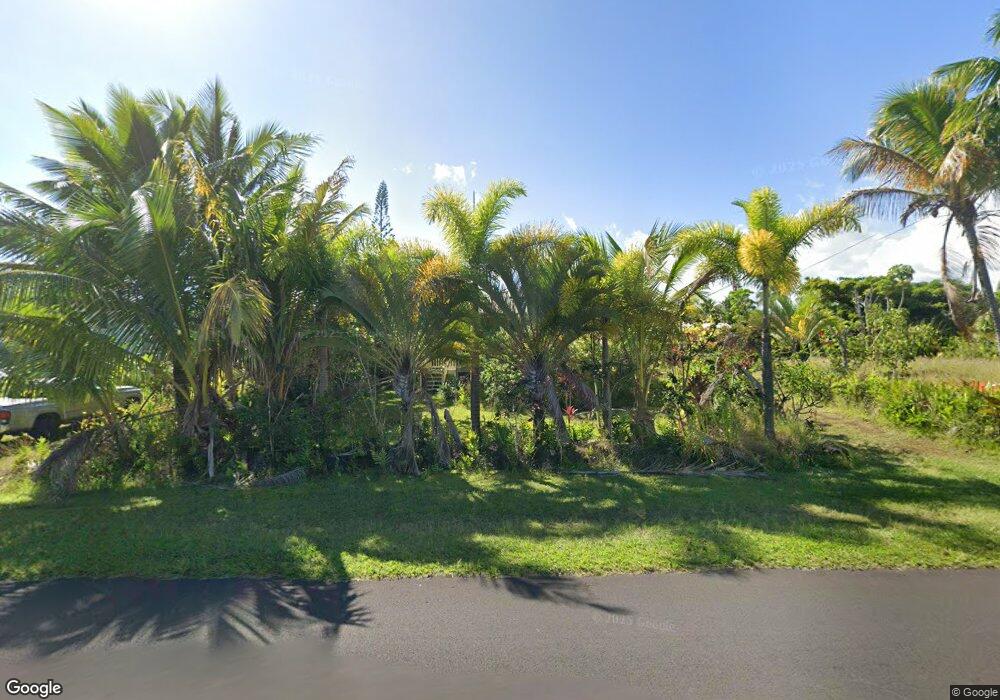
This home is located at 12-165 Mapuana Ave, Pahoa, HI 96778 and is currently estimated at $260,031, approximately $477 per square foot. 12-165 Mapuana Ave is a home located in Hawaii County with nearby schools including Pahoa Elementary School and Pahoa High & Intermediate School.
Ownership History
Date
Name
Owned For
Owner Type
Purchase Details
Closed on
Jan 27, 2009
Sold by
Wroblewski Michael A
Bought by
Smith Raymond Norman and Smith Joann Ida
Current Estimated Value
Home Financials for this Owner
Home Financials are based on the most recent Mortgage that was taken out on this home.
Original Mortgage
$106,200
Interest Rate
5.19%
Mortgage Type
Purchase Money Mortgage
Purchase Details
Closed on
Sep 28, 2004
Sold by
Nakagawa Melvin Katsumi and Nakagawa Jean Harue
Bought by
Wroblewski Michael A
Create a Home Valuation Report for This Property
The Home Valuation Report is an in-depth analysis detailing your home's value as well as a comparison with similar homes in the area
Home Values in the Area
Average Home Value in this Area
Purchase History
| Date | Buyer | Sale Price | Title Company |
|---|---|---|---|
| Smith Raymond Norman | $120,000 | Fam | |
| Wroblewski Michael A | $25,000 | -- |
Source: Public Records
Mortgage History
| Date | Status | Borrower | Loan Amount |
|---|---|---|---|
| Previous Owner | Smith Raymond Norman | $106,200 |
Source: Public Records
Tax History
| Year | Tax Paid | Tax Assessment Tax Assessment Total Assessment is a certain percentage of the fair market value that is determined by local assessors to be the total taxable value of land and additions on the property. | Land | Improvement |
|---|---|---|---|---|
| 2025 | $200 | $135,400 | $27,900 | $107,500 |
| 2024 | $200 | $131,500 | $27,900 | $103,600 |
| 2023 | $200 | $127,700 | $27,900 | $99,800 |
| 2022 | $200 | $124,000 | $27,900 | $96,100 |
| 2021 | $200 | $120,400 | $27,900 | $92,500 |
| 2020 | $200 | $117,900 | $27,200 | $90,700 |
| 2019 | $1,162 | $104,700 | $25,400 | $79,300 |
| 2018 | $936 | $100,100 | $25,400 | $74,700 |
| 2017 | $899 | $96,100 | $23,500 | $72,600 |
| 2016 | $872 | $94,300 | $23,500 | $70,800 |
Source: Public Records
Map
Nearby Homes
- 12-162 W Moanauli Loop
- 12-169 Mapuana Ave
- 0 Lawaianui St
- 12-154 Mapuana Ave
- 12-7005 Ho'Eunalu St
- 0 Ho'Eunalu St Unit 715685
- 12-7002 Ka'Iwa St
- 0 Kaiwa
- 12-7002 Ho'Eunalu St
- 12-7002 Koaekea St
- 0 Koaekea St
- 0 Mapuana Ave Unit Lot 157
- 12-173 Mapuana Ave
- 0 Mapuana Ave Unit 726138
- 0 Mapuana Ave Unit 727264
- 0 Mapuana Ave Unit Lot 155
- 0 Mapuana Ave Unit 726139
- 12-7001 Kaihulali St
- 0 Kaihulali St
- 12-7003 Kaihulali St
- 12-7044 Kaihulali St
- 12-159 Mapuana Ave
- 12-162 Mapuana Ave
- 12-157 Mapuana Ave
- 12-166 Mapuana Ave
- 12-7040 Kaihalulu St
- 12-7040 Lawaianui St
- 12-164 Moanauli Loop
- 0 Moanauli Loop Unit 706320
- 12-165 E Moanauli Loop
- 12-7043 Kaihulali St
- 12-142 W Moanauli Loop
- 12-7041 Kapohanalu St
- 12-7039 Lawaianui St
- 0 Kapohanalu St
- 12-140 W Moanauli Loop
- 12-185 E Moanauli Loop
- 12-181 E Moanauli Loop
- 0 E Moanauli Loop
- 12 Kaihalulu St
Your Personal Tour Guide
Ask me questions while you tour the home.
