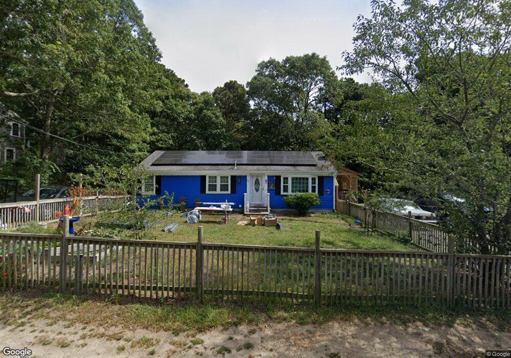
12 Acorn Rd Dennis, MA 02638
East Dennis NeighborhoodEstimated Value: $536,000 - $687,000
3
Beds
1
Bath
1,001
Sq Ft
$629/Sq Ft
Est. Value
About This Home
This home is located at 12 Acorn Rd, Dennis, MA 02638 and is currently estimated at $629,300, approximately $628 per square foot. 12 Acorn Rd is a home located in Barnstable County with nearby schools including Dennis-Yarmouth Regional High School and Latham School.
Ownership History
Date
Name
Owned For
Owner Type
Purchase Details
Closed on
Jul 30, 2014
Sold by
Barbara E Grimes Ft
Bought by
Grey Jason B and Davenport Annemarie
Current Estimated Value
Home Financials for this Owner
Home Financials are based on the most recent Mortgage that was taken out on this home.
Original Mortgage
$233,000
Outstanding Balance
$178,126
Interest Rate
4.18%
Mortgage Type
VA
Estimated Equity
$451,174
Purchase Details
Closed on
Oct 6, 2009
Sold by
Grimes Barbara E
Bought by
Barbara E Grimes Ft and Grimes Barbara E
Purchase Details
Closed on
Nov 10, 1999
Sold by
Pickering James L
Bought by
Grimes John L
Home Financials for this Owner
Home Financials are based on the most recent Mortgage that was taken out on this home.
Original Mortgage
$72,750
Interest Rate
7.68%
Mortgage Type
Purchase Money Mortgage
Create a Home Valuation Report for This Property
The Home Valuation Report is an in-depth analysis detailing your home's value as well as a comparison with similar homes in the area
Home Values in the Area
Average Home Value in this Area
Purchase History
| Date | Buyer | Sale Price | Title Company |
|---|---|---|---|
| Grey Jason B | $233,000 | -- | |
| Barbara E Grimes Ft | -- | -- | |
| Grimes John L | $97,000 | -- |
Source: Public Records
Mortgage History
| Date | Status | Borrower | Loan Amount |
|---|---|---|---|
| Open | Grey Jason B | $233,000 | |
| Previous Owner | Grimes John L | $71,500 | |
| Previous Owner | Grimes John L | $72,750 |
Source: Public Records
Tax History Compared to Growth
Tax History
| Year | Tax Paid | Tax Assessment Tax Assessment Total Assessment is a certain percentage of the fair market value that is determined by local assessors to be the total taxable value of land and additions on the property. | Land | Improvement |
|---|---|---|---|---|
| 2025 | $2,334 | $539,000 | $161,300 | $377,700 |
| 2024 | $2,219 | $505,500 | $155,100 | $350,400 |
| 2023 | $2,147 | $459,700 | $141,000 | $318,700 |
| 2022 | $2,104 | $375,700 | $141,100 | $234,600 |
| 2021 | $6,129 | $332,300 | $138,300 | $194,000 |
| 2020 | $1,917 | $314,300 | $138,300 | $176,000 |
| 2019 | $1,816 | $294,300 | $135,600 | $158,700 |
| 2018 | $1,652 | $260,600 | $116,200 | $144,400 |
| 2017 | $1,574 | $256,000 | $116,200 | $139,800 |
| 2016 | $1,518 | $232,400 | $129,100 | $103,300 |
| 2015 | $1,487 | $232,400 | $129,100 | $103,300 |
| 2014 | $1,361 | $214,400 | $129,100 | $85,300 |
Source: Public Records
Map
Nearby Homes
- 15 Trudy Cir
- 32 Captain Walsh Dr
- 61 Barque Cir
- 43 Barque Cir
- 15 Captain Jud Rd
- 4 Landing Ln
- 10 Devonshire Ln
- 21 Compass Ln
- 25 Ronda Ln
- 16 Uncle Stanleys Way
- 102 Prince Way
- 11 Uncle Stanleys Way
- 55 Monument View Rd
- 42 Agnes Rd
- 6 Match Point
- 153 Bayridge Dr
- 102 Wildwood Rd
- 1706 Route 6a Unit 3
- 310 Old Chatham Rd Unit J-12