Estimated Value: $216,000 - $264,000
--
Bed
--
Bath
1,836
Sq Ft
$128/Sq Ft
Est. Value
About This Home
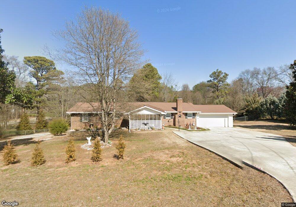
This home is located at 12 Althea Dr NW, Rome, GA 30165 and is currently estimated at $234,574, approximately $127 per square foot. 12 Althea Dr NW is a home located in Floyd County with nearby schools including Coosa Middle School and Coosa High School.
Ownership History
Date
Name
Owned For
Owner Type
Purchase Details
Closed on
Feb 5, 2013
Sold by
Anderson Earl E and Anderson Debbie M
Bought by
Anderson Debbie M
Current Estimated Value
Purchase Details
Closed on
Oct 1, 1984
Bought by
P and R
Purchase Details
Closed on
Jul 27, 1983
Sold by
Mauney Dwight D and Mauney Carolyn
Bought by
Money Ernest J and Money Angela D
Purchase Details
Closed on
May 29, 1971
Sold by
Sprayberry Birrel
Bought by
Mauney Dwight D and Mauney Carolyn
Purchase Details
Closed on
Nov 7, 1967
Bought by
P and R
Purchase Details
Closed on
Nov 6, 1967
Sold by
Martin Robert J
Bought by
Sprayberry Birrel
Purchase Details
Closed on
Sep 8, 1964
Sold by
Anderson E E
Bought by
Martin Robert J
Purchase Details
Closed on
Sep 4, 1964
Sold by
Martin Robert J
Bought by
Anderson E E
Purchase Details
Closed on
Jan 1, 1961
Bought by
Martin Robert J
Create a Home Valuation Report for This Property
The Home Valuation Report is an in-depth analysis detailing your home's value as well as a comparison with similar homes in the area
Home Values in the Area
Average Home Value in this Area
Purchase History
| Date | Buyer | Sale Price | Title Company |
|---|---|---|---|
| Anderson Debbie M | -- | -- | |
| P | -- | -- | |
| Anderson Earl E | $36,000 | -- | |
| Money Ernest J | $35,500 | -- | |
| Mauney Dwight D | $24,000 | -- | |
| P | -- | -- | |
| Sprayberry Birrel | $14,800 | -- | |
| Martin Robert J | -- | -- | |
| Anderson E E | -- | -- | |
| Martin Robert J | -- | -- |
Source: Public Records
Tax History Compared to Growth
Tax History
| Year | Tax Paid | Tax Assessment Tax Assessment Total Assessment is a certain percentage of the fair market value that is determined by local assessors to be the total taxable value of land and additions on the property. | Land | Improvement |
|---|---|---|---|---|
| 2024 | $1,232 | $78,650 | $11,634 | $67,016 |
| 2023 | $1,158 | $74,453 | $9,972 | $64,481 |
| 2022 | $994 | $63,065 | $8,310 | $54,755 |
| 2021 | $1,608 | $58,176 | $8,310 | $49,866 |
| 2020 | $1,538 | $54,076 | $6,648 | $47,428 |
| 2019 | $1,471 | $51,664 | $6,648 | $45,016 |
| 2018 | $1,440 | $50,062 | $6,648 | $43,414 |
| 2017 | $1,431 | $49,387 | $6,648 | $42,739 |
| 2016 | $1,444 | $49,116 | $6,640 | $42,476 |
| 2015 | -- | $49,876 | $6,640 | $43,236 |
| 2014 | -- | $50,636 | $6,640 | $43,996 |
Source: Public Records
Map
Nearby Homes
- 0 Alabama Hwy Unit 10590171
- 0 Alabama Hwy Unit 7635346
- 0 Alabama Hwy Unit 7494552
- 43 Brownlow Dr NW
- 33 Cedar Ln NW
- 31 Cedar Ln NW
- 4813 Alabama Hwy SW
- 36 Stargazer Trail NW
- 10 Nest Dr NW
- 48 Atwood Dr NW
- 4485 Alabama Hwy
- 5 Red Fox Dr SW
- 8 Kayla Dr NW
- 775 Mays Bridge Rd SW
- 26 Red Fox Dr SW
- 1 Ann Dr NW
- 458 Kraftsman Rd SW
- 293 N Avery Rd NW
- 45 Albert Ave NW
- 86 N Avery Rd NW
- 14 Althea Dr NW
- 10 Althea Dr NW
- 0 Althea Dr NW Unit 7138548
- 0 Althea Dr NW Unit 8393093
- 0 Althea Dr NW
- 4 Mulberry Rd NW
- 4 Mulberry Rd NW
- 0 Mulberry Rd NW Unit 2734940
- 0 Mulberry Rd NW Unit 7156998
- 0 Mulberry Rd NW Unit 146-176 7500085
- 0 Mulberry Rd NW
- 0 Mulberry Rd NW Unit 8104699
- 0 Mulberry Rd NW Unit 3266521
- 0 Mulberry Rd NW Unit 8122906
- 0 Mulberry Rd NW Unit 8557365
- 8 Althea Dr NW
- 13 Althea Dr NW
- 6 Althea Dr NW
- 3 Cedar Ln NW
- 3 Cedar Ln NW