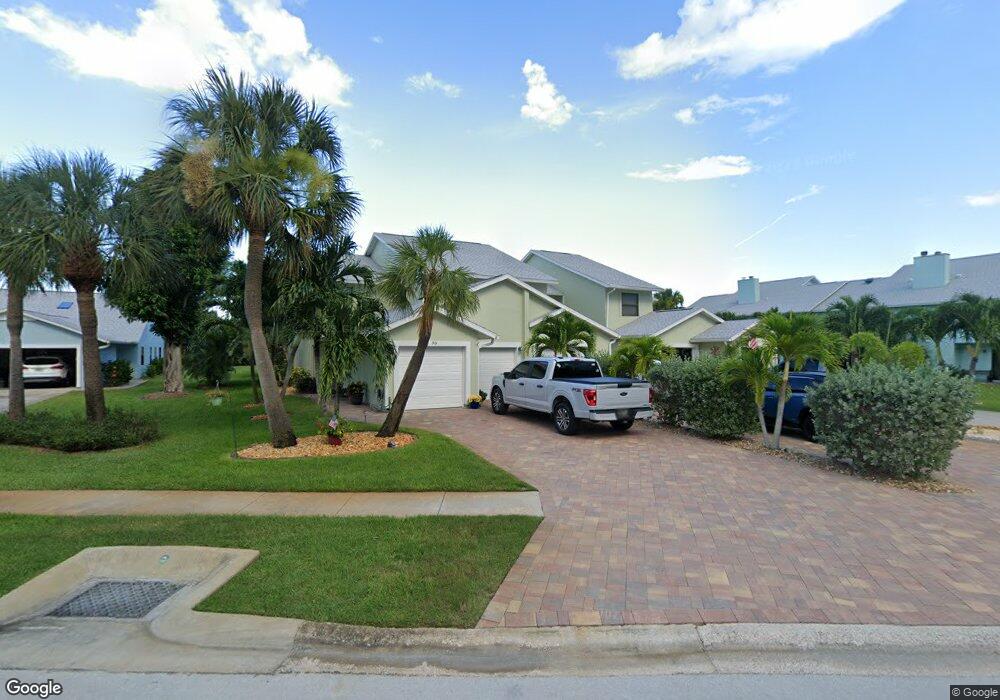
12 Anchor Dr Unit 12 Indian Harbour Beach, FL 32937
Estimated Value: $336,064 - $385,000
3
Beds
3
Baths
1,506
Sq Ft
$238/Sq Ft
Est. Value
About This Home
This home is located at 12 Anchor Dr Unit 12, Indian Harbour Beach, FL 32937 and is currently estimated at $359,016, approximately $238 per square foot. 12 Anchor Dr Unit 12 is a home located in Brevard County with nearby schools including Ocean Breeze Elementary School, Satellite Senior High School, and DeLaura Middle School.
Ownership History
Date
Name
Owned For
Owner Type
Purchase Details
Closed on
Feb 29, 2016
Sold by
Andreson Laurence L and Andreson Joanne
Bought by
Burns Elizabeth Anne and Hinman Richard L
Current Estimated Value
Home Financials for this Owner
Home Financials are based on the most recent Mortgage that was taken out on this home.
Original Mortgage
$140,000
Interest Rate
3.81%
Purchase Details
Closed on
Jul 29, 2013
Sold by
Anderson Laurence L and Anderson Joanne
Bought by
Anderson Laurence L and Anderson Michael B
Home Financials for this Owner
Home Financials are based on the most recent Mortgage that was taken out on this home.
Original Mortgage
$108,000
Interest Rate
3.96%
Purchase Details
Closed on
Aug 31, 1999
Sold by
Harbin John Travis and Harbin Hope D
Bought by
Anderson Laurence L and Anderson Michael B
Home Financials for this Owner
Home Financials are based on the most recent Mortgage that was taken out on this home.
Original Mortgage
$60,000
Interest Rate
7.5%
Create a Home Valuation Report for This Property
The Home Valuation Report is an in-depth analysis detailing your home's value as well as a comparison with similar homes in the area
Home Values in the Area
Average Home Value in this Area
Purchase History
| Date | Buyer | Sale Price | Title Company |
|---|---|---|---|
| Burns Elizabeth Anne | $180,000 | Liberty Maximum Title Inc | |
| Anderson Laurence L | -- | Title Source Inc | |
| Anderson Laurence L | $86,000 | -- |
Source: Public Records
Mortgage History
| Date | Status | Borrower | Loan Amount |
|---|---|---|---|
| Previous Owner | Burns Elizabeth Anne | $140,000 | |
| Previous Owner | Anderson Laurence L | $108,000 | |
| Previous Owner | Anderson Laurence L | $60,000 |
Source: Public Records
Tax History Compared to Growth
Tax History
| Year | Tax Paid | Tax Assessment Tax Assessment Total Assessment is a certain percentage of the fair market value that is determined by local assessors to be the total taxable value of land and additions on the property. | Land | Improvement |
|---|---|---|---|---|
| 2025 | $2,400 | $191,200 | -- | -- |
| 2024 | $2,337 | $185,820 | -- | -- |
| 2023 | $2,337 | $180,410 | $0 | $0 |
| 2022 | $2,158 | $175,160 | $0 | $0 |
| 2021 | $2,212 | $170,060 | $0 | $0 |
| 2020 | $2,209 | $167,720 | $0 | $0 |
| 2019 | $2,192 | $163,950 | $0 | $0 |
| 2018 | $2,188 | $160,900 | $0 | $0 |
| 2017 | $2,194 | $157,600 | $50,000 | $107,600 |
| 2016 | $1,125 | $96,910 | $35,000 | $61,910 |
| 2015 | $1,149 | $96,240 | $35,000 | $61,240 |
| 2014 | $1,153 | $95,480 | $30,000 | $65,480 |
Source: Public Records
Map
Nearby Homes
- 43 Anchor Dr
- 128 Windward Way
- 690 Trinidad Ct
- 305 Wimico Dr
- 138 Windward Way
- 524 Mcguire Blvd
- 234 Micanopy Ct
- 699 Bimini Rd
- 106 Tradewinds Dr Unit 106
- 142 Lansing Island Dr
- 154 Lansing Island Dr
- 115 Enclave Ave
- 435 Desoto Pkwy
- 101 Wimico Dr
- 215 S Robert Way
- 431 E Amherst Cir
- 235 S Marco Way
- 29 Marina Isles Blvd
- 149 Kristi Dr
- 155 Kristi Dr