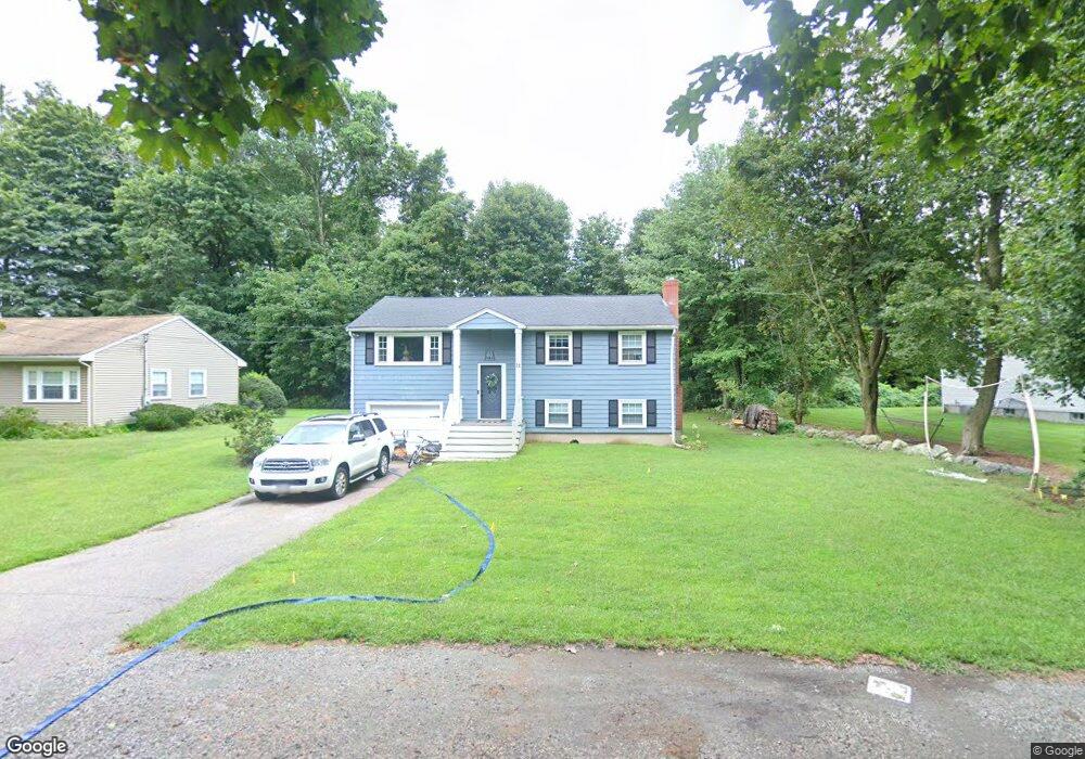
12 Arbor Ct East Walpole, MA 02032
Estimated Value: $629,000 - $655,907
3
Beds
2
Baths
1,440
Sq Ft
$444/Sq Ft
Est. Value
About This Home
This home is located at 12 Arbor Ct, East Walpole, MA 02032 and is currently estimated at $638,977, approximately $443 per square foot. 12 Arbor Ct is a home located in Norfolk County with nearby schools including Old Post Road School, Walpole Middle School, and Walpole High School.
Ownership History
Date
Name
Owned For
Owner Type
Purchase Details
Closed on
Feb 28, 2005
Sold by
Gurnick Karen A and Gurnick Michael J
Bought by
Kirby Jessica L and Kirby Michael R
Current Estimated Value
Home Financials for this Owner
Home Financials are based on the most recent Mortgage that was taken out on this home.
Original Mortgage
$288,240
Outstanding Balance
$147,290
Interest Rate
5.73%
Mortgage Type
Purchase Money Mortgage
Estimated Equity
$491,687
Create a Home Valuation Report for This Property
The Home Valuation Report is an in-depth analysis detailing your home's value as well as a comparison with similar homes in the area
Home Values in the Area
Average Home Value in this Area
Purchase History
| Date | Buyer | Sale Price | Title Company |
|---|---|---|---|
| Kirby Jessica L | $360,300 | -- |
Source: Public Records
Mortgage History
| Date | Status | Borrower | Loan Amount |
|---|---|---|---|
| Open | Kirby Jessica L | $288,240 | |
| Closed | Kirby Jessica L | $72,060 |
Source: Public Records
Tax History Compared to Growth
Tax History
| Year | Tax Paid | Tax Assessment Tax Assessment Total Assessment is a certain percentage of the fair market value that is determined by local assessors to be the total taxable value of land and additions on the property. | Land | Improvement |
|---|---|---|---|---|
| 2025 | $7,190 | $560,400 | $332,200 | $228,200 |
| 2024 | $7,038 | $532,400 | $319,300 | $213,100 |
| 2023 | $6,770 | $487,400 | $277,700 | $209,700 |
| 2022 | $6,409 | $443,200 | $257,200 | $186,000 |
| 2021 | $6,168 | $415,600 | $242,600 | $173,000 |
| 2020 | $6,186 | $412,700 | $228,900 | $183,800 |
| 2019 | $5,958 | $394,600 | $220,100 | $174,500 |
| 2018 | $5,552 | $363,600 | $211,800 | $151,800 |
| 2017 | $5,369 | $350,200 | $203,700 | $146,500 |
| 2016 | $5,223 | $335,700 | $195,800 | $139,900 |
| 2015 | $4,892 | $311,600 | $178,200 | $133,400 |
| 2014 | $4,685 | $297,300 | $178,200 | $119,100 |
Source: Public Records
Map
Nearby Homes
- 0 Charlotte Rd
- 7 Washington Green
- 11 Park Ln
- Unit 11 Powder House Ln Unit 11
- 8 Powder House Ln Unit 2
- Unit 12 Powder House Ln Unit 12
- Unit 3 Powder House Ln Unit 3
- 363 - 367 Washington St
- 34 Austin St Unit 1L
- 22 Coolidge Rd
- 5 Atwood Ave
- 70 Endicott St Unit 404
- 70 Endicott St Unit 1306
- 531 Walpole St
- 486 Washington St
- 1086 Washington St
- 83 Dean St
- 270 Moosehill Rd
- 130 Dean St
- 18 Laurel Rd
- 8 Arbor Ct
- 18 Arbor Ct
- 12 Maguire Park
- 8 Maguire Park
- 57 Pleasant St
- 19 Arbor Ct
- 19 Arbor Ct Unit 19
- 19 Arbor Ct Unit 21
- 21 Arbor Ct Unit 21
- 112 Union St
- 112 Union St Unit A
- 47 Pleasant St
- 67 Pleasant St
- 67 Pleasant St
- 67 Pleasant St Unit studio
- 15 Maguire Park
- 15 Maguire Park Unit B
- 75 Pleasant St
- 11 Maguire Park
- 130 Union St