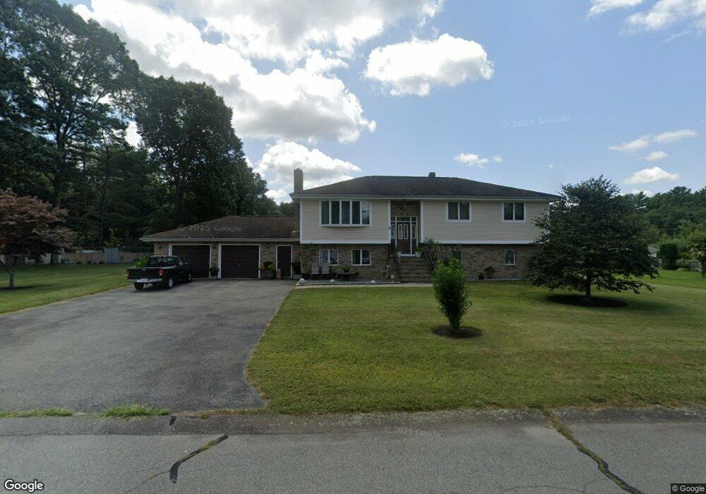
12 Balsam Brook Ln Acushnet, MA 02743
Upper Acushnet NeighborhoodEstimated Value: $599,276 - $721,000
--
Bed
2
Baths
2,567
Sq Ft
$260/Sq Ft
Est. Value
About This Home
This home is located at 12 Balsam Brook Ln, Acushnet, MA 02743 and is currently estimated at $666,569, approximately $259 per square foot. 12 Balsam Brook Ln is a home located in Bristol County with nearby schools including Acushnet Elementary School, Albert F Ford Middle School, and Alma Del Mar Charter School.
Ownership History
Date
Name
Owned For
Owner Type
Purchase Details
Closed on
Sep 24, 1991
Sold by
White Mark W and White Jeff A
Bought by
Silva Jose P and Silva Odete M
Current Estimated Value
Purchase Details
Closed on
Jun 12, 1991
Sold by
Pacheco Leonard M
Bought by
Abg Corp
Create a Home Valuation Report for This Property
The Home Valuation Report is an in-depth analysis detailing your home's value as well as a comparison with similar homes in the area
Home Values in the Area
Average Home Value in this Area
Purchase History
| Date | Buyer | Sale Price | Title Company |
|---|---|---|---|
| Silva Jose P | $50,000 | -- | |
| Abg Corp | $47,655 | -- |
Source: Public Records
Mortgage History
| Date | Status | Borrower | Loan Amount |
|---|---|---|---|
| Closed | Abg Corp | $27,000 | |
| Previous Owner | Abg Corp | $70,000 |
Source: Public Records
Tax History Compared to Growth
Tax History
| Year | Tax Paid | Tax Assessment Tax Assessment Total Assessment is a certain percentage of the fair market value that is determined by local assessors to be the total taxable value of land and additions on the property. | Land | Improvement |
|---|---|---|---|---|
| 2025 | $59 | $545,200 | $150,200 | $395,000 |
| 2024 | $5,894 | $516,600 | $142,000 | $374,600 |
| 2023 | $5,528 | $460,700 | $122,900 | $337,800 |
| 2022 | $4,999 | $376,700 | $117,500 | $259,200 |
| 2021 | $5,037 | $364,200 | $117,500 | $246,700 |
| 2020 | $5,077 | $364,200 | $117,500 | $246,700 |
| 2019 | $5,193 | $366,200 | $120,200 | $246,000 |
| 2018 | $5,051 | $350,300 | $120,200 | $230,100 |
| 2017 | $4,927 | $341,200 | $120,200 | $221,000 |
| 2016 | $4,647 | $319,800 | $112,000 | $207,800 |
| 2015 | $4,301 | $301,200 | $112,000 | $189,200 |
Source: Public Records
Map
Nearby Homes
- 14 Balsam Brook Ln
- 11 Balsam Brook Ln
- 8 Rock Cress Ln
- 3 Snap Weed Ln
- 4 Rock Cress Ln
- 7 Rock Cress Ln
- 9 Rock Cress Ln
- 11 Rock Cress Ln
- 10 Rock Cress Ln
- 11 Snap Weed Ln
- 4 Snap Weed Ln
- 7 Snap Weed Ln
- 5 Rock Cress Ln
- 7 Balsam Brook Ln
- 2 Snap Weed Ln
- 6 Snap Weed Ln
- 15 Rock Cress Ln
- 3 Rock Cress Ln
- 8 Balsam Brook Ln
- 5 Balsam Brook Ln