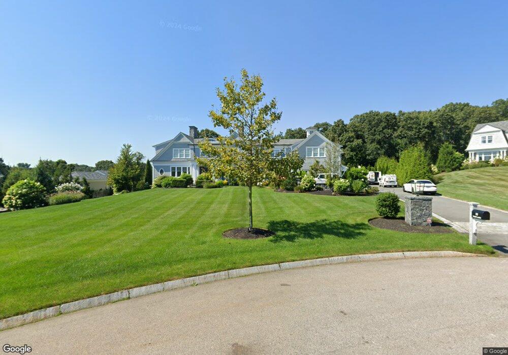
12 Barn Ln Southborough, MA 01772
Estimated Value: $2,590,000 - $3,025,836
5
Beds
7
Baths
6,370
Sq Ft
$434/Sq Ft
Est. Value
About This Home
This home is located at 12 Barn Ln, Southborough, MA 01772 and is currently estimated at $2,766,279, approximately $434 per square foot. 12 Barn Ln is a home with nearby schools including Mary E Finn School, Albert S. Woodward Memorial School, and Margaret A. Neary School.
Ownership History
Date
Name
Owned For
Owner Type
Purchase Details
Closed on
Sep 17, 2019
Sold by
Dasilva Leonardo L
Bought by
Leonardo Dasilva Ret and Dasilva
Current Estimated Value
Purchase Details
Closed on
Dec 20, 2016
Sold by
12 Barn Road T
Bought by
Dasilva Leonardo L
Purchase Details
Closed on
Oct 21, 2002
Sold by
Fisher Road Rt
Bought by
12 Barn Road T
Create a Home Valuation Report for This Property
The Home Valuation Report is an in-depth analysis detailing your home's value as well as a comparison with similar homes in the area
Home Values in the Area
Average Home Value in this Area
Purchase History
| Date | Buyer | Sale Price | Title Company |
|---|---|---|---|
| Leonardo Dasilva Ret | -- | -- | |
| Leonardo Dasilva Ret | -- | -- | |
| Dasilva Leonardo L | $550,000 | -- | |
| 12 Barn Road T | $525,000 | -- | |
| 12 Barn Road T | $525,000 | -- |
Source: Public Records
Tax History Compared to Growth
Tax History
| Year | Tax Paid | Tax Assessment Tax Assessment Total Assessment is a certain percentage of the fair market value that is determined by local assessors to be the total taxable value of land and additions on the property. | Land | Improvement |
|---|---|---|---|---|
| 2025 | $36,289 | $2,627,700 | $609,100 | $2,018,600 |
| 2024 | $34,594 | $2,487,000 | $594,400 | $1,892,600 |
| 2023 | $33,412 | $2,263,700 | $579,300 | $1,684,400 |
| 2022 | $31,007 | $1,904,600 | $519,800 | $1,384,800 |
| 2021 | $28,586 | $1,763,500 | $499,900 | $1,263,600 |
| 2020 | $29,337 | $1,760,900 | $498,700 | $1,262,200 |
| 2019 | $29,533 | $1,764,200 | $498,700 | $1,265,500 |
| 2018 | $8,049 | $498,700 | $498,700 | $0 |
| 2017 | $6,880 | $420,000 | $420,000 | $0 |
| 2016 | $6,673 | $421,800 | $421,800 | $0 |
| 2015 | $6,044 | $377,300 | $377,300 | $0 |
Source: Public Records
Map
Nearby Homes
- 181 Morrissey Rd
- 379 Stearns Rd
- 43 Stearns Rd
- 105 Fisher Rd
- 237 Brigham St
- 56 Sears Rd
- lot 1 Sears Rd
- 38 Gleason Street Extension
- Lot 2 Quinn Rd
- 68 River St
- 58 Walker St
- 14 High St
- 120 Airport Blvd
- 14 Lovers Ln
- 15 Lovers Ln
- 150 Framingham Rd
- 8 Saint Mary's Way Unit 8
- 30 Broad St Unit 104
- 30A Winter Ave
- 76 Broad St