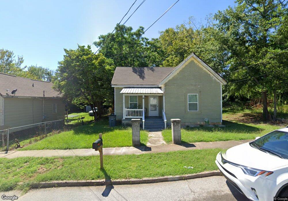
12 Barry Ave Lagrange, GA 30241
Estimated Value: $59,000 - $108,000
2
Beds
1
Bath
1,068
Sq Ft
$84/Sq Ft
Est. Value
About This Home
This home is located at 12 Barry Ave, Lagrange, GA 30241 and is currently estimated at $89,859, approximately $84 per square foot. 12 Barry Ave is a home located in Troup County with nearby schools including Franklin Forest Elementary School, Hollis Hand Elementary School, and Ethel W. Kight Elementary School.
Ownership History
Date
Name
Owned For
Owner Type
Purchase Details
Closed on
Feb 25, 2010
Sold by
David Bradley Rentals Llc
Bought by
S
Current Estimated Value
Purchase Details
Closed on
Jun 13, 2002
Sold by
Hester J A
Bought by
Perry David Bradley
Purchase Details
Closed on
Mar 1, 1988
Sold by
J A and J Hester T
Bought by
Hester J A
Purchase Details
Closed on
Jan 1, 1966
Sold by
Brock W C
Bought by
J A and J Hester T
Create a Home Valuation Report for This Property
The Home Valuation Report is an in-depth analysis detailing your home's value as well as a comparison with similar homes in the area
Purchase History
| Date | Buyer | Sale Price | Title Company |
|---|---|---|---|
| S | $38,000 | -- | |
| S | $38,000 | -- | |
| Perry David Bradley | $375,000 | -- | |
| Hester J A | -- | -- | |
| J A | -- | -- |
Source: Public Records
Tax History
| Year | Tax Paid | Tax Assessment Tax Assessment Total Assessment is a certain percentage of the fair market value that is determined by local assessors to be the total taxable value of land and additions on the property. | Land | Improvement |
|---|---|---|---|---|
| 2025 | $634 | $24,880 | $3,400 | $21,480 |
| 2024 | $634 | $23,240 | $3,400 | $19,840 |
| 2023 | $566 | $20,760 | $3,400 | $17,360 |
| 2022 | $493 | $17,680 | $3,400 | $14,280 |
| 2021 | $340 | $11,280 | $2,840 | $8,440 |
| 2020 | $340 | $11,280 | $2,840 | $8,440 |
| 2019 | $343 | $11,360 | $2,840 | $8,520 |
| 2018 | $321 | $10,660 | $3,100 | $7,560 |
| 2017 | $322 | $10,660 | $3,100 | $7,560 |
| 2016 | $321 | $10,634 | $3,100 | $7,534 |
| 2015 | $262 | $8,677 | $2,844 | $5,834 |
| 2014 | $253 | $8,370 | $2,844 | $5,527 |
| 2013 | -- | $8,722 | $2,844 | $5,879 |
Source: Public Records
Map
Nearby Homes
- 5 Curran Ave
- 204 Cleveland Dr
- 212 Cleveland Dr
- 4 1/2 Barnard Ave
- 130 Clara Jean Ct
- 902 Georgia Ave
- 15 Fulton St
- 618 S Harlem Cir
- 110 Lenox Cir
- 616 S Harlem Cir
- 0 N Barnard Ave
- 2 Louise St
- 121 de Groat St
- 107 N Barnard Ave
- 608 S Harlem Cir
- 210 Hearthstone Dr
- 621 Arthur St
- 606 S Harlem Cir
- 305 Lenox Cir
- 121 Ct